
Opening hours:Today closed
Place:
Längenfeld
:
Alpine pasture / hut / mountain restaurant
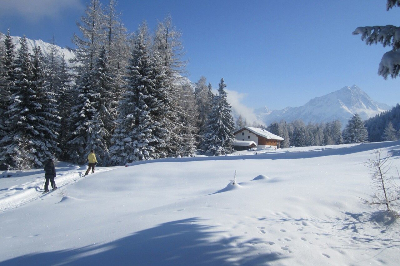
LÄNGENFELD WINKLEN -> Winkelbergsee -> WURZBERGALM
Please note the current snow and avalanche report for the coming days: www.oetztal.com/en/ & https://lawinen.report/bulletin/latest
The Ötztal Tourism team is happy to inform you personally about the condition of the winter hiking trails.
Ötztal Tourism T +43 5 72 00 300 - info@laengenfeld.com
Appropriate equipment such as breathable and weather-adapted outdoor clothing is required for all hikes and routes.
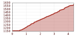
The alpine route up to the Wurzbergalm is neither difficult nor steep and therefore well suited for children, especially as a sled ride shortens the return elegantly. From the Längenfeld district of Winklen (parking at the forest edge), a wide forest road extends in long switchbacks up to the Wurzbergalm (1,575m). Through the bright, sunny forest area of the Köfler mountain slip, one of the largest in the Alps, you quickly gain height until the trees unexpectedly give way to a clearing at just under 1,600m. Now it’s only a few steps to the alm with its sun terrace. Lucky is the one who has a sled and can now race down to the valley on a prepared sledding run. Those who don’t have one can simply borrow one from the Holzknecht host family. Of course, not without having taken a proper break beforehand – best with Ramona’s apple strudel, blueberry punch, or a glass of fresh milk from the farm in the valley.
Travel comfortably and safely by train to the Ötztal station. The final stop or exit point is ÖTZTAL station. Afterwards, travel conveniently and quickly with public transport or local taxi companies through the entire valley to your desired destination! The current bus schedule is available at: http://fahrplan.vvt.at
The following parking option is available in Längenfeld:
Parking lot between Winklen and Unterried - free of charge (starting point of the hike)


")


