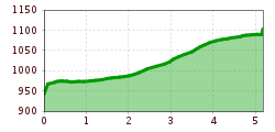
Open interactive mapOpen this POI on the interactive mapElevation profileTest Weiterwanderweg Etappe 1.gpx
prosseggklamm-matrei-2024-c-peter-maier72_TVB Osttirol_Peter Maier_Matrei in Osttirol.jpg © Peter Maier Circular Hike Proßeggklamm - Hinteregg - Matrei i. O.Difficulty:mediumLength:12.4 kmDuration:5:20 hElevation uphill:722 mSee trailSee trail: Circular Hike Proßeggklamm - Hinteregg - Matrei i. O.
High and sacred – Stage 08 from Obermauern to KalsMore InformationMore Information: High and sacred – Stage 08 from Obermauern to Kals
Adlertrail © bikeboard/Roland Kachelhauser Adlertrail No. 138Difficulty:mediumLength:3.7 kmDuration:0:20 hGo to biketourGo to biketour: Adlertrail No. 138
stabanthuette-wandern-sommer-terrasse-c-desiree-de-zordo.jpg © Desirèe de Zordo Trail Virgentaler Sonnseitenweg Stage 4More InformationMore Information: Trail Virgentaler Sonnseitenweg Stage 4
loebbentoerl-c-konrad-klaunzer.JPG © Konrad Klaunzer Venediger Altitude Trail Stage 6More InformationMore Information: Venediger Altitude Trail Stage 6
wandern-nilljochhuette-c-desiree-dezordo.jpg © Desirèe De Zordo Trail Virgentaler Sonnseitenweg Stage 3More InformationMore Information: Trail Virgentaler Sonnseitenweg Stage 3
wandern-stuhleralm-c-desiree-dezordo.jpg © Desirèe De Zordo Trail Virgentaler Sonnseitenweg Stage 2More InformationMore Information: Trail Virgentaler Sonnseitenweg Stage 2
Mit dem Nationalpark Ranger unterwegs © NPHT/Martin Lugger Hiking tour to Lucknerhütte 2.241mDifficulty:mediumLength:5.2 kmDuration:2:20 hElevation uphill:320 mSee trailSee trail: Hiking tour to Lucknerhütte 2.241m
Zedlacher Paradies Kinder © Assil Hannah Themed path Zedlacher ParadiesDifficulty:easyLength:4.4 kmDuration:1:20 hElevation uphill:119 mSee trailSee trail: Themed path Zedlacher Paradies
Eagle Walk Stage O2: Johannishütte - EisseehütteDifficulty:difficultLength:10.0 kmDuration:6:00 hElevation uphill:1,020 mSee trailSee trail: Eagle Walk Stage O2: Johannishütte - Eisseehütte
East Tyrol, Prägraten, Großvenediger, Johannishütte_Tirol Werbung_Huang Long-Nong_Prägraten am Großvenediger.jpg © Huang Long-Nong Eagle Walk Stage O1: Ströden - Johannis HütteDifficulty:mediumLength:13.0 kmDuration:6:30 hElevation uphill:1,430 mSee trailSee trail: Eagle Walk Stage O1: Ströden - Johannis Hütte
Adlerweg East Tyrol stage 3: Bonn-Matreier hut © Tirol Werbung/Raimund Mühlburger Eagle Walk Stage O3: Eisseehütte - Bonn-Matreier-HütteDifficulty:mediumLength:7.0 kmDuration:3:30 hElevation uphill:600 mSee trailSee trail: Eagle Walk Stage O3: Eisseehütte - Bonn-Matreier-Hütte
Eagle Trail stage O5: Badener Hütte © Badener Hütte Eagle Walk Stage O5: Badener Hütte - Matreier TauernhausDifficulty:difficultLength:14.0 kmDuration:5:30 hElevation uphill:450 mSee trailSee trail: Eagle Walk Stage O5: Badener Hütte - Matreier Tauernhaus
Eagle Trail stage O5: Badener Hütte © Badener Hütte Eagle Walk Stage O4: Bonn-Matreier Hütte - Badener HütteDifficulty:difficultLength:10.0 kmDuration:5:00 hElevation uphill:800 mSee trailSee trail: Eagle Walk Stage O4: Bonn-Matreier Hütte - Badener Hütte
Eagle Trail East Tyrol stage 8 © Tirol Werbung/Frank Bauer Eagle Walk Stage O8: Kalser Tauernhaus - StüdlhütteDifficulty:mediumLength:14.0 kmDuration:6:30 hElevation uphill:1,440 mSee trailSee trail: Eagle Walk Stage O8: Kalser Tauernhaus - Stüdlhütte
Eagle Trail stage O6: Sudetendeutsche Hut © DAV Eagle Walk Stage O6: Matrei in Osttirol - Sudetendeutsche HütteDifficulty:mediumLength:8.0 kmDuration:4:00 hElevation uphill:1,250 mSee trailSee trail: Eagle Walk Stage O6: Matrei in Osttirol - Sudetendeutsche Hütte
Eagle Trail East Tyrol stage 9: Stüdlhütte © Grafik Zloebl Eagle Walk Stage O9: Stüdlhütte - LucknerhausDifficulty:difficultLength:11.0 kmDuration:5:30 hElevation uphill:450 mSee trailSee trail: Eagle Walk Stage O9: Stüdlhütte - Lucknerhaus
Eagle Trail stage O6: Sudetendeutsche Hut © DAV Eagle Walk Stage O7: Sudetendeutsche Hütte - Kalser TauernhausDifficulty:mediumLength:7.5 kmDuration:4:00 hElevation uphill:300 mSee trailSee trail: Eagle Walk Stage O7: Sudetendeutsche Hütte - Kalser Tauernhaus
Iseltrail - Umbalkees © M. Schickhofer Iseltrail Stage 5More InformationMore Information: Iseltrail Stage 5
Badener Huette © Fabian Pimminger Badener HütteDifficulty:difficultLength:23.2 kmDuration:12:00 hElevation uphill:1,754 mSee trailSee trail: Badener Hütte
Glocknerkrone_Etappe_1_SudetendeutscheHütte_2023_cPeterMaier-1251.jpg © Peter Maier Hiking tour to Sudetendeutschen Hütte 2.650mDifficulty:mediumLength:15.5 kmDuration:8:15 hElevation uphill:1,203 mSee trailSee trail: Hiking tour to Sudetendeutschen Hütte 2.650m
wandern-blickaufprossegg-c-desiree-dezordo.jpg © Desirèe De Zordo Trail Virgentaler SonnseitenwegDifficulty:mediumLength:41.9 kmDuration:19:00 hElevation uphill:2,641 mSee trailSee trail: Trail Virgentaler Sonnseitenweg
aussergschloess_06-19_(c)www.bergpixel.de © Bergpixel Hike to the Berghaus AußergschlössDifficulty:easyLength:5.2 kmDuration:1:45 hElevation uphill:169 mSee trailSee trail: Hike to the Berghaus Außergschlöss
Herbstwanderung_TVB Osttirol_Nationalpark Hohe Tauern Alexander Tempel_Matrei in Osttirol.jpg © www.alexander-tempel.de Hiking tour to St. Pöltner Hütte and 3 lakesDifficulty:difficultLength:14.8 kmDuration:7:40 hElevation uphill:1,119 mSee trailSee trail: Hiking tour to St. Pöltner Hütte and 3 lakes
glocknerkrone-stuedlhuette-etappe-3-c-peter-maier-903.jpg © Peter Maier / Austria Lucknerhaus - StüdlhütteDifficulty:mediumLength:9.3 kmDuration:4:30 hElevation uphill:862 mSee trailSee trail: Lucknerhaus - Stüdlhütte
Give feedback for a chance to win a special holiday experience!Click here for the surveyClick here for the survey


www.bergpixel.de")


