Eight of the Best Snowshoe Trails in Tirol’s Backcountry
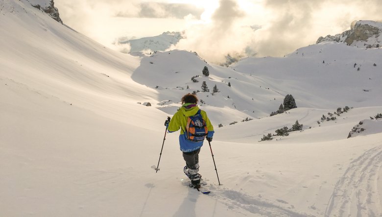
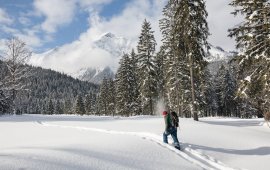
The beauty of snowshoeing comes from its simplicity—just strap in and go! I discovered this gentle winter activity last year and find it’s a perfect alternative to Alpine skiing. Do you want to traipse through deep powder in the backcountry, scaling peaks, or is a snowshoe run on packed trails followed by sledding down more your style? Or maybe, it’s somewhere in the middle where you’d like to snowshoe through a peaceful forest, connecting with the Zen of nature. For your snowshoeing pleasure in Tirol here are eight highly recommended trails.
These trails are a selection of my personal favourites, tried and tested. Though these trails are generally safe, snowshoeing is not without its risks. Many trails can be traveled safely, but check recent and current avalanche and weather conditions before heading off the beaten path. If you plan to recreate in avalanche terrain, you will need standard avalanche rescue gear and avalanche training. Most recommended suggestions are safe in late winter and spring. Have fun at taking in the sights and sounds of Tirol while it’s blanketed in snow!
1. Rangger Köpfl (1,939m) & Krimpenbachalm – Gorgeous Scenery high above Inntal Valley

Why?
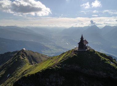
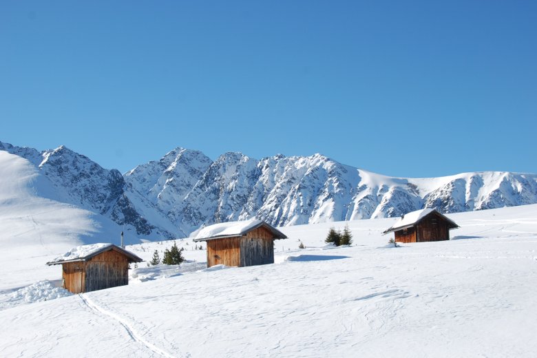
At 1,939 meters, sweeping views of Tirol’s capital Innsbruck and the Inntal Valley greet you from the top of Rangger Köpfl! If that’s not enough to slack your jaw, turn around to watch the winter wonderland below Rosskogel Peak, just waiting to be treaded by you. This is premiere terrain for winter enthusiasts! Dramatic mounds of snow await snowshoers at Krimpenbachalm Alpine Pasture (which is closed during the winter months). This rewarding walk is a classic on a sunny day — I suggest taking a break to soak in the serenity and the beauty of the mountains. If you’re lucky, you can do so on a bench in front of the cabin that has been cleared from snow.
Trail Talk
You can choose to hike for as little or as much as fits your ability level (and snow coverage). You can strap on your snowshoes at the base of Peter-Anich-Bahn Gondola in Oberperfuss (if there’s good snow coverage and if you feel you’re up to it); alternately you can ride the gondola up for one section and start at Panorama Restaurant Stiglreith or continue riding the gondola to the top at Sulzstich. If you take the trailhead at Stiglreith, follow the old track of the former T-bar lift at the right hand side of the ski run. Having reached the gondola’s top terminal at Sulzstich, traverse the ski run and follow signage for “Rosskogelhütte”. Warm up at this quaint cabin with homemade delicacies. Trust me, you won’t regret it. From there, it’s only a short walk to the summit of Rangger Köpfl.
Krimpenbachalm Alpine Pasture Hut is visible from there. Continue across the upland plateau below Rosskogel Peak to get there. After taking in the solitude at the hut, traverse the southern flank of Rangger Köpfl until you reach the sledding track. You might choose to use this track down, watching out for the occasional sledder, or you may follow one of the ski touring trails that weave through the adjoining forest.
Trail Info
Trailhead: Top of Peter-Anich-Bahn Gondola in Oberperfuss, at the entrance to Sellrainer Tal Valley, Stubai Alps
Distance: 7 kilometers
Hiking Time: 3 hours from the top terminal
Elevation Gain: 380 vertical meters from the top terminal
Difficulty: Easy, should be doable for most beginning snowshoers, there are a couple of steeper sections next to the ski run but they are not challenging
Avalanche Risk: The risk of avalanche on this route is low. To stay on the safe side, take the route I described.
Trailside Eateries: Rosskogel Hut, Sulzstich Market-Style Restaurant, Stiglreith Panorama Restaurant
2. Zäunlkopf Mountain (1,746m) – A Little Peak with a Gigantic Reward
Why?
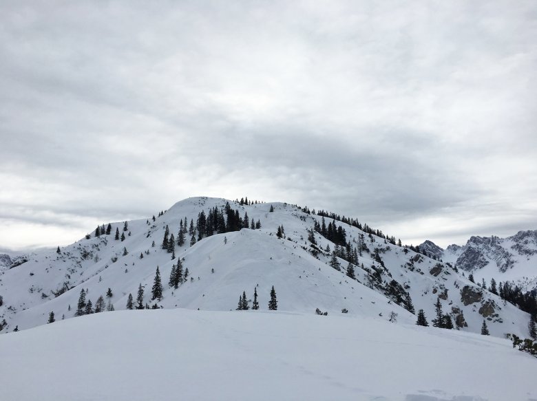
This little gem is too often overlooked. It’s a little steep and a little challenging getting to the top of Zäunlkopf Peak. But the scenic rewards? Far from little—they’re gigantic! While Zäunlkopf may lack the elevation of neighbouring mountains, it more than makes up for it with superior views. From this summit amid the rugged Karwendel Mountains, stand mesmerized, frozen in awe, utterly fixated on the alluring Karwendel Valleys, towered by the lofty range of the same name. Gaze to the opposite side to see the jagged ridges and peaks of Wetterstein and Mieminger Kette rising high above the Seefeld upland plateau. I became so lost in the spectacular views that I lost track of time and the planned half-day trip ended up in an almost all-day trek.
Trail Talk
This trail gets down to business right from the start and requires some serious stamina. Start by heading up the former ski run of Mühlberg Lift, crossing the sledding track several times. Climbing steeply, the trail works its way up to the old lift terminal. There, the steep grade lessens. Follow signage to Oberbrunnalm and Zäunlkopf and continue your uphill trek through a slightly wooded area.
After a short, steep traverse, breathtaking views open around you. A final ramble along a ridge is all that’s keeping you from the actual 1,746-meter summit. Take some time to savour more sweet views before turning around for the return trip back to the trailhead. Optional, you can get back along Oberbrunnalm Alpine Pasture.
Trail Info
Trailhead: Mühlberg Car Park in Scharnitz (close to the railroad station of Scharnitz) near Seefeld, Karwendel Mountain Range
Distance: 8.8 kilometers
Time: 2.5 hours up, 1.5 hours down
Elevation Gain: 830 vertical meters
Difficulty: Moderate; requires experience with route finding and has a couple of steeper sections that can be challenging
Avalanche Risk: The risk of avalanche is low if you keep to the described route.
Trailside Eateries: None
3. Rofanspitze Peak (2,259m) – Where Snowshoeing Fanatics Find Nirvana

Why?
In the winter, the terrain surrounding Erfurter Hut becomes a paradise for snowshoers. In fact, we were so mesmerized by its stunning Alpine beauty that we decided to stay longer just to enjoy sunrise at Erfurter Hut—despite the freezing cold. Why can snowshoeing fanatics find nirvana in Rofan Range? On the one hand, you can ride Rofan Gondola to its top at Erfurter Hut, effortlessly gaining vertical feet. Reaching the top at 1,800 meters with minimal effort, the trail starts high.
On the other hand, you don’t necessarily need to embark on the demanding tour atop 2,259-meter Rofanspitze Peak. There are plenty of rewarding snowshoeing options in the scenic area surrounding Erfurter Hut for all exertion and skill levels. However, those having experience with travel in high Alpine terrain in winter are strongly recommended to scale Rofanspitze, because it’s so worth it. The route to the summit will have you hopping with joy with its nonstop horizon-spanning views of the jagged ridges and colossal summits of Rofan Range. By carefully picking your route, the steepest terrain and the more dangerous avalanche slopes can be avoided, but this requires experience with route finding and snow conditions.
Trail Talk
If you enjoy a good all-day workout, this tour atop Rofanspitze is best started at the base of Rofan Gondola. First, follow the summer trail and continue your uphill trek toward Erfurter Hut. From the hut, traverse the ski run in a northeastern direction. The first section of the route follows the Ski Touring Trail and is well marked with interpretive signage. The next section leads through undulating terrain and via a steep section up to Grubascharte Notch. Requiring technical abilities and endurance, the final push to the summit is the challenging traverse of a steep slope with a few zig zags bringing you up the top. Follow the same route back to the trailhead.
Trail Info
Trailhead: Maurach am Achensee, Rofan Gondola, Erfurter Hütte
Distance: 7 kilometers from Erfurter Hut; 15 kilometers from the base of Rofan Gondola
Time: 4 hours from Erfurter Hut; 8 hours from the base of Rofan Gondola
Elevation Gain: 420 vertical meters
Difficulty: Expert
Avalanche Risk: The final traverse and the last uphill slope are avalanche-prone and should be avoided if there is any risk of avalanches. Please carefully consider the local avalanche forecast before venturing out.
Trailside Eateries: Erfurter Hut, Buchauer Alm Alpine Pasture Hut
4. Feldringalm Alpine Pasture Hut (1,888m) & Faltegartenköpfl Peak (2,184m)
Why?
The 7-kilometer roundtrip snowshoe past Feldringalm Alpine Pasture Hut and atop the summit of Faltegartenköpfl is a very rewarding trip at Haimingerberg. It should be doable for most beginning snowshoers; actually, it is the perfect tour to show new hikers the extraordinary places their feet can take them—which in this case is a mountaintop.
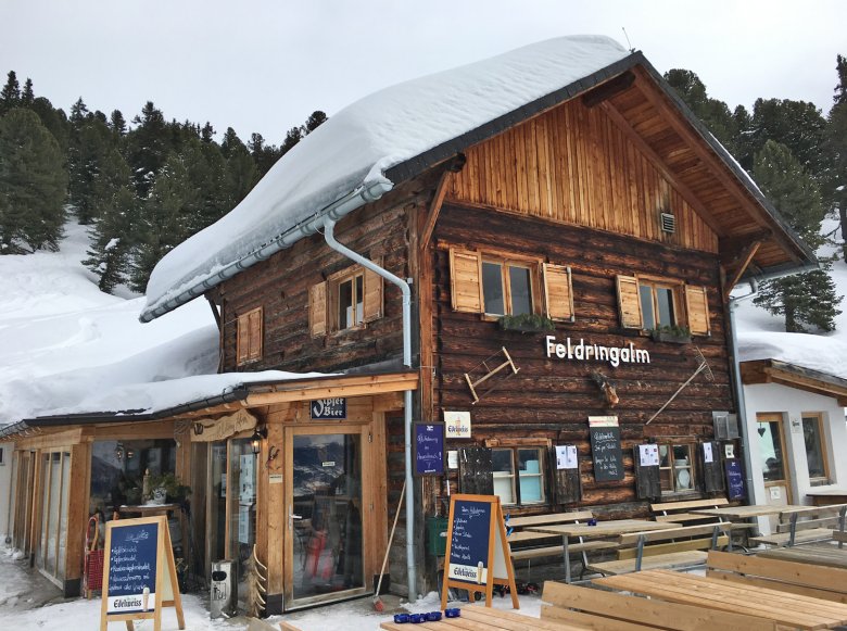
What makes this tour so special is charming Feldringalm Alpine Pasture Hut. This cozy log cabin boasts a comforting and snug interior and is one of those places where you will be made to feel truly at home. The views from the top of Faltegartenköpfl Peak are spectacular, particularly the unobstructed view of 3,000-meter Acherkogel Peak. Its sheer walls of a summit at the gateway to Ötztal Valley are very striking. The vertiginous views of Inntal Valley far below make Faltegartenköpfl Peak feel lofty in its own way.
Trail Talk
The route to the summit is easy to describe. From the trailhead, follow the sledding track up to Feldringalm Alpine Pasture Hut, which will take about 30 to 40 minutes. From the cabin, continue your uphill trek through an open strip of forest. This section is a bit steeper again, and flattens out into a beautiful slightly hilly area named Feldringer Böden. It is a popular destination, so there is almost always a clearly visible track to follow. Cross under the power line and climb steeply until you reach a saddle below the actual summit. Traverse the summit slope and circumnavigate the peak to get to its cross on the summit along a narrow ridge. On your way back, a short side-trip to Grünwaslkreuz Peak is a rewarding way to extend your trip. This route will bring you down to the open strip of forest above Feldringalm Alpine Pasture Hut.
Trail Info
Trailhead: Sattele Car Park , accessible from Oetz or Haiming, Sellrainer Berge
Distance: Roughly 7 kilometers
Time: 3 – 4 hours
Elevation Gain: 500 vertical meters
Difficulty: Easy
Avalanche Risk: The risk of avalanche is low if you keep to the described route.
Trailside Eateries: Feldringalm Alpine Pasture Hut
5. Visiting Naviser Almen Alpine Pasture Huts
Why?
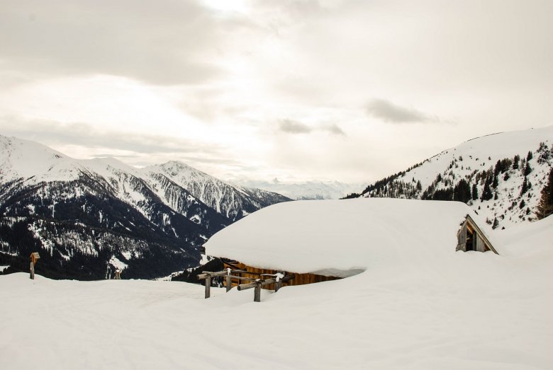
Valsertal, Schmirrntal and Navistal: The eastern side valleys of Wipptal Valley are among my favourite destinations for snowshoeing adventures in and among some of Tirol’s most pristine and beautiful surroundings. With sleepy Mountain(eering) Villages and lovely Alpine pastures this area rewards with a true wilderness experience and is a real mountain gem. Aptly named „Navis Alpine Pasture Loop“, this well maintained trail in Naviser Tal Valley links various Alpine pastures, in summer as well as in winter. At the end of this trail you will find Naviser Hut, a mountain refuge that is open year-round. Peeralm, Tischleralm, Vögeleralm, Zehenter Alm, Klammalm, Poltenalm and Stöcklalm all are located along the loop or nearby and all are wonderful sights to behold in the winter, blanketed in fluffy white snow.
During the winter months, Peeralm Alpine Pasture Hut at the start of the loop and bespoke Naviser Hut at its end are open and welcome visitors with culinary delicacies. By the way, Naviser Hut rents out sleds, allowing you to whisk down the mountain at the speed of light with your snowshoes attached to your backpack.
Trail Talk
Arriving by train and bus, follow the tiny mountain road to Grün Car Park. Riding your own car, you can either leave your vehicle there or further down at Schranzberg Car Park. From the car park named Grün follow the sledding track up to Peeralm Alpine Pasture Hut. From there, a short yet very rewarding side-trip to Zehenter Alm is strongly recommended.
Back at Peeralm, continue your wintry trek past Tischleralm and Vögeleralm towards the end of Naviser Tal Valley. You can opt for taking a short detour to Klammalm or walking to Poltenalm and Naviser Hut along the wonderful forest trail. From Naviser Hut, the sledding track will bring you back down to the trailhead at Navis, either on snowshoes or on a sled.
Trail Info
Trailhead: Navis in the Tux Alps, Schranzberg Bus Stop/Car Park or Grün Car Park
Distance: 10 kilometers
Time: 4 hours; add an additional 45 minutes each for side trips to Zehenter Alm and Klammalm
Elevation Gain: 500 vertical meters
Difficulty: Easy
Avalanche Risk: The risk of avalanche is low if you keep to the described route.
Trailside Eateries: Peeralm, Naviser Hut
6. Padauner Kogl (2,066m): Hidden Gem in Valsertal Valley
Why?
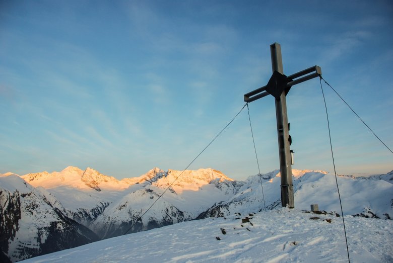
Valsertal Valley is a serene and remote setting for amazing winter adventure . Even getting there is a feast for all senses. On the mountain road to Padaun, I found myself in a world almost as far removed as you can get from the hustle and bustle below. Quaint and time-weathered farmsteads, towering mountains and stands of old-growth forest dusted with luxurious snow paint a beautiful picture. In such surroundings, one can come to terms with nature at her most benevolent.
It took me almost twice as long to get to the top as mentioned in the guidebook that day. Okay, the cross on the summit is not really that high up (a little over 2,000 meters), but I became so lost in the spectacular scenery that I lost track of time and almost ended up spending the night. Pine and spruce dusted with snow, gorgeous and mighty Olperer and Schrammacher Mountains sparkling in the sunlight… I got so captivated by these two Zillertal behemoths that I stayed up on the summit of Padauner Kogl until sunset, when the Alpenglow had the two peaks aflame with orange light. Fortunately, this is a very short tour. Should you opt for a memorable sunset experience, too, rest assured that you will be back at the trailhead at nightfall. If you prefer to go earlier, Padauner Kogl makes a wonderful half-day trip. On the drive back home it is worth stopping in Padaun or Vals.
Trail Talk
From the tiny hamlet of Padaun, take the paved road to Larcher Hof, where the trail starts to climb toward Padauner Kogl. A steep section takes you up to the edge of the forest, from where a narrow and well-marked path weaves up through old-growth forest until you reach the rope of an aerial cableway. Through thinning forest, follow the cableway line until you get to its top. From this tiny building, head northwards through alternating stands of trees and open fields to a fence. The trail runs parallel to this fence and delivers you to the steep summit slope. After that, the trail to the cross on the summit is mostly flat. Take a break to soak up the sweeping vistas, then retrace your steps to get back to the trailhead.
Trail Info
Trailhead: Car Park at Padaun above Valsertal Valley, Tux Alps
Distance: 6.8 kilometers
Time: 1.5 hours
Elevation Gain: 480 vertical meters
Difficulty: Moderate
Avalanche Risk: The risk of avalanche is low if you keep to the described route.
Trailside Eateries: Steckholzer Mountain Inn in Padaun
7. Feilalm Alpine Pasture Hut (1,372m) & Feilkopf Peak (1,562m): High Above Achensee Lake & Karwendel Valleys

Why?
From Pertisau, ascend through the gentle Karwendel Valleys of Gerntal and Falzthurntal that afford wonderful winter walking opportunities. This scenic area provides access to quaint inns and warming huts and is a great way to commune with nature. Leave behind the crowds to find a peaceful, snow-covered landscape on this amazing Snowshoe Tour atop Feilkopf Peak. Feilalm Alpine Pasture Hut possesses a stunning location embedded between the two valleys. Apart from offering a cozy parlour and serving hearty Tirol staples like cheese dumplings, the quaint cabin boasts stunning views of Achensee Lake below.
If you’re feeling extra adventurous, climb the 1,562-meter summit of Feilkopf Peak for even more expansive and spectacular views of jagged ridges and horizon-dominating Sonnjoch Col. Those wanting to make a trek up but not down are recommended to whizz down the mountain on a sled rented from Feilalm Alpine Pasture Hut.
Trail Talk
Trailhead of this enjoyable snowshoe walk is the Karwendeltäler Car Park and there are two options to get to Feilalm. You can either take the wide forest road that turns into Gerntal Valley after Pletzachalm or opt for the more challenging uphill trek through forest and along the southern flank of Feilkopf Peak. Again, there are various ways to get from Feilalm to Feilkopf. The easier yet longer option follows the Alpine pasture trail to Gütenbergalm and accesses the summit from the west. The direct route that avoids losing elevation is a bit steep and traverses the eastern slope on its way to the summit. Retrace your steps to get back to Feilalm, where you can opt for another way back down: Rent a sled and speed down the mountain!
Trail Info
Trailhead: Karwendeltäler Car Park, Pertisau
Distance: 14 kilometers
Time: 4.5 hours
Elevation Gain: 600 vertical meters
Difficulty: Easy on the forest road; moderate on the forest path. The ascent of Feilkopf Peak is rated easy or moderate, depending on your chosen route.
Avalanche Risk: Avalanche risk is generally low; the southern flank is avalanche-prone and should be avoided if there is any risk of avalanches.
Trailside Eateries: Feilalm, Pletzachalm
8. Blaser Mountain (2,241m) – A Fine Vantage Point & A Good Workout

Why?
Aptly named, Blaser Mountain translates to ‘Blower’, so be prepared for gusty winds at this mountaintop high above Steinach am Brenner. If weather conditions are fine, however, this demanding tour gives a panoramic payoff of jagged peaks and ridges that will leave you momentarily paralyzed. 360 degree vistas of the Stubai and Zillertal Alps will most certainly slack your jaw. Moreover, the route atop Blaser Mountain offers a good chance at solitude despite the incredible beauty of the winter scenery. At 10 kilometers and with 1000 meters of elevation gain through easy terrain with low avalanche risk, the trail provides snowshoers with a very good workout.
Trail Talk
From the car park in Trins-Leiten, follow the summer road to Blaser Hut, cross the forest road and continue your uphill trek through a gorgeously scenic valley. After a moderate climb, pass the rustic Blaser Hut, which is closed during the winter months. The climb continues and culminates on the peak named Blaser Mountain with its great views. From the summit, a beautiful roundtrip to Sanddürrenmähder along the Ski Route is a great way of taking in more of the scenery. If you don’t want to extend your trip, follow the same route back to the trailhead in Gschnitztal Valley.
Trail Info
Trailhead: Car park of Blaser Hut in the hamlet of Leiten near Trins
Distance: 10 kilometers
Time: 5.5 hours
Elevation Gain: 1,000 vertical meters
Difficulty: Moderate
Avalanche Risk: The risk of avalanche on this route is low. To stay on the safe side, take the route I described.
Trailside Eateries: None, Blaser Hut is closed during the winter months
Do you have any fave snowshoe walks in Tirol? Share in the comments below!


