Mountain hikes 4-Lakes Route - Längenfeld

Längenfeld / Ötztaler Alpen
Difficulty ratings: difficult
Route length: 16.7 km
Duration: 9:30 h

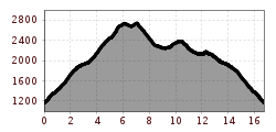
PLEASE NOTE: Due to forestry work, the trail from the district of Lehn to the Stabele Alm is closed. Alternatively, you can reach the Stabele Alm via the forest road. LEHN -> Stabele Alm –> Leckalm –> Plattach Lake –> Felder Scharte -> White Lake –> Lower Spitzig Lake –> Hauersee –> Innerbergalm -> LEHN

Tour information

  • Requirement: difficult
  • Length: 16.7 km
  • Duration: 9:30 h
  • Elevation uphill:2,066 hm
  • Elevation downhill:2,066 hm
Highest point2,796 m

Starting point

Lehn near Längenfeld

Finishing point

Lehn near Längenfeld
  • Fitness level 5 / 6

Best time of year

  • January
  • February
  • March
  • April
  • May
  • June
  • July
  • August
  • September
  • October
  • November
  • December

Equipment

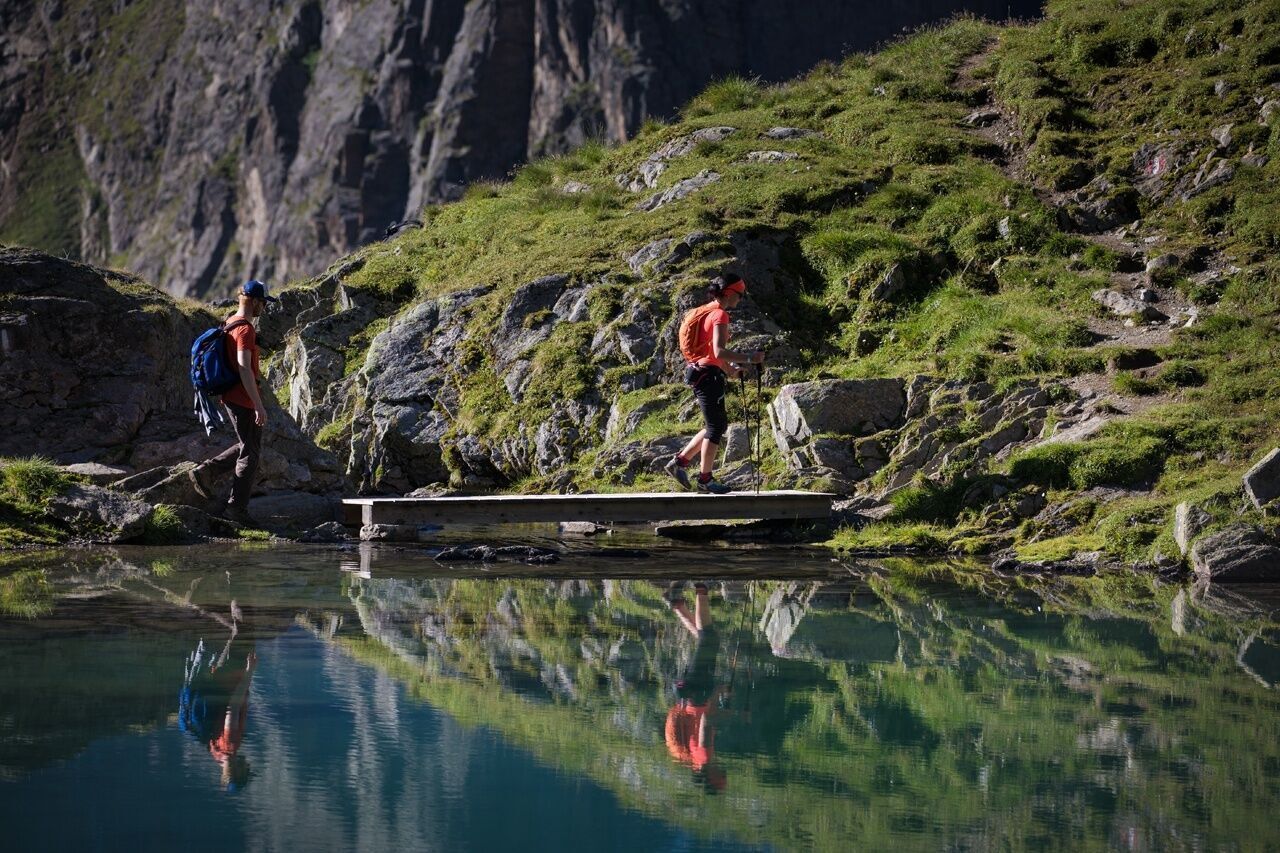
Moderate difficulty mountain path; suitable for sure-footed and experienced mountain hikers; good physical condition, mountain experience, and mountain equipment (see under Equipment) necessary. Please observe the current weather report.

Appropriate equipment such as breathable and weather-appropriate outdoor clothing is required for all hikes and routes. Carrying a first aid kit, a mobile phone, and possibly a hiking map, as well as sufficient provisions for hikes without catering options, is necessary.

Source: TVB Ötztal Tourismus

Description

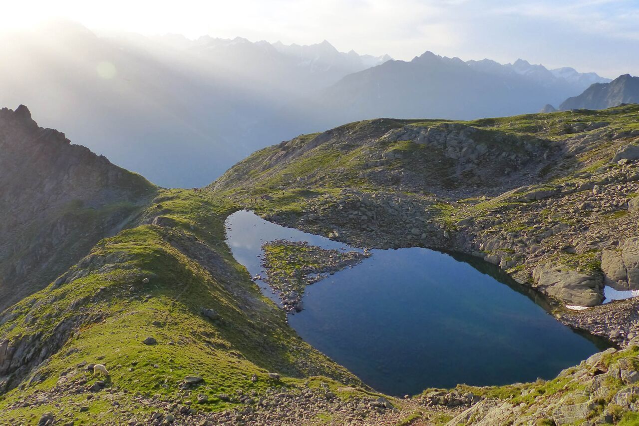
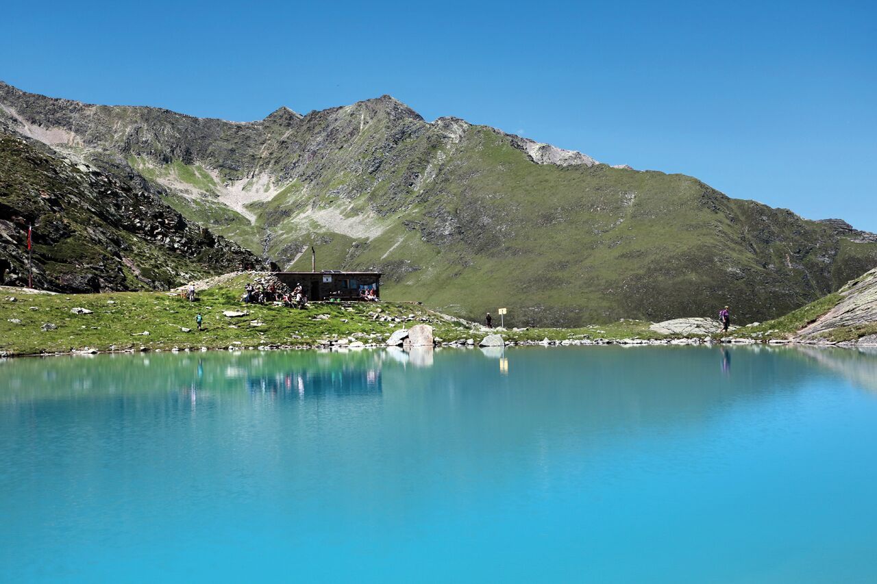
This circular hiking trail reflects the colors of water from Caribbean blue to crystal clear to meadow green with its four lakes shimmering in different colors depending on the season. However, attention should also be paid to the small treasures in and around the lakes.

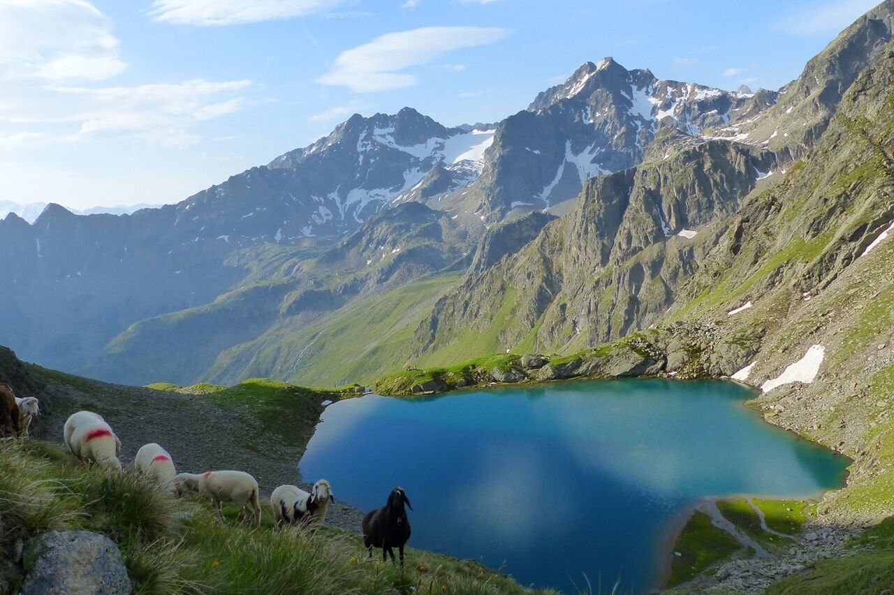
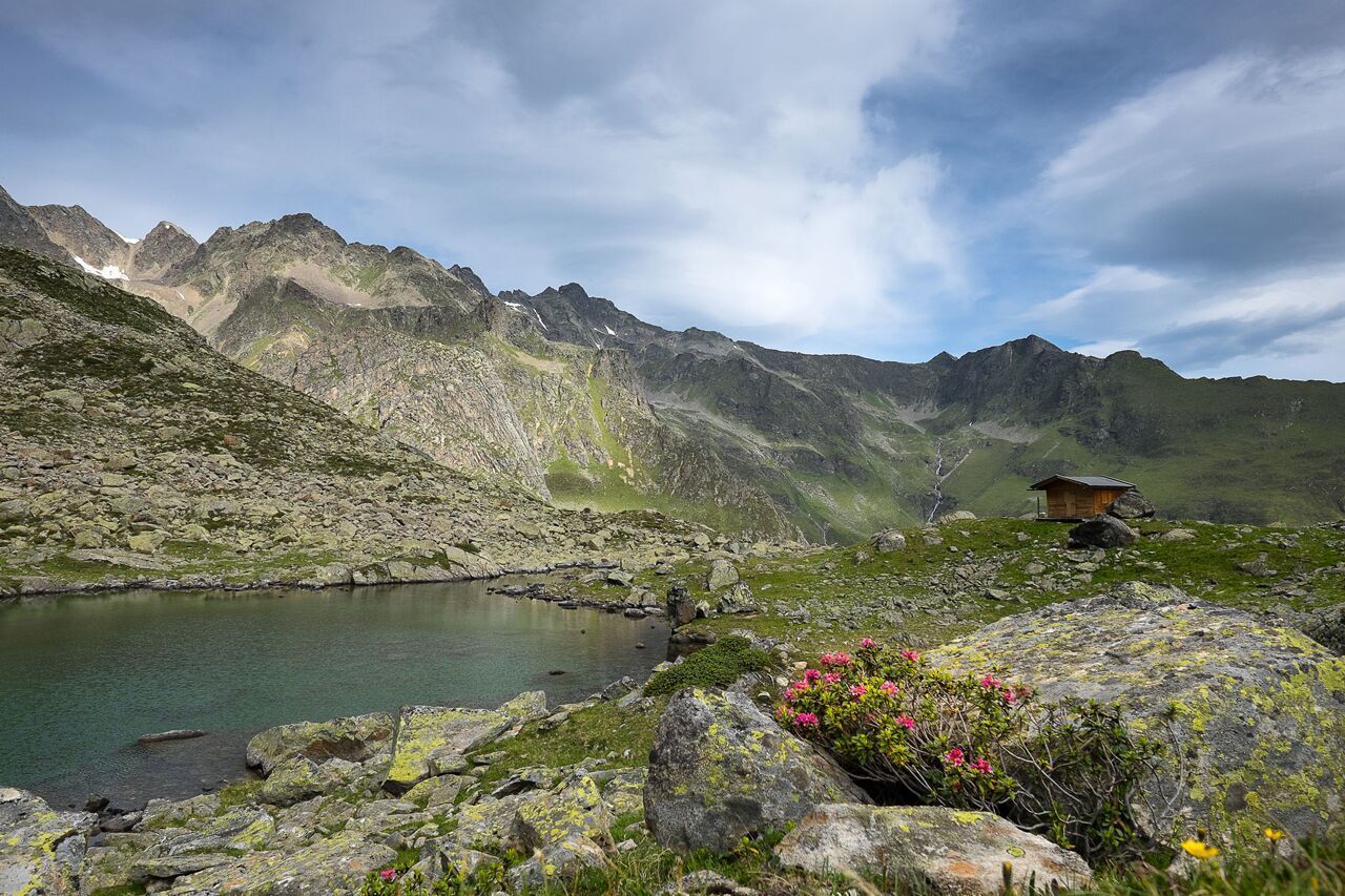
The path leads from the hamlet of Lehn in Längenfeld over a trail to Stabele Alm and past the Leckalm across lush green pastures along a ridge to the first of the four mountain lakes, the Plattachsee. From there you can already see the newly created trail that leads over the Felder Scharte, past the salt licks for the sheep, down steep grassy slopes to a new natural spectacle, the White Lake. It is the largest and deepest of the four lakes and invites you with its milky green color and numerous rest areas for a short relaxing break. Slowly it then continues along a beautiful high path from the White Lake to the somewhat lower situated Lower Spitzig Lake. Nestled in rough mountain landscape, it rests there very quietly and has a calming aura. From there it goes on to the last of the four lakes, the Hauersee. Depending on the season, it shimmers milky green to turquoise. Surrounded by the so-called Fünffingerspitzen, you can once again briefly enjoy the pleasant tranquility of the 2300 meters altitude before you start your descent.

On the way down, you have a fantastic view of the Innerbergtal and the Hauertal on the Hauer ridge towards Innerbergalm. At the tip of this ridge lies the Wöckelwarte, from which you can let your gaze wander over Längenfeld. From there, it goes through an enchanting stone pine forest back to the lush alpine pastures and fields shortly before the Innerbergalm. The descent takes place, as does the ascent, via the trail back to Lehn. 


Nearby huts and mountain restaurants

Getting here

  • Arrival by public transport

    Travel comfortably and safely by train. The final stop and exit point is ÖTZTAL station. Then you travel conveniently and quickly with public bus services or local taxi companies through the entire valley to your desired destination. The current bus timetable is available at: http://fahrplan.vvt.at

  • Parking

    The following parking options are available in Längenfeld/Lehn:

    • Lehn - via ferrata (paid)

More tours in the surrounding area

  • Ötztal Trek Stage 6

    Difficulty: difficult
    Length: 7.6 km Duration: 3:30 h Elevation uphill: 640 m
  • Ötztal Trek Stage 3

    Difficulty: difficult
    Length: 10.4 km Duration: 4:00 h Elevation uphill: 842 m
  • Ötztal Trek Stage 7

    Difficulty: difficult
    Length: 5.3 km Duration: 2:00 h Elevation uphill: 376 m
  • Ötztal Trek Stage 1

    Difficulty: medium
    Length: 18.6 km Duration: 6:30 h Elevation uphill: 1,561 m
  • Ötztal Trek Stage 17

    Difficulty: difficult
    Length: 16.4 km Duration: 6:00 h Elevation uphill: 1,080 m
  • Ötztal Trek Stage 14

    Difficulty: difficult
    Length: 6.3 km Duration: 3:00 h Elevation uphill: 1,004 m
  • Ötztal Trek Stage 12

    Difficulty: difficult
    Length: 4.8 km Duration: 2:00 h Elevation uphill: 592 m
  • Ötztaler Urweg

    Length: 189.1 km Duration: 72:19 h Elevation uphill: 9,428 m
  • Ötztal Trek Stage 4

    Difficulty: difficult
    Length: 8.9 km Duration: 4:00 h Elevation uphill: 802 m
  • Ötztal Trek Stage 10

    Difficulty: difficult
    Length: 11.1 km Duration: 4:30 h Elevation uphill: 1,476 m
  • Ötztal Trek Stage 16

    Difficulty: difficult
    Length: 6.9 km Duration: 2:30 h Elevation uphill: 358 m
  • Ötztal Trek Stage 11

    Difficulty: difficult
    Length: 12.0 km Duration: 5:00 h Elevation uphill: 705 m
  • Ötztal Trek Stage 5

    Difficulty: difficult
    Length: 8.1 km Duration: 3:30 h Elevation uphill: 1,125 m
  • Ötztal Trek Stage 22

    Difficulty: difficult
    Length: 21.5 km Duration: 8:00 h Elevation uphill: 647 m
  • Vent - Breslauer Hütte - Vernagthütte

    Difficulty: medium
    Length: 10.4 km Duration: 4:00 h Elevation uphill: 1,203 m
  • Ötztal Trek Stage 21

    Difficulty: difficult
    Length: 9.4 km Duration: 4:30 h Elevation uphill: 1,270 m
  • Ötztal Trek Stage 8

    Difficulty: difficult
    Length: 9.3 km Duration: 3:30 h Elevation uphill: 274 m
  • Ötztal Trek

    Length: 246.4 km Duration: 84:25 h Elevation uphill: 18,910 m
  • Ötztal Trek Stage 20

    Opening hours: closed
    Difficulty: medium
    Length: 6.4 km Duration: 3:00 h Elevation uphill: 610 m
  • Mountain peak Rosskopf

    Difficulty: medium
    Length: 2.0 km Duration: 2:00 h Elevation uphill: 379 m
Newsletter

The mountain is calling? So does our newsletter!

In our monthly newsletter we reveal the best holiday tips for Tyrol.