Themed hikes Umhausen rund Um

Umhausen / Stubai Alps
Difficulty ratings: easy
Route length: 8.1 km
Duration: 3:00 h

Umhausen -> Waalweg -> Steppsteig -> Wienersteig -> Umhausen 
Tour information

  • Requirement: easy
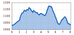
  • Length: 8.1 km
  • Duration: 3:00 h
  • Elevation uphill:499 hm
  • Elevation downhill:499 hm
Highest point1,190 m

Starting point

Umhausen

Finishing point

Umhausen
  • Fitness level 2 / 6

Best time of year

  • January
  • February
  • March
  • April
  • May
  • June
  • July
  • August
  • September
  • October
  • November
  • December

Equipment

Easy hiking trail; suitable for beginners and walkers

Please check the current weather forecast at: www.oetztal.com/de/sommer.html

Appropriate equipment such as breathable and weather-appropriate outdoor clothing, ankle-high hiking boots, wind, rain, and sun protection, a hat, and possibly gloves, is required for all hikes and routes. Carrying a first aid kit, a mobile phone, and possibly a hiking map, as well as sufficient provisions for hikes without dining options, is necessary.

Source: TVB Ötztal Tourismus

Description

Experience trails in the Umhausen valley basin

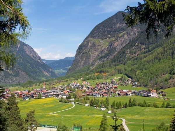
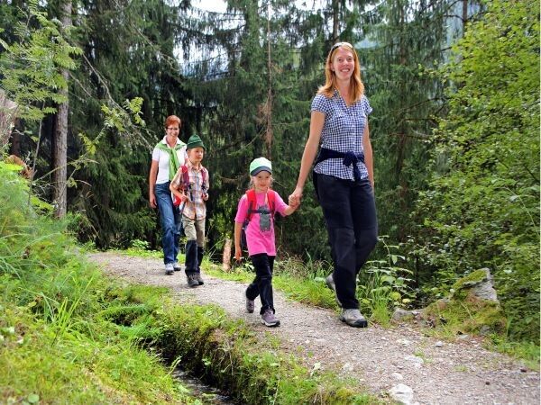
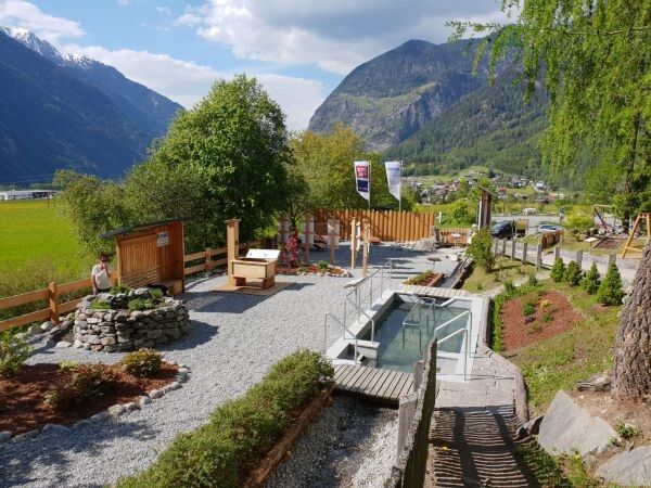
Walk, read, discover, and marvel. A complete program for body and mind is offered by the newly designed trail network “Umhausen rund um”. Three forest trails run around the village at an altitude of 1050 m: the Waalweg, the Steppsteig, and the Wienersteig. Information boards, viewing platforms, a nature trail, and playgrounds invite you to linger. A nature and cultural experience trail network for strolling, hiking, and enjoying around and in Umhausen.


Nearby huts and mountain restaurants

Getting here

  • Arrival by public transport

    Travel comfortably and safely by train to the Ötztal train station. The final stop or exit point is ÖTZTAL station. Afterwards, you can conveniently and quickly travel through the entire valley to your desired destination using public transport or local taxi companies.

    The current bus schedule is available at: fahrplan.vvt.at

  • Parking

    The following parking options are available in Umhausen:

    • Mure parking lot - free of charge
    • Bischoffsplatz - paid from 07:00 to 18:30

Weather

Wed

light rain showers
24°C/15°C
55%2.1l5 km/h

Today

mainly clear
25°C/13°C
0%0l5 km/h

Fri

clear sky
28°C/13°C
5%2.5l5 km/h
Go to weather forecast

More tours in the surrounding area

  • Ötztal Trek Stage 3

    Difficulty:difficult
    Length:10.4 kmDuration:4:00 hElevation uphill:842 m
  • Ötztal Trek Stage 1

    Difficulty:medium
    Length:18.6 kmDuration:6:30 hElevation uphill:1,561 m
  • Ötztal Trek Stage 14

    Difficulty:difficult
    Length:6.3 kmDuration:3:00 hElevation uphill:1,004 m
  • Ötztal Trek Stage 12

    Difficulty:difficult
    Length:4.8 kmDuration:2:00 hElevation uphill:592 m
  • Ötztal Trek Stage 4

    Difficulty:difficult
    Length:8.9 kmDuration:4:00 hElevation uphill:802 m
  • Ötztal Trek Stage 10

    Difficulty:difficult
    Length:11.1 kmDuration:4:30 hElevation uphill:1,476 m
  • Ötztal Trek Stage 8

    Difficulty:difficult
    Length:9.3 kmDuration:3:30 hElevation uphill:274 m
  • Ötztal Trek

    Length:246.4 kmDuration:84:25 hElevation uphill:18,910 m
  • Ötztal Trek Stage 20

    Difficulty:medium
    Length:6.4 kmDuration:3:00 hElevation uphill:610 m
  • Ötztal Trek Stage 11

    Difficulty:difficult
    Length:12.0 kmDuration:5:00 hElevation uphill:705 m
  • Ötztal Trek Stage 5

    Difficulty:difficult
    Length:8.1 kmDuration:3:30 hElevation uphill:1,125 m
  • Ötztal Trek Stage 6

    Difficulty:difficult
    Length:7.6 kmDuration:3:30 hElevation uphill:640 m
  • Ötztal Trek Stage 7

    Difficulty:difficult
    Length:5.3 kmDuration:2:00 hElevation uphill:376 m
  • Ötztal Trek Stage 17

    Difficulty:difficult
    Length:16.4 kmDuration:6:00 hElevation uphill:1,080 m
  • Ötztal Trek Stage 16

    Difficulty:difficult
    Length:6.9 kmDuration:2:30 hElevation uphill:358 m
  • Ötztaler Urweg

    Length:189.1 kmDuration:72:19 hElevation uphill:9,428 m
  • Ötztal Trek Stage 22

    Difficulty:difficult
    Length:21.5 kmDuration:8:00 hElevation uphill:647 m
  • Ötztal Trek Stage 21

    Difficulty:difficult
    Length:9.4 kmDuration:4:30 hElevation uphill:1,270 m
Newsletter

The mountain is calling? So does our newsletter!

In our monthly newsletter we reveal the best holiday tips for Tyrol.