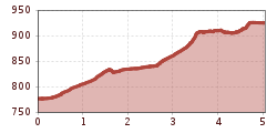
Winter hike Winter path Tumpen - no. 404

open
Oetz / Ötztaler Alpen
Difficulty ratings: medium
Route length: 5.0 km
Duration: 2:00 h

CENTRAL PARKING LOT OETZ --> Habichen --> TUMPEN

Tour information

  • Requirement: medium
  • Length: 5.0 km
  • Duration: 2:00 h
  • Elevation uphill:152 hm
  • Elevation downhill:4 hm
Highest point928 m

Starting point

Oetz central parking lot

Finishing point

Tumpen
  • Fitness level 3 / 6
  • Technique 2 / 6

Best time of year

  • January
  • February
  • March
  • April
  • May
  • June
  • July
  • August
  • September
  • October
  • November
  • December

Equipment

Please note the current snow and avalanche report for the coming days: www.oetztal.com/de/winter.html & avalanche.report/albina-web/bulletin/2019-01-07

Appropriate equipment such as breathable and weather-appropriate outdoor clothing, wind, rain, snow and sun protection, hat and gloves, is required for all hikes and routes. Carrying a first aid kit, a mobile phone, and possibly a map, as well as sufficient provisions for tours without any dining options, is necessary.

Source: Ötztal

Description

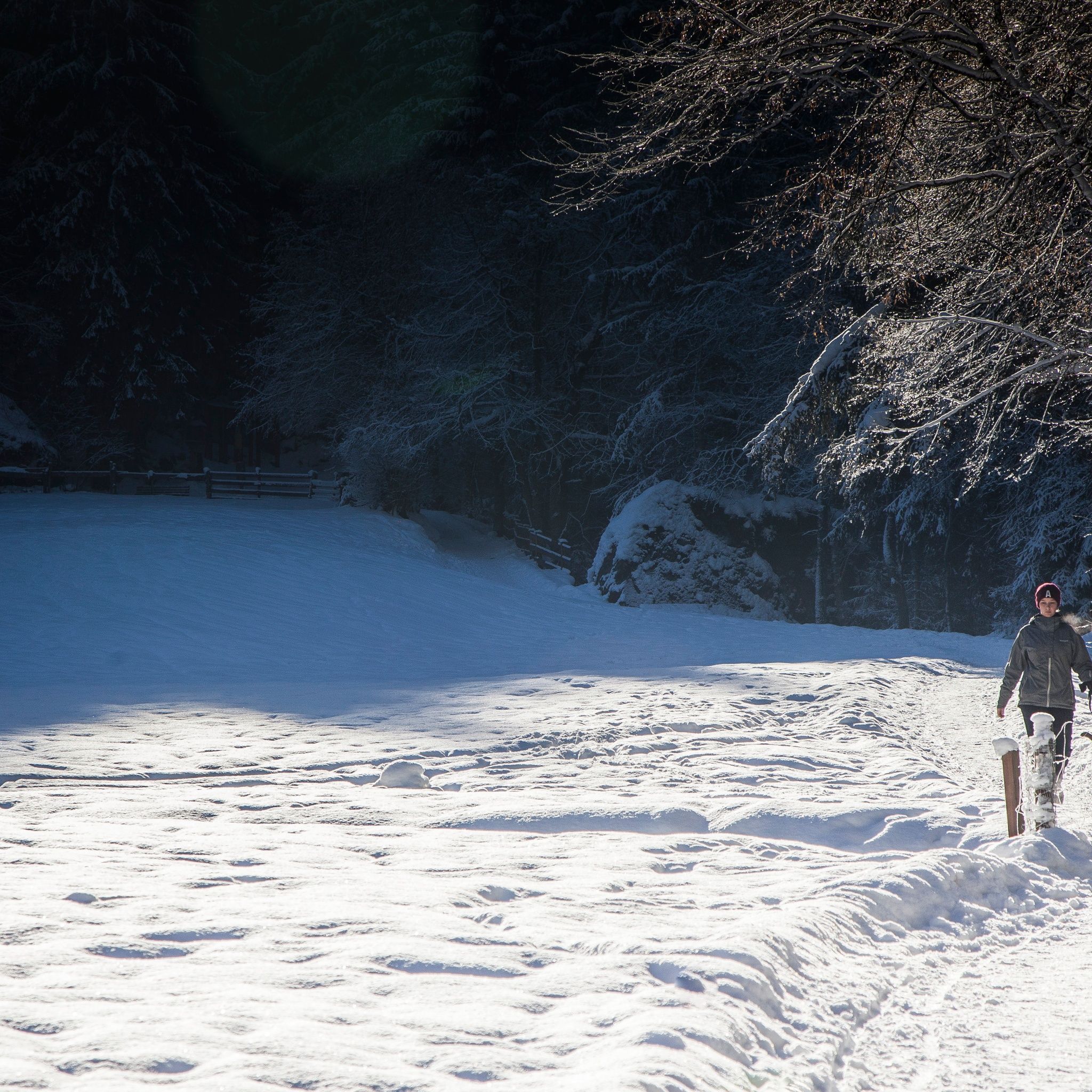
The hiking path leads from the central parking lot in Oetz at the edge of the village along a paved path downstream to the hamlet of Habichen. In Habichen, you cross the street by the Hotel Waldhof and continue walking on a flat forest path. This path merges into a wide meadow path and then back onto a paved side road. On this road, you cross the Ötztaler Ache on a covered wooden bridge.

Tip: After about 300 meters, the path to Habicher See branches off to the right. The small detour takes about 15 minutes.

At the end of the village of Habichen, you walk further up the paved side road to the federal highway. Next to the federal highway, a separate walking path leads up the two hairpin bends to the forest junction. Here begins again a beautiful forest and meadow path that leads along the wintry creek to Tumpen.

From there, you can take the bus back to Oetz.


Getting here

  • Arrival by public transport

    Travel comfortably and safely by train to Ötztal station. The terminus or exit point is ÖTZTAL station. Afterwards, you can conveniently and quickly travel through the entire valley to your desired destination with public transport or local taxi companies. The current bus schedule is available at: http://fahrplan.vvt.at

  • Parking

    The following parking options are available:

    • Central parking lot Oetz (fee required)
    • Parking lot at the rafting entry point (at the end of Oetz on the right side) (fee required)
    • Overnight parking for multi-day tours: central parking lot Oetz, tickets available at the Oetz information office.
    • Parking lot Acherkogelbahn (fee required)

More tours in the surrounding area

Newsletter

The mountain is calling? So does our newsletter!

In our monthly newsletter we reveal the best holiday tips for Tyrol.