Mountain hikes Waalweg Fundustal - Umhausen

closed
Umhausen / Ötztaler Alpen
Difficulty ratings: medium
Route length: 6.1 km
Duration: 2:02 h

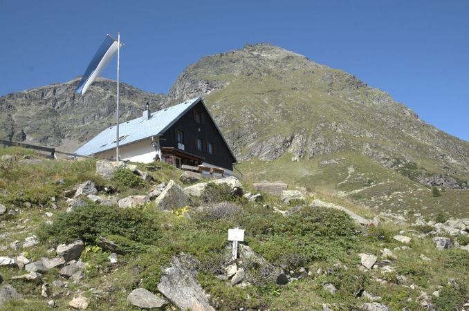
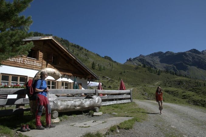
HINTERE FUNDUSALM -> Frischmann Hut -> Köfler Waalweg -> Köfler Scharte -> HINTERE FUNDUSALM

Tour information

  • Requirement: medium
  • Length: 6.1 km
  • Duration: 2:02 h
  • Elevation uphill:255 hm
  • Elevation downhill:255 hm
Highest point2,208 m

Starting point

Hintere Fundusalm

Finishing point

Hintere Fundusalm
  • Fitness level 3 / 6

Best time of year

  • January
  • February
  • March
  • April
  • May
  • June
  • July
  • August
  • September
  • October
  • November
  • December

Equipment

Moderately difficult mountain trail; suitable for sure-footed and experienced mountain hikers; 

Good physical condition, mountain experience and mountain equipment (see under Equipment) are necessary

Please note the current weather report

Appropriate equipment such as breathable and weather-appropriate outdoor clothing, ankle-high hiking boots, wind, rain and sun protection, hat, possibly gloves, is required for all hikes and routes. Carrying a first aid kit, a mobile phone, possibly a hiking map, and sufficient provisions for hikes without the option to stop for food is necessary.

Source: TVB Ötztal Tourismus

Description

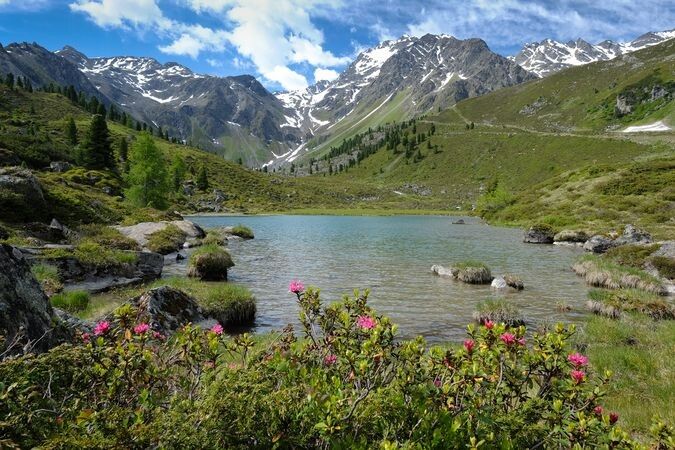
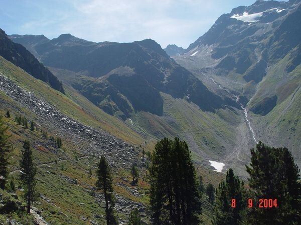
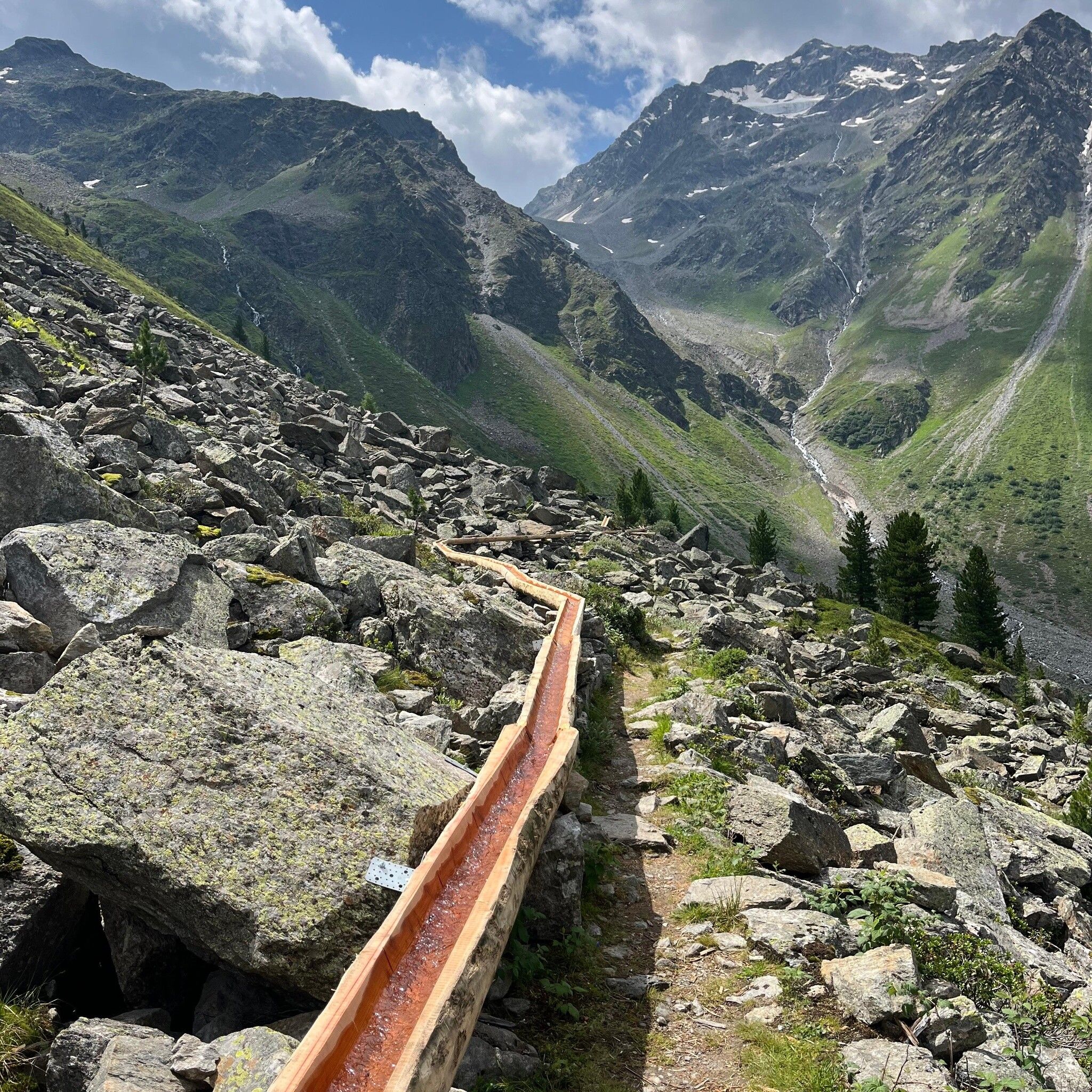
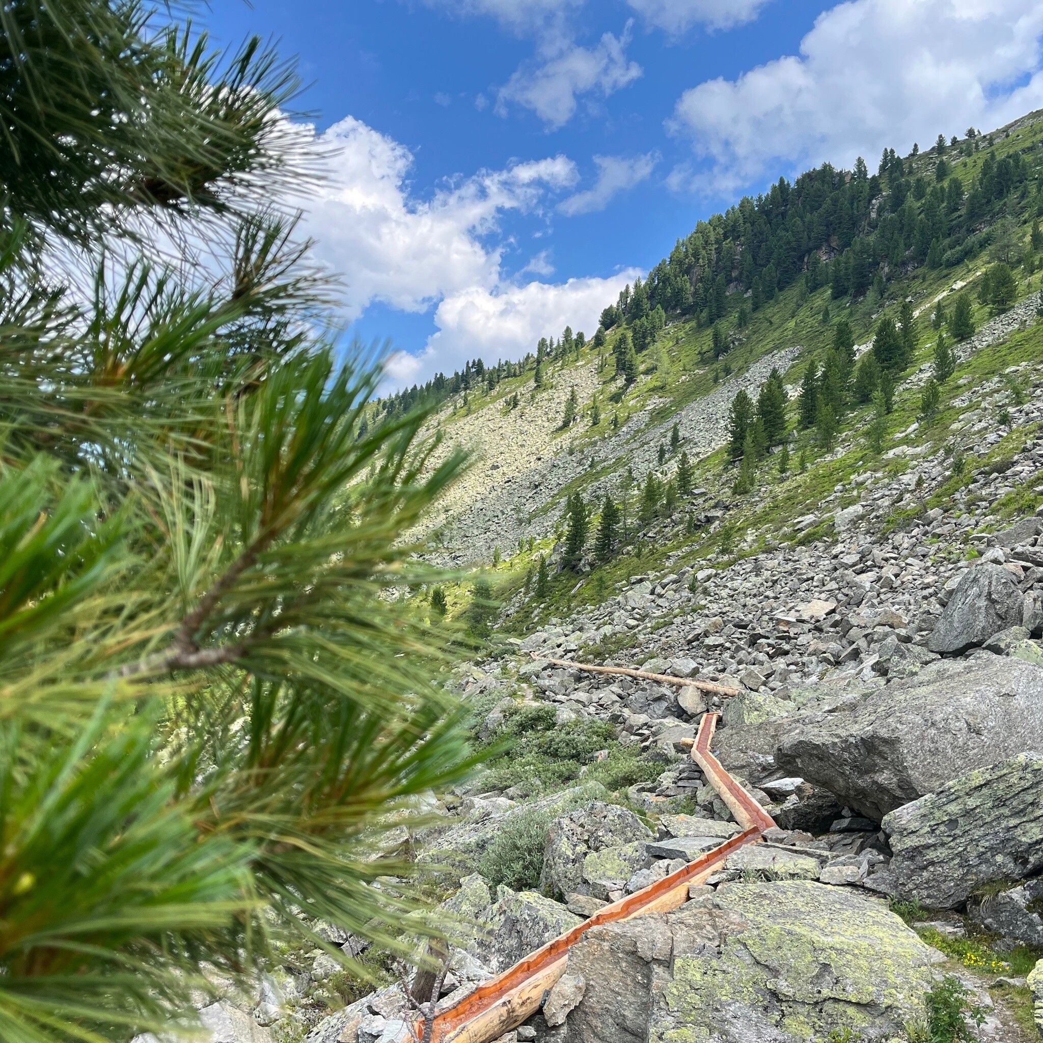
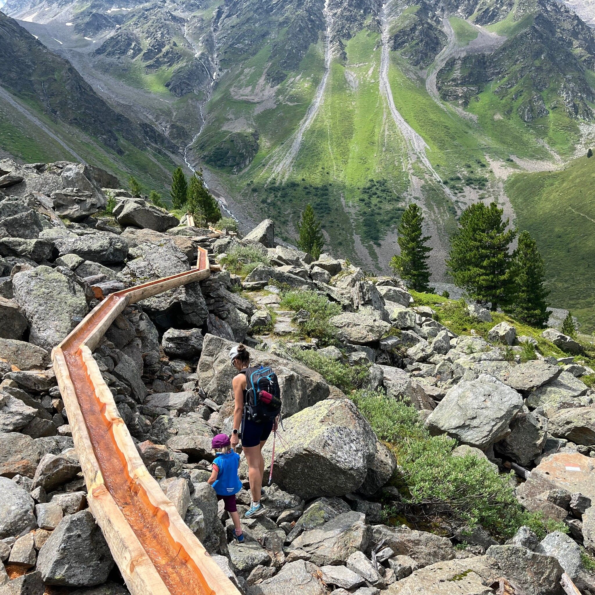
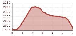
The hut taxi takes you from Umhausen to the Hintere Fundusalm. The solitude and beauty of nature can be wonderfully enjoyed here. Green meadows and the crystal-clear Fundussee invite you to linger on a hot summer day. From here, the hiking trail to the Frischmann Hut begins. The circular trail then leads in the direction of Schwarze Wand and over the Köfler Waalweg, which is probably unique due to its exposed location above the tree line and the terrain composition (more than 50% consists of primary rock scree), up to the Köfler Scharte at 2,084 m above sea level. From the pass, a short path leads back down to the Hintere Fundusalm, where you can take the hut taxi back to Umhausen. Those still fit and willing can hike back to Umhausen via the wide forest road - hiking time about two hours.


Nearby huts and mountain restaurants

Getting here

  • Arrival by public transport

    Travel comfortably and safely by train to the Ötztal train station. The final stop or exit point is the ÖTZTAL station. Afterwards, you can conveniently and quickly continue with public transport or local taxi companies through the whole valley to your desired destination! The current bus schedule is available at: http://fahrplan.vvt.at

  • Parking

    The following parking options are available in Umhausen:

    • Parking lot Mure | free of charge

More tours in the surrounding area

  • Ötztal Trek Stage 4

    Difficulty: difficult
    Length: 8.9 km Duration: 4:00 h Elevation uphill: 802 m
  • Ötztal Trek Stage 3

    Difficulty: difficult
    Length: 10.4 km Duration: 4:00 h Elevation uphill: 842 m
  • Ötztal Trek Stage 8

    Difficulty: difficult
    Length: 9.3 km Duration: 3:30 h Elevation uphill: 274 m
  • Ötztal Trek Stage 1

    Difficulty: medium
    Length: 18.6 km Duration: 6:30 h Elevation uphill: 1,561 m
  • Ötztal Trek Stage 14

    Difficulty: difficult
    Length: 6.3 km Duration: 3:00 h Elevation uphill: 1,004 m
  • Ötztal Trek Stage 20

    Opening hours: closed
    Difficulty: medium
    Length: 6.4 km Duration: 3:00 h Elevation uphill: 610 m
  • Ötztal Trek Stage 5

    Difficulty: difficult
    Length: 8.1 km Duration: 3:30 h Elevation uphill: 1,125 m
  • Ötztal Trek Stage 6

    Difficulty: difficult
    Length: 7.6 km Duration: 3:30 h Elevation uphill: 640 m
  • Ötztal Trek Stage 10

    Difficulty: difficult
    Length: 11.1 km Duration: 4:30 h Elevation uphill: 1,476 m
  • Ötztal Trek Stage 7

    Difficulty: difficult
    Length: 5.3 km Duration: 2:00 h Elevation uphill: 376 m
  • Ötztal Trek

    Length: 246.4 km Duration: 84:25 h Elevation uphill: 18,910 m
  • Ötztal Trek Stage 17

    Difficulty: difficult
    Length: 16.4 km Duration: 6:00 h Elevation uphill: 1,080 m
  • Ötztal Trek Stage 16

    Difficulty: difficult
    Length: 6.9 km Duration: 2:30 h Elevation uphill: 358 m
  • Ötztal Trek Stage 11

    Difficulty: difficult
    Length: 12.0 km Duration: 5:00 h Elevation uphill: 705 m
  • Ötztal Trek Stage 12

    Difficulty: difficult
    Length: 4.8 km Duration: 2:00 h Elevation uphill: 592 m
  • Ötztaler Urweg

    Length: 189.1 km Duration: 72:19 h Elevation uphill: 9,428 m
  • Ötztal Trek Stage 21

    Difficulty: difficult
    Length: 9.4 km Duration: 4:30 h Elevation uphill: 1,270 m
  • Vent - Breslauer Hütte - Vernagthütte

    Difficulty: medium
    Length: 10.4 km Duration: 4:00 h Elevation uphill: 1,203 m
  • Ötztal Trek Stage 22

    Difficulty: difficult
    Length: 21.5 km Duration: 8:00 h Elevation uphill: 647 m
Newsletter

The mountain is calling? So does our newsletter!

In our monthly newsletter we reveal the best holiday tips for Tyrol.