Themed hikes Water strider Piburger See Oetz

Oetz / Ötztal Alps
Difficulty ratings: easy
Route length: 9.2 km
Duration: 3:00 h

Oetz –> Wellerbrücke (Achstürze) –> Piburger See –> Seejöchl –> Piburg –> Oetz
Tour information

  • Requirement: easy
  • Length: 9.2 km
  • Duration: 3:00 h
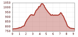
  • Elevation uphill:538 hm
  • Elevation downhill:538 hm
Highest point1,048 m

Starting point

Oetz

Finishing point

Oetz
  • Fitness level 2 / 6

Best time of year

  • January
  • February
  • March
  • April
  • May
  • June
  • July
  • August
  • September
  • October
  • November
  • December

Equipment

Sure-footedness

No particular difficulties

Wearing hiking gear such as breathable and weather-appropriate outdoor clothing, ankle-high hiking boots, wind, rain and sun protection, a hat and possibly gloves is recommended! It is also important to bring sufficient provisions as well as a first aid kit, a mobile phone and possibly a hiking map.

Standard hiking equipment

Source: TVB Ötztal Tourismus

Description

On this hike, you experience the wild water of the Ötztaler Ache in contrast to the calm water of the Piburger See.

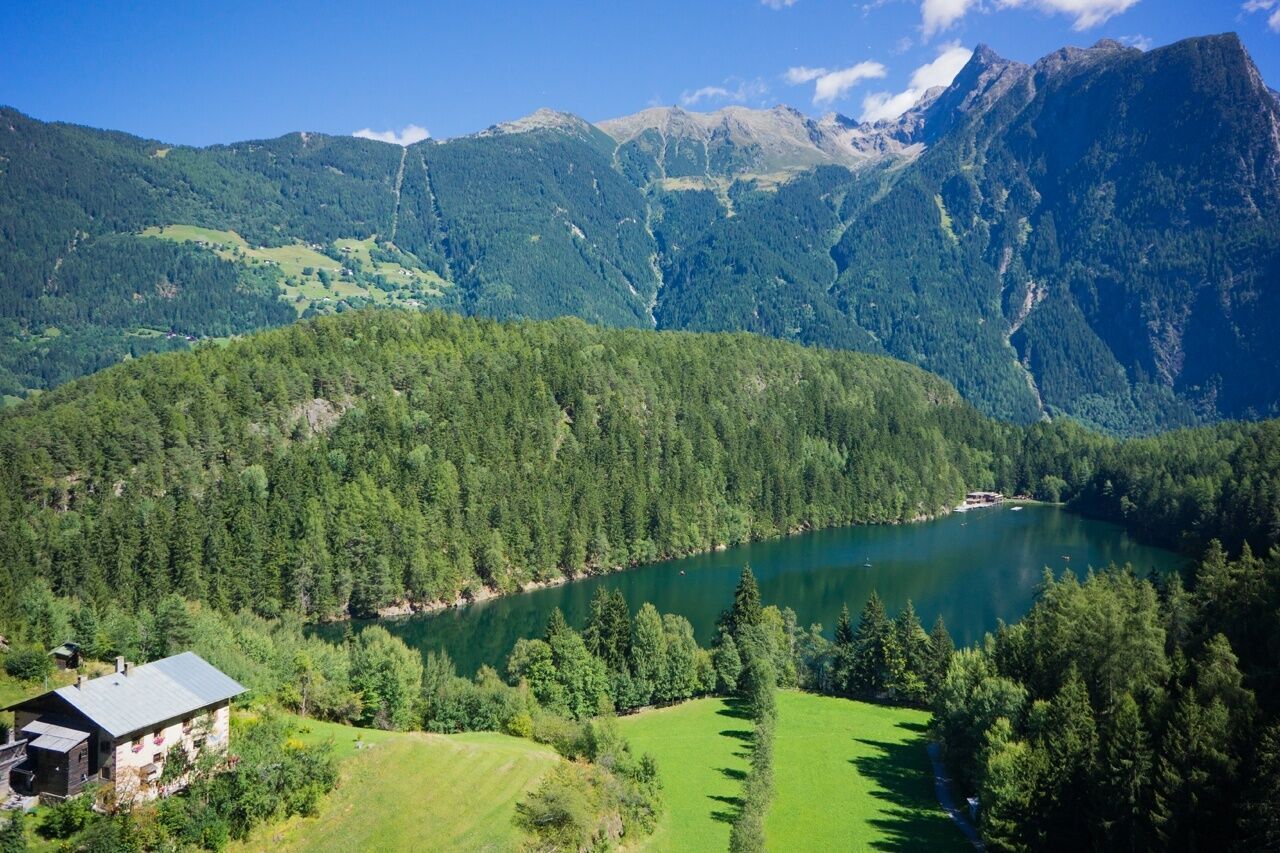
From Oetz, you walk along the roaring waters of the Ötztaler Ache over a gravel path heading south. In a forested area, you reach the Wellerbrücke. Here, the view opens onto one of the most extreme wild water sports courses and a longtime venue of the extreme kayak world championship. On the other side, you follow the signposted hiking trail and later a forest road towards Piburger See. Suddenly the forest edges open and you look out at the picturesque lake surrounded by many myths.

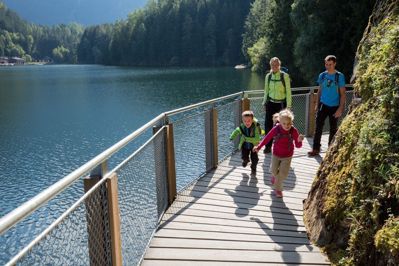
Keeping left, you hike up to Seejöchl. The steep ascent is rewarded with a breathtaking view of the harmonious landscape. The circular path continues to Piburg and then back down and around the lake. Returning to the bathing facility, you walk left on the signposted path back to Oetz. On the descent, solitary benches or inns invite you to rest.


Nearby huts and mountain restaurants

Getting here

  • Arrival by public transport

    Travel comfortably and safely by train to the Ötztal station. The final stop or exit point is the ÖTZTAL station. Afterwards, you can conveniently and quickly travel through the entire valley to your desired destination using public transit or local taxi companies! The current bus schedule is available at: http://fahrplan.vvt.at

  • Parking

    Oetz is located in western Austria in the state of TIROL, in a southern side valley of the Inn Valley - the ÖTZTAL. For your arrival by car, plan the optimal route from your home location with the route planner online: https://www.google.at/maps


    The following parking options are available in Oetz/Piburg:

    • Acherkogelbahn parking lot (paid)
    • Rafting entry point parking lot (at the end of Oetz on the right side) (paid)
    • Oetz central parking lot (paid)
    • Overnight parking for multi-day routes: Oetz central parking lot, tickets available at the Oetz information office.
    • Piburg parking lot at Hotel Seerose, paid

Weather

Today

mainly clear
17°C/7°C
0%0l5 km/h

Tue

clear sky
18°C/6°C
80%3.9l10 km/h

Wed

moderate rain
11°C/6°C
85%18.3l5 km/h
Go to weather forecast

More tours in the surrounding area

  • Ötztaler Urweg

    Difficulty:difficult
    Length:177.2 kmDuration:60:49 hElevation uphill:7,541 m
  • Ötztal Trek Stage 22

    Difficulty:difficult
    Length:21.5 kmDuration:8:00 hElevation uphill:647 m
  • Ötztal Trek Stage 21

    Difficulty:difficult
    Length:9.4 kmDuration:4:30 hElevation uphill:1,270 m
  • Siegerlandhütte - Sölden

    Difficulty:medium
    Length:8.0 kmDuration:3:30 hElevation uphill:780 m
  • Ötztal Trek Stage 6

    Difficulty:difficult
    Length:7.6 kmDuration:3:30 hElevation uphill:640 m
  • Ötztal Trek Stage 10

    Opening hours:closed
    Difficulty:difficult
    Length:11.1 kmDuration:4:30 hElevation uphill:1,476 m
  • Ötztal Trek Stage 8

    Difficulty:difficult
    Length:9.3 kmDuration:3:30 hElevation uphill:274 m
  • Ötztal Trek

    Length:246.4 kmDuration:84:25 hElevation uphill:18,910 m
  • Ötztal Trek Stage 17

    Difficulty:difficult
    Length:16.4 kmDuration:6:00 hElevation uphill:1,080 m
  • Ötztal Trek Stage 16

    Difficulty:difficult
    Length:6.9 kmDuration:2:30 hElevation uphill:358 m
  • Ötztal Trek Stage 11

    Difficulty:difficult
    Length:12.0 kmDuration:5:00 hElevation uphill:705 m
  • Ötztal Trek Stage 4

    Difficulty:difficult
    Length:8.9 kmDuration:4:00 hElevation uphill:802 m
  • Ötztal Trek Stage 3

    Difficulty:difficult
    Length:10.4 kmDuration:4:00 hElevation uphill:842 m
  • Ötztal Trek Stage 1

    Difficulty:medium
    Length:18.6 kmDuration:6:30 hElevation uphill:1,561 m
  • Ötztal Trek Stage 14

    Difficulty:difficult
    Length:6.3 kmDuration:3:00 hElevation uphill:1,004 m
  • Ötztal Trek Stage 20

    Difficulty:medium
    Length:6.4 kmDuration:3:00 hElevation uphill:610 m
  • Ötztal Trek Stage 12

    Difficulty:difficult
    Length:4.8 kmDuration:2:00 hElevation uphill:592 m
  • Ötztal Trek Stage 5

    Difficulty:difficult
    Length:8.1 kmDuration:3:30 hElevation uphill:1,105 m
Newsletter

The mountain is calling? So does our newsletter!

In our monthly newsletter we reveal the best holiday tips for Tyrol.