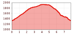
Open interactive mapOpen this POI on the interactive mapElevation profileRundtour Hoanzer- & Steineralm.gpx
pilgrimage-church-maria-schnee-obermauern-nilbach-hoch-c-bernhard-assmair.jpg © Bernhard Aßmair Theme path "Virgen crossroads"Difficulty:easyLength:3.1 kmDuration:1:00 hElevation uphill:90 mSee trailSee trail: Theme path "Virgen crossroads"
Figerhorn - Goßglockner_TVB Osttirol_Elias Bachmann_Kals am Großglockner (1) © TVB Osttirol | Elias Bachmann FigerhornDifficulty:difficultLength:6.5 kmDuration:6:00 hElevation uphill:807 mSee trailSee trail: Figerhorn
wanderung-grosser-zunig-wokenmeer-c-bernhard-assmair.jpg © Bernhard Aßmair Lasörling altitude trailDifficulty:mediumLength:57.0 kmDuration:25:00 hElevation uphill:3,740 mSee trailSee trail: Lasörling altitude trail
wandern2-neuepragerhuette-c-dezordo-desiree.jpg © Desirèe De Zordo Venediger altitude trailDifficulty:difficultLength:55.5 kmDuration:27:00 hElevation uphill:3,915 mSee trailSee trail: Venediger altitude trail
muhs-pyramide-panoramaweg-herbst23-c-anna-ladstaetter.jpeg © Anna Ladstätter Muhs panorama trailDifficulty:mediumLength:15.2 kmDuration:6:00 hElevation uphill:1,090 mSee trailSee trail: Muhs panorama trail
Neue Reichenbergerhütte_TVB Osttirol_Geyer Johannes_No location given © TVB Osttirol | Johannes Geyer Hike to Neuen Reichenberger HütteDifficulty:mediumLength:9.1 kmDuration:9:00 hElevation uphill:1,210 mSee trailSee trail: Hike to Neuen Reichenberger Hütte
Hoch und Heilig Etappe 7 Virgen Lasörlinghütte_TVB Osttirol_Peter Maier_Virgen in Osttirol.jpg © Peter Maier Hiking tour to Lasörlinghütte 2.350mDifficulty:mediumLength:14.6 kmDuration:7:10 hElevation uphill:1,080 mSee trailSee trail: Hiking tour to Lasörlinghütte 2.350m
Kalser Tauernhaus im Nationalpark Hohe Tauern © NPHT Hannah Assil und Michael Kastl Hike to Kalser TauernhausDifficulty:mediumLength:12.2 kmDuration:4:00 hElevation uphill:244 mSee trailSee trail: Hike to Kalser Tauernhaus
wanderung-neue-sajathuette-ausblick-c-bernhard-assmair.jpg © Bernhard Aßmair Hiking tour to Neue Sajathütte 2.600mDifficulty:mediumLength:10.3 kmDuration:6:50 hElevation uphill:1,080 mSee trailSee trail: Hiking tour to Neue Sajathütte 2.600m
Singletrail Kals © Miriam Raneburger Gornerwald Trail No. 139Difficulty:difficultLength:2.3 kmDuration:0:30 hGo to biketourGo to biketour: Gornerwald Trail No. 139
hochundheilig-etappe9-kalsamgrossglockner-c-peter-maier.jpg © Peter Maier High and sacred – Stage 09 from Kals to HeiligenblutMore InformationMore Information: High and sacred – Stage 09 from Kals to Heiligenblut
High and sacred – Stage 08 from Obermauern to KalsMore InformationMore Information: High and sacred – Stage 08 from Obermauern to Kals
Adlertrail © bikeboard/Roland Kachelhauser Adlertrail No. 138Difficulty:mediumLength:3.7 kmDuration:0:20 hGo to biketourGo to biketour: Adlertrail No. 138
iseltrail-etappe2-feldner-katarakte-c-ramona-walder.jpg © TVB Osttirol/Waldner Ramona Iseltrail Stage 2More InformationMore Information: Iseltrail Stage 2
Gschlöss mit Venedigermassiv_TVB Osttirol_Kurzthaler Martin_Keine Ortsangabe.jpg © Kurzthaler Martin Hike to the Venedigerhaus InnergschlößDifficulty:easyLength:8.5 kmDuration:2:30 hElevation uphill:180 mSee trailSee trail: Hike to the Venedigerhaus Innergschlöß
Iseltrail - Umbalkees © M. Schickhofer Iseltrail Stage 5More InformationMore Information: Iseltrail Stage 5
Bergabbau vor vielen Jahren am Gassla Anda Weg.jpg © Klaunzer Badener HütteDifficulty:difficultLength:23.2 kmDuration:11:30 hElevation uphill:1,750 mSee trailSee trail: Badener Hütte
Stüdlhütte-Kals-Sommer2019-Matteo Bachmann.JPG © Matteo Bachmann Lucknerhaus - StüdlhütteDifficulty:mediumLength:9.3 kmDuration:5:30 hElevation uphill:862 mSee trailSee trail: Lucknerhaus - Stüdlhütte
wandern-sudetendeutschehuette2-c-desiree-dezordo.jpg © Desirèe De Zordo Hiking tour to Sudetendeutschen Hütte 2.650mDifficulty:mediumLength:15.5 kmDuration:7:00 hElevation uphill:1,200 mSee trailSee trail: Hiking tour to Sudetendeutschen Hütte 2.650m
aussergschloess_06-19_(c)www.bergpixel.de © Bergpixel Hike to the Berghaus AußergschlössDifficulty:easyLength:5.2 kmDuration:1:45 hElevation uphill:170 mSee trailSee trail: Hike to the Berghaus Außergschlöss
Glacier trail Innergschlöss/SchlatenkeesDifficulty:mediumLength:9.4 kmDuration:5:00 hElevation uphill:680 mSee trailSee trail: Glacier trail Innergschlöss/Schlatenkees
wanderung-umbalfaelle-wasserfall-c-bernhard-assmair.jpg © Bernhard Aßmair Umbal waterfalls nature force trailDifficulty:easyLength:5.8 kmDuration:2:30 hElevation uphill:250 mSee trailSee trail: Umbal waterfalls nature force trail
Böses WeiblDifficulty:difficultLength:14.1 kmDuration:8:00 hElevation uphill:1,193 mSee trailSee trail: Böses Weibl
winter-kals-langlaufen.jpg © Eva Oberhauser Romantikloipe KalsOpening hours:openDifficulty:mediumLength:4.2 kmElevation uphill:45 m:Style: ClassicGo to Cross-country skiing trailGo to Cross-country skiing trail: Romantikloipe Kals
Langlaufen Blusenrunde © Peter Maier Unterfeldloipe Prägraten (illuminated)Opening hours:openDifficulty:easyLength:3.3 kmElevation uphill:36 m:Style: ClassicGo to Cross-country skiing trailGo to Cross-country skiing trail: Unterfeldloipe Prägraten (illuminated)
Give feedback for a chance to win a special holiday experience!Click here for the surveyClick here for the survey

")


www.bergpixel.de")
")


