Long-distance hike Adlerweg trail. Stage 3: Eisseehütte – Bonn-Matreier-Hütte

Prägraten am Großvenediger / Venedigergruppe
Difficulty ratings: medium
Route length: 7.0 km
Duration: 3:30 h

Adlerweg trail. Stage 3: Eisseehütte – Bonn-Matreier-Hütte

Tour information

  • Requirement: medium
  • Length: 7.0 km
  • Duration: 3:30 h
  • Elevation uphill:544 hm
  • Elevation downhill:322 hm
Highest point2,740 m

Starting point

Eisseehütte

Finishing point

Bonn-Matreier-Hütte
  • Fitness level 4 / 6
  • Technique 4 / 6

Best time of year

  • January
  • February
  • March
  • April
  • May
  • June
  • July
  • August
  • September
  • October
  • November
  • December
Source: TVB Osttirol

Description

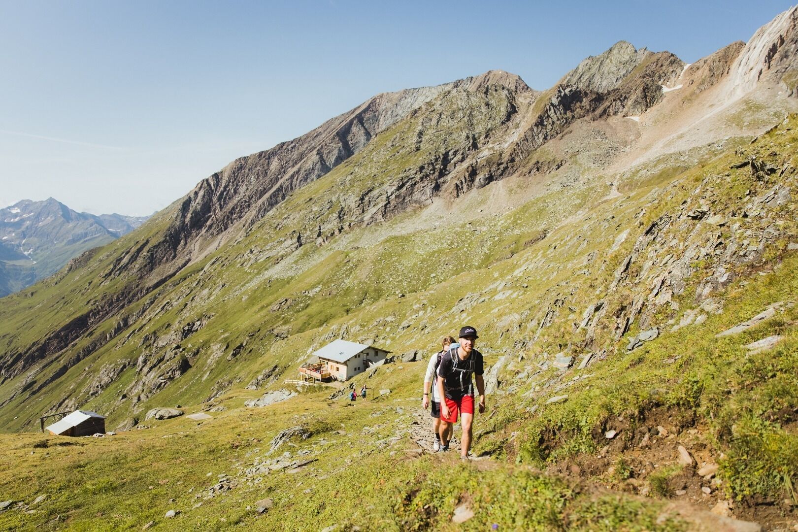
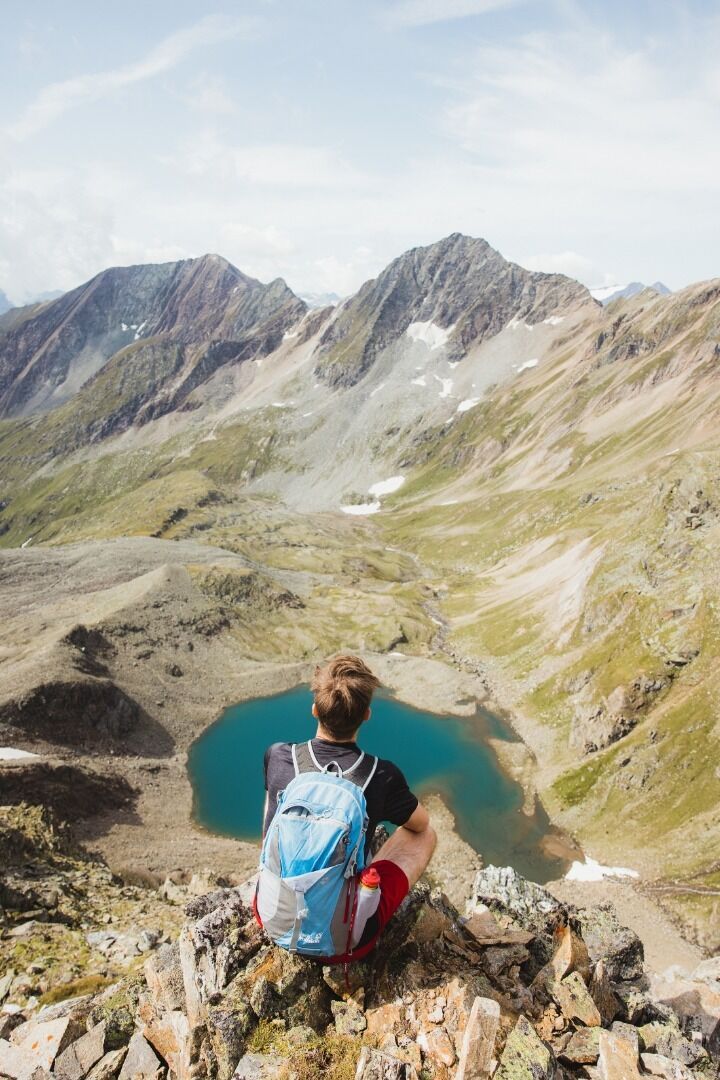
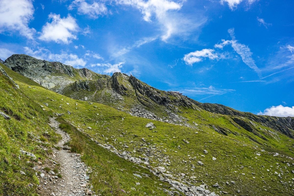
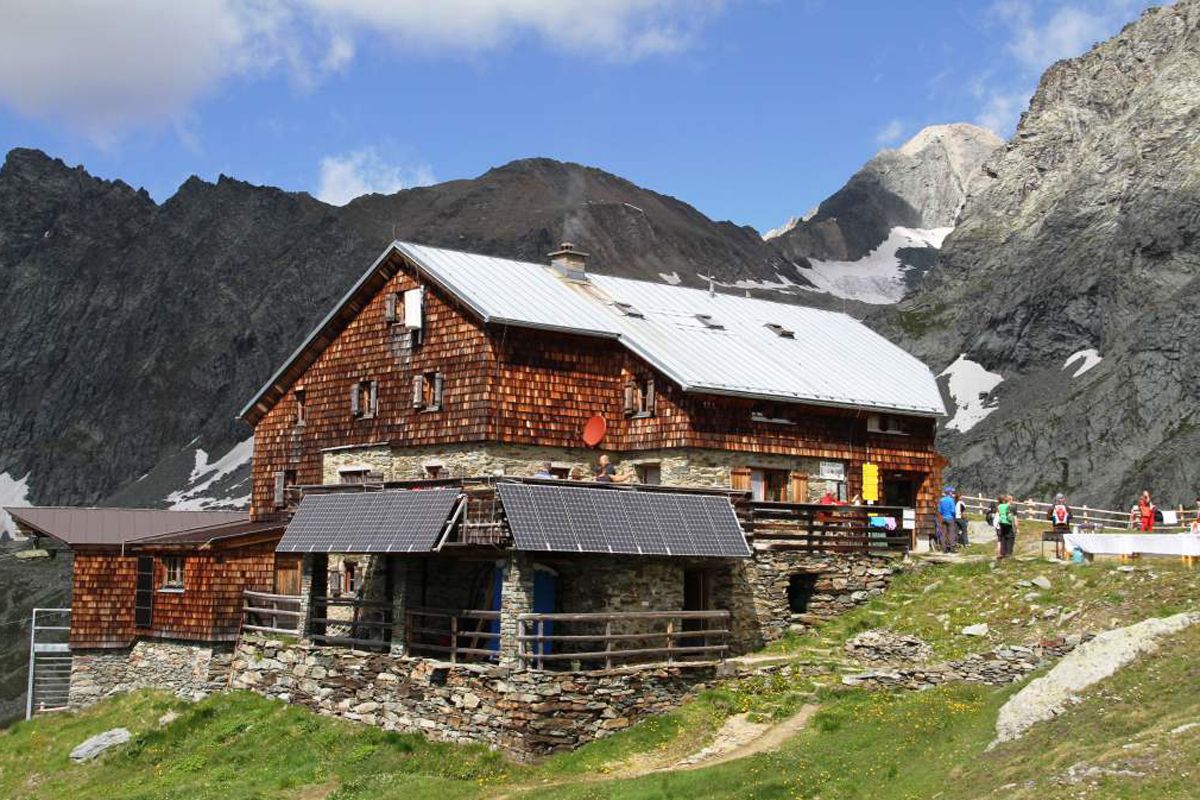
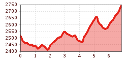
From Eissee Hut, descend a few metres to get to the signpost of the Venediger High Trail, heading left to the eastern slopes of Timmeltal Valley. The traverse of Hexenkopf Peak’s southwest ridge follows an easy contour; then you will tackle the west ridge of Hoher Eicham Peak. After a pleasant and almost level first section, get down to business. Climbing steeply, the trail furiously works its way up the west flank of Wunwand, assisted by stone steps and a fixed anchoring system of cables. The trail switchbacks up, traversing a tussock slope on its one-kilometre way to Wunwand’s southwest ridge. In this area, a trail branches off to Wallhornalm Alpine Pasture Hut in Timmeltal Valley; the High Trail, however, continues along a tussock slope south of Wunwand and rounds a minor spur of Wunspitze’s south ridge. Another 30-minute climb takes you to a niche; slightly above the trail divides, running left to Obere Wunalm and right to Untere Wunalm. The route of the Venediger High Trail runs high above Virgental Valley. The way eases, then climbs again, this time to mount the ridge of Eselsrücken, which is the gateway to Großes Niltal Valley. A sharp little gully has to be descended in 15 switchbacks, below which you go down to a boulder field, crossing rivulets of Nilkees Glacier. From here, the trail reveals Bonn-Matreier-Hut that is your destination. A well-maintained trail, beautifully crafted with stone steps, brings you to this stately shingle-clad shelter that is renowned for serving hearty specialties, which are perfect to gather new strength after the efforts of the day.  

Nearby huts and mountain restaurants

More tours in the surrounding area

  • Hike to the Venedigerhaus Innergschlöß

    Difficulty: easy
    Length: 8.5 km Duration: 2:30 h Elevation uphill: 180 m
  • Hike to Neuen Reichenberger Hütte

    Difficulty: medium
    Length: 9.1 km Duration: 9:00 h Elevation uphill: 1,210 m
  • Lucknerhaus - Stüdlhütte

    Difficulty: medium
    Length: 9.3 km Duration: 5:30 h Elevation uphill: 862 m
  • Badener Hütte

    Difficulty: difficult
    Length: 23.2 km Duration: 11:30 h Elevation uphill: 1,750 m
  • Hike to Kalser Tauernhaus

    Difficulty: medium
    Length: 12.2 km Duration: 4:00 h Elevation uphill: 244 m
  • Hiking tour to Neue Sajathütte 2.600m

    Difficulty: medium
    Length: 10.3 km Duration: 6:50 h Elevation uphill: 1,080 m
  • Hiking tour to Lasörlinghütte 2.350m

    Difficulty: medium
    Length: 14.6 km Duration: 7:10 h Elevation uphill: 1,080 m
  • Lasörling altitude trail

    Difficulty: medium
    Length: 57.0 km Duration: 25:00 h Elevation uphill: 3,740 m
  • Venediger altitude trail

    Difficulty: difficult
    Length: 55.5 km Duration: 27:00 h Elevation uphill: 3,915 m
  • Figerhorn

    Difficulty: difficult
    Length: 6.5 km Duration: 6:00 h Elevation uphill: 807 m
  • Muhs panorama trail

    Difficulty: medium
    Length: 15.2 km Duration: 6:00 h Elevation uphill: 1,090 m
  • Umbal waterfalls nature force trail

    Difficulty: easy
    Length: 5.8 km Duration: 2:30 h Elevation uphill: 250 m
  • Böses Weibl

    Difficulty: difficult
    Length: 14.1 km Duration: 8:00 h Elevation uphill: 1,193 m
  • Lasörling 3.098m

    Difficulty: difficult
    Length: 21.9 km Duration: 12:00 h Elevation uphill: 1,940 m
  • Rotenkogel

    Difficulty: difficult
    Length: 3.9 km Duration: 3:00 h Elevation uphill: 383 m
  • Themed path Zedlacher Paradies

    Difficulty: easy
    Length: 4.3 km Duration: 2:30 h Elevation uphill: 130 m
  • Eagle Walk Stage O1: Ströden - Johannis Hütte

    Difficulty: medium
    Length: 13.0 km Duration: 6:30 h Elevation uphill: 1,430 m
Newsletter

The mountain is calling? So does our newsletter!

In our monthly newsletter we reveal the best holiday tips for Tyrol.