
Hut hike Circular walk: Innere Steiner Alm (Hoanzer Alm) – Maria Schnee Rock Chapel – Äußere Steiner Alm

Matrei in Osttirol / Granatspitze Group
Difficulty ratings: easy
Route length: 7.9 km
Duration: 4:30 h

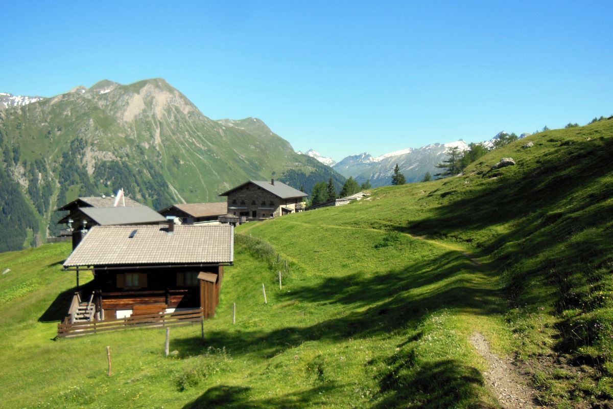
A scenic circular walk to the rustic Innere Steiner Alm (Hoanzer Alm) via forest paths and alpine pastures to the peaceful rock chapel of Maria Schnee, carved into the rock, and on to the Äußere Steiner Alm. A direct return route with impressive views of the mountains back to the starting point.
Tour information

  • Requirement: easy
  • Length: 7.9 km
  • Duration: 4:30 h
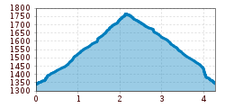
  • Elevation uphill:671 hm
  • Elevation downhill:672 hm
Highest point1,938 m

Starting point

Car park Stein 1.330m

Finishing point

Car park Stein 1.330m
  • Fitness level 3 / 6
  • Technique 2 / 6

Best time of year

  • January
  • February
  • March
  • April
  • May
  • June
  • July
  • August
  • September
  • October
  • November
  • December

Trail condition

Hiking trail
Source: TVB Osttirol

Description

The starting point for this lovely walk is the car park at the hamlet of Stein. From there, you follow a picturesque path through the forest. Once you’ve left the woodland behind, you walk briefly across a meadow up to the Innere Steiner Alm. Once at the top, you’ll be rewarded with a breathtaking view of the Venediger Group. The Innere Steiner Alm is also known as the Hoanzer Alm. You then continue eastwards along the meadow path, through the high forest and across mountain meadows to the Äußere Steiner Alm. A visit to the rock chapel of Maria Schnee, just before the Äußere Steiner Alm, is definitely worthwhile. For the return journey, follow the slightly steeper footpath directly back to the Stein car park.

Nearby huts and mountain restaurants

Getting here

  • Arrival by public transport

    Bus stop Matrei i.O. Felbertauernstüberl

  • Parking

    Car park Stein

Weather

Today

light rain showers
22°C/10°C
65%1l5 km/h

Tue

clear sky
24°C/8°C
0%0l5 km/h

Wed

light rain showers
22°C/10°C
85%27.2l0 km/h
Go to weather forecast

More tours in the surrounding area

  • Venediger altitude trail

    Difficulty:difficult
    Length:55.5 kmDuration:27:00 hElevation uphill:3,975 m
  • Figerhorn

    Difficulty:difficult
    Length:6.6 kmDuration:6:00 hElevation uphill:811 m
  • Theme path "Virgen crossroads"

    Difficulty:easy
    Length:3.2 kmDuration:1:00 hElevation uphill:104 m
  • Lasörling altitude trail

    Difficulty:medium
    Length:55.4 kmDuration:25:00 hElevation uphill:3,718 m
  • Muhs panorama trail

    Difficulty:medium
    Length:15.2 kmDuration:6:00 hElevation uphill:1,090 m
  • Herz-Ass Villgratental

    Difficulty:medium
    Length:75.6 kmDuration:34:00 hElevation uphill:5,703 m
  • Hike to the Venedigerhaus Innergschlöß

    Difficulty:easy
    Length:8.6 kmDuration:2:30 hElevation uphill:184 m
  • Children's mile Golzentipp

    Difficulty:easy
    Length:3.7 kmDuration:2:00 hElevation uphill:140 m
  • Iseltrail

    Difficulty:medium
    Length:75.3 kmDuration:24:30 hElevation uphill:2,347 m
  • Trail Virgentaler Sonnseitenweg

    Difficulty:medium
    Length:41.9 kmDuration:19:00 hElevation uphill:2,641 m
  • Badener Hütte

    Difficulty:difficult
    Length:23.2 kmDuration:12:00 hElevation uphill:1,754 m
  • Lucknerhaus - Stüdlhütte

    Difficulty:medium
    Length:9.3 kmDuration:4:30 hElevation uphill:862 m
  • Hiking tour to St. Pöltner Hütte and 3 lakes

    Difficulty:difficult
    Length:14.8 kmDuration:7:40 hElevation uphill:1,119 m
  • Hike to Kalser Tauernhaus

    Difficulty:medium
    Length:12.2 kmDuration:4:00 hElevation uphill:244 m
  • Hiking tour to Neue Sajathütte 2.600m

    Difficulty:medium
    Length:10.3 kmDuration:6:50 hElevation uphill:1,086 m
  • Hiking tour to Zupalsee Hütte 2.350m

    Difficulty:medium
    Length:14.9 kmDuration:8:30 hElevation uphill:1,261 m
Newsletter

The mountain is calling? So does our newsletter!

In our monthly newsletter we reveal the best holiday tips for Tyrol.
