Mountain hikes Hiking tour to Bergersee Hütte

Prägraten am Großvenediger / Venedigergruppe
Difficulty ratings: medium
Route length: 10.6 km
Duration: 4:30 h

Hiking tour to Bergersee Hütte

Tour information

  • Requirement: medium
  • Length: 10.6 km
  • Duration: 4:30 h
  • Elevation uphill:900 hm
  • Elevation downhill:900 hm
Highest point2,180 m

Starting point

Parking place Freizeitzentrum Gries

Finishing point

Parking place Freizeitzentrum Gries
  • Fitness level 3 / 6
  • Technique 3 / 6

Best time of year

  • January
  • February
  • March
  • April
  • May
  • June
  • July
  • August
  • September
  • October
  • November
  • December
Source: TVB Osttirol

Description

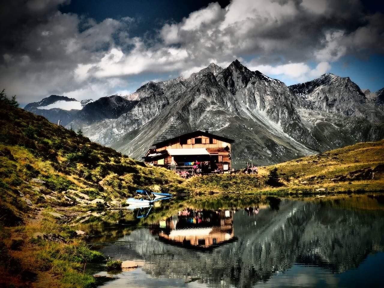
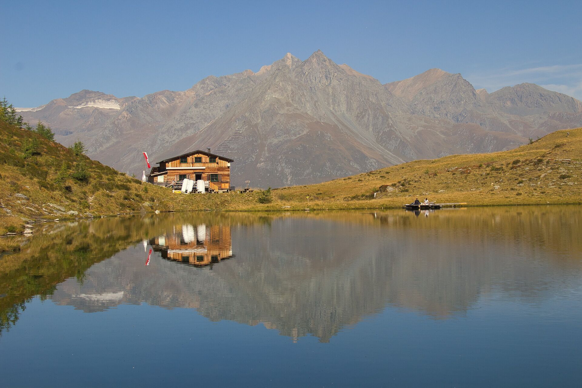
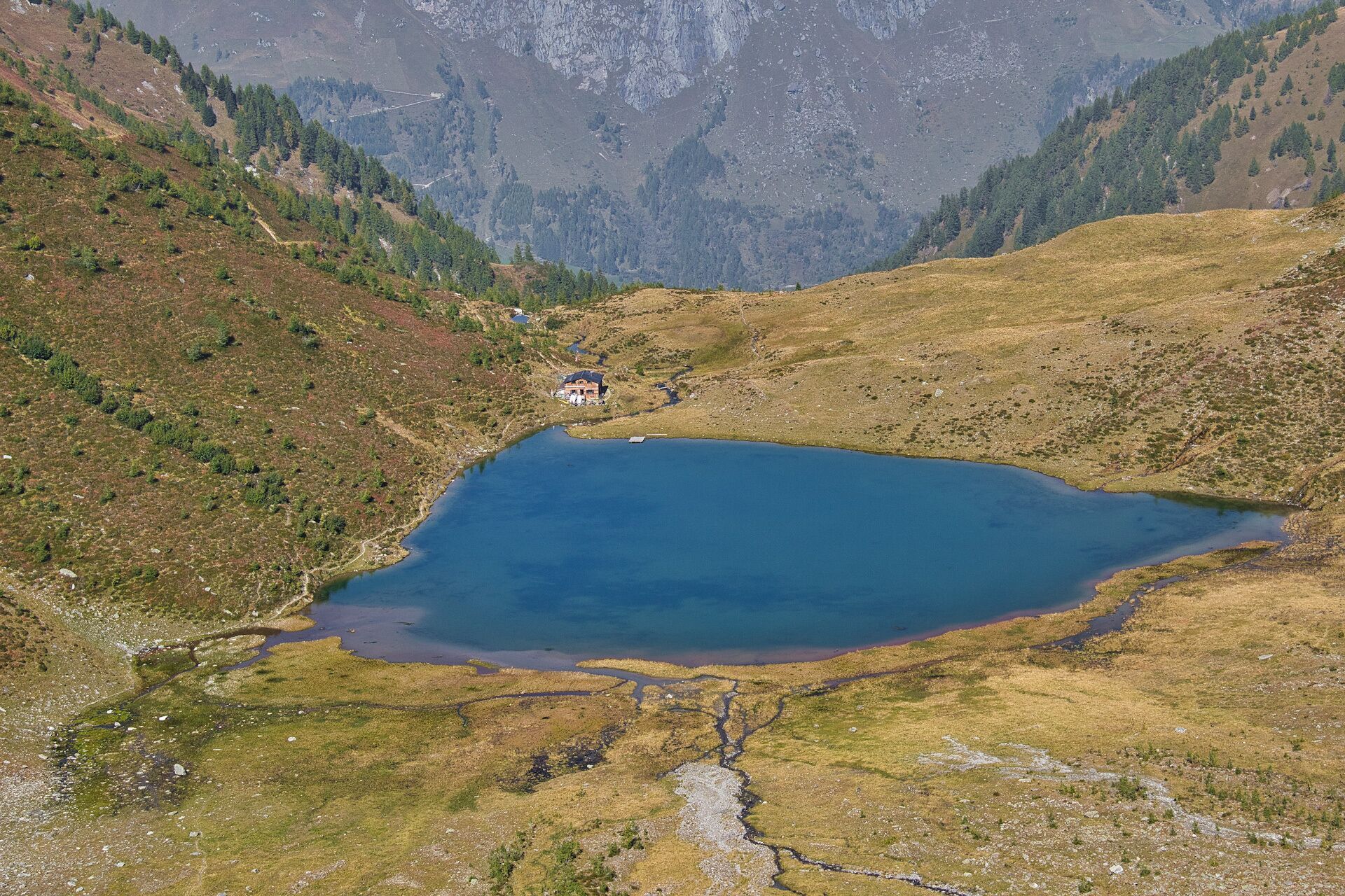
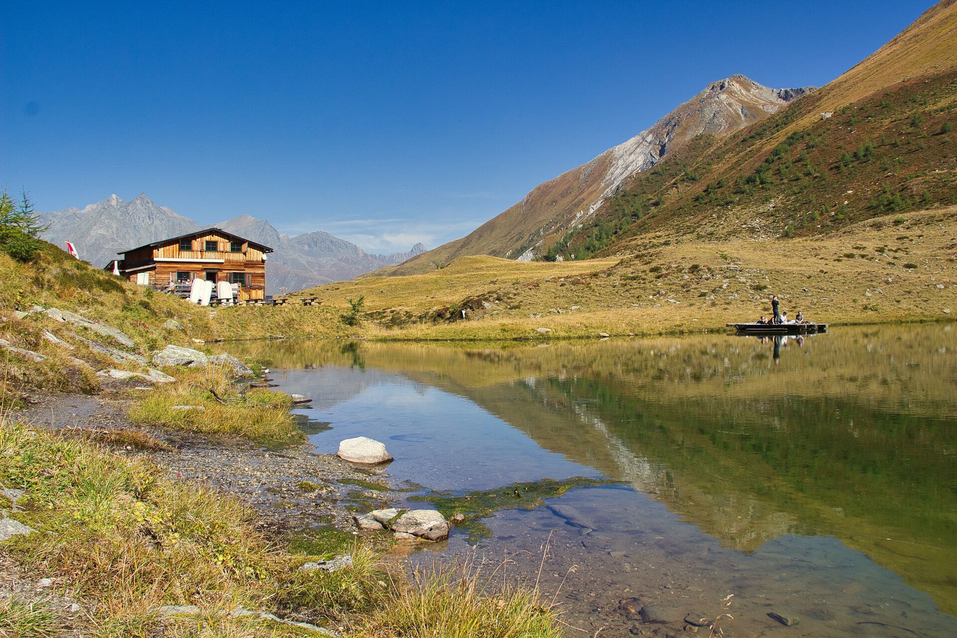
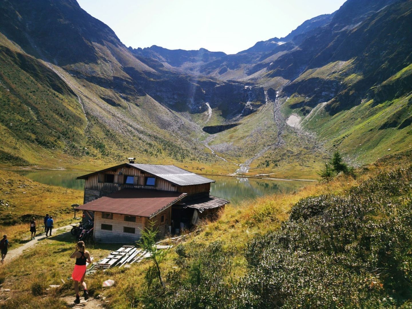
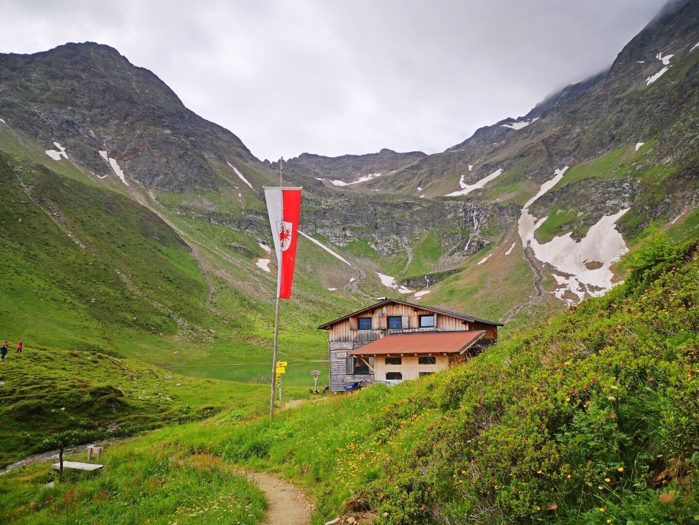
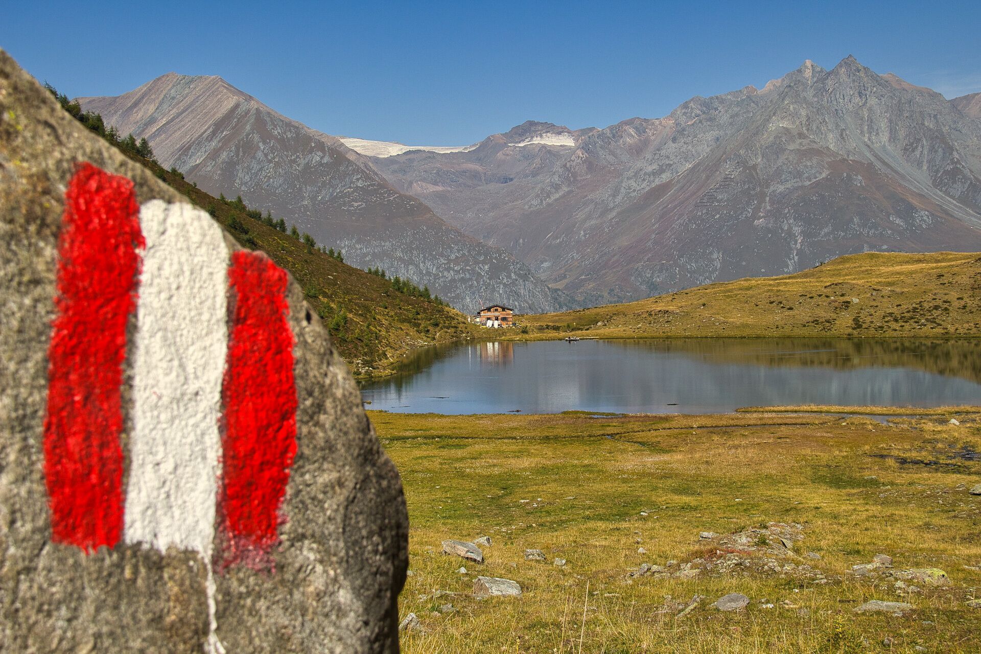
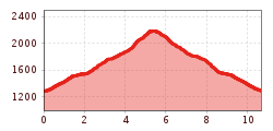
The ascent is from the parking place "Freizeitzentrum Gries" through the valley Zopatnitzental and takes about 2.5 hours. The hiking trip first begins on an ashpalt road and continues later on a footpath, which mostly leads through the forest. Above the forest border, you cross a bridge on the left side, hike through a slope in serpentines and cross a bridge again below the waterfall. Then follow the markings up to the hut Bergersee Hütte (2.181) and the idyllic mountain like Berger See.

Nearby huts and mountain restaurants

Getting here

  • Arrival by public transport

    Prägraten a.G. Gemeindeamt

  • Parking

    Parking place Freizeitzentrum Gries

More tours in the surrounding area

  • Lasörling altitude trail

    Difficulty: medium
    Length: 57.0 km Duration: 25:00 h Elevation uphill: 3,740 m
  • Venediger altitude trail

    Difficulty: difficult
    Length: 55.5 km Duration: 27:00 h Elevation uphill: 3,915 m
  • Figerhorn

    Difficulty: difficult
    Length: 6.5 km Duration: 6:00 h Elevation uphill: 807 m
  • Hike to the Venedigerhaus Innergschlöß

    Difficulty: easy
    Length: 8.5 km Duration: 2:30 h Elevation uphill: 180 m
  • Rotenkogel

    Difficulty: difficult
    Length: 3.9 km Duration: 3:00 h Elevation uphill: 383 m
  • Lasörling 3.098m

    Difficulty: difficult
    Length: 21.9 km Duration: 12:00 h Elevation uphill: 1,940 m
  • Umbal waterfalls nature force trail

    Difficulty: easy
    Length: 5.8 km Duration: 2:30 h Elevation uphill: 250 m
  • Muhs panorama trail

    Difficulty: medium
    Length: 15.2 km Duration: 6:00 h Elevation uphill: 1,090 m
  • Hike to Neuen Reichenberger Hütte

    Difficulty: medium
    Length: 9.1 km Duration: 9:00 h Elevation uphill: 1,210 m
  • Hiking tour to Lasörlinghütte 2.350m

    Difficulty: medium
    Length: 14.6 km Duration: 7:10 h Elevation uphill: 1,080 m
  • Badener Hütte

    Difficulty: difficult
    Length: 23.2 km Duration: 11:30 h Elevation uphill: 1,750 m
  • Lucknerhaus - Stüdlhütte

    Difficulty: medium
    Length: 9.3 km Duration: 5:30 h Elevation uphill: 862 m
  • Hike to Kalser Tauernhaus

    Difficulty: medium
    Length: 12.2 km Duration: 4:00 h Elevation uphill: 244 m
  • Hiking tour to Neue Sajathütte 2.600m

    Difficulty: medium
    Length: 10.3 km Duration: 6:50 h Elevation uphill: 1,080 m
  • Böses Weibl

    Difficulty: difficult
    Length: 14.1 km Duration: 8:00 h Elevation uphill: 1,193 m
  • Eagle Walk Stage O1: Ströden - Johannis Hütte

    Difficulty: medium
    Length: 13.0 km Duration: 6:30 h Elevation uphill: 1,430 m
Newsletter

The mountain is calling? So does our newsletter!

In our monthly newsletter we reveal the best holiday tips for Tyrol.