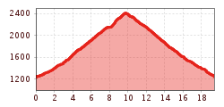
Mountain hikes Reiterkarspitz

Untertilliach / Karnischer Hauptkamm
Difficulty ratings: medium
Route length: 19.4 km
Duration: 7:00 h

Reiterkarspitz

Tour information

  • Requirement: medium
  • Length: 19.4 km
  • Duration: 7:00 h
  • Elevation uphill:1,200 hm
  • Elevation downhill:1,200 hm
Highest point2,422 m

Starting point

Soldhäuser Untertilliacher

Finishing point

Reiterkarspitz
  • Fitness level 4 / 6
  • Technique 4 / 6

Best time of year

  • January
  • February
  • March
  • April
  • May
  • June
  • July
  • August
  • September
  • October
  • November
  • December
Source: TVB Osttirol

Description

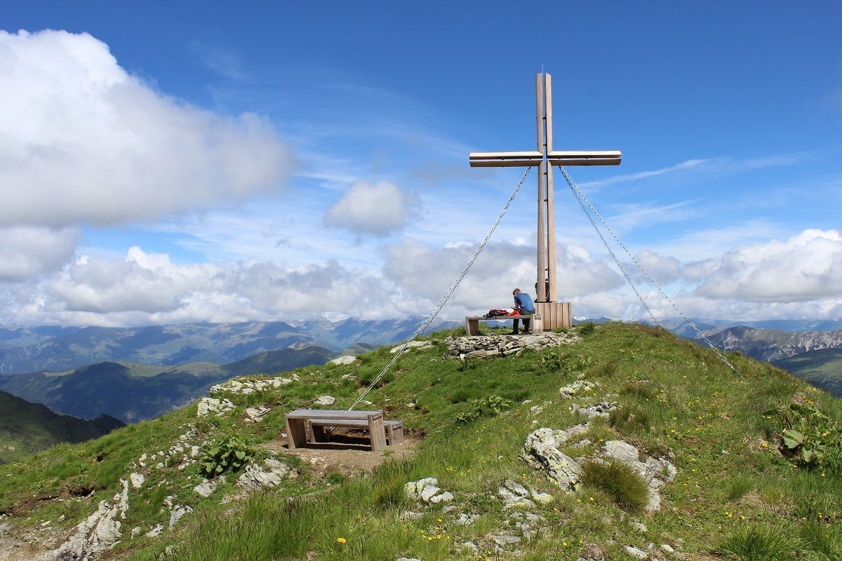
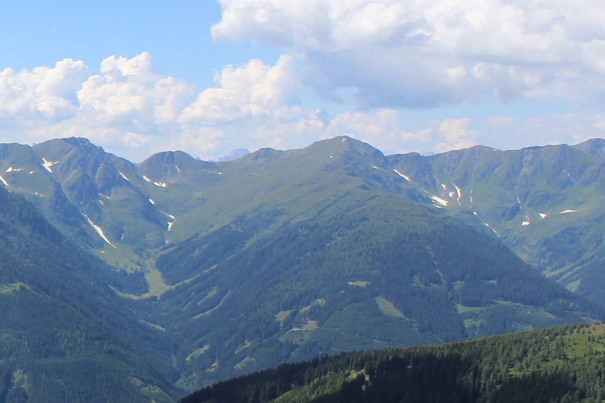
From the head of the valley in Winklertal, a cart track proceeds in serpentines up to the Oberalm, an Alpine lodge made out of stone. From here the trail continues to the Winklerjoch and via the Carnic altitude trail to the Reiterkarspitz.

Getting here

  • Arrival by public transport

    Mit dem Bus bis zur Haltestelle "Untertilliach Winkl"

  • Parking

    Parkplatz Winkl "Soldhäuser"

More tours in the surrounding area

  • Herz-Ass Villgratental

    Difficulty: medium
    Length: 76.0 km Duration: 34:00 h Elevation uphill: 5,750 m
  • Lasörling altitude trail

    Difficulty: medium
    Length: 57.0 km Duration: 25:00 h Elevation uphill: 3,740 m
  • Venediger altitude trail

    Difficulty: difficult
    Length: 55.5 km Duration: 27:00 h Elevation uphill: 3,915 m
  • Figerhorn

    Difficulty: difficult
    Length: 6.5 km Duration: 6:00 h Elevation uphill: 807 m
  • Hike to the Venedigerhaus Innergschlöß

    Difficulty: easy
    Length: 8.5 km Duration: 2:30 h Elevation uphill: 180 m
  • Rotenkogel

    Difficulty: difficult
    Length: 3.9 km Duration: 3:00 h Elevation uphill: 383 m
  • Lasörling 3.098m

    Difficulty: difficult
    Length: 21.9 km Duration: 12:00 h Elevation uphill: 1,940 m
  • Toblacher Pfannhorn

    Difficulty: medium
    Length: 9.8 km Duration: 4:30 h Elevation uphill: 1,020 m
  • Schober trek

    Difficulty: medium
    Length: 33.0 km Duration: 30:00 h Elevation uphill: 3,200 m
  • Golzentipp 2.317 m

    Difficulty: easy
    Length: 5.6 km Duration: 2:00 h Elevation uphill: 267 m
  • Hike to Jagdhausalm 2.009m

    Difficulty: easy
    Length: 16.6 km Duration: 5:00 h Elevation uphill: 400 m
  • Große Kinigat

    Difficulty: difficult
    Length: 8.5 km Elevation uphill: 1,250 m
  • Oberseitsee - Seespitze 3.021 m

    Difficulty: difficult
    Length: 14.4 km Duration: 8:30 h Elevation uphill: 1,310 m
  • Umbal waterfalls nature force trail

    Difficulty: easy
    Length: 5.8 km Duration: 2:30 h Elevation uphill: 250 m
  • Lake Schwarzsee

    Difficulty: medium
    Length: 7.8 km Duration: 3:30 h Elevation uphill: 790 m
  • Rote Spitze 2,956 m

    Difficulty: medium
    Length: 10.2 km Duration: 5:30 h Elevation uphill: 1,260 m
  • Muhs panorama trail

    Difficulty: medium
    Length: 15.2 km Duration: 6:00 h Elevation uphill: 1,090 m
Newsletter

The mountain is calling? So does our newsletter!

In our monthly newsletter we reveal the best holiday tips for Tyrol.