Mountain hikes Wiesbauerspitze 2.767 m

Prägraten am Großvenediger / Venedigergruppe
Difficulty ratings: medium
Route length: 17.9 km
Duration: 8:00 h

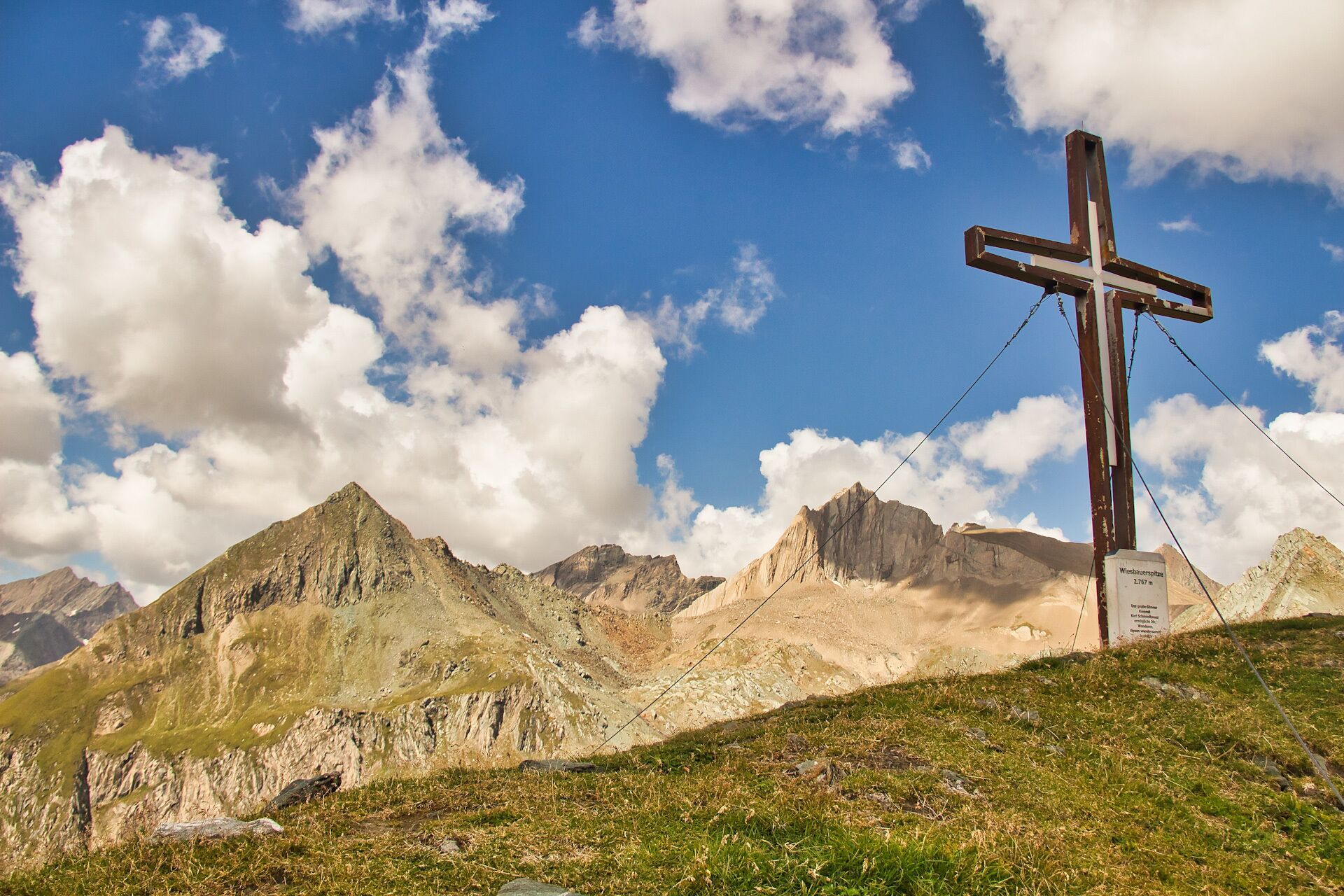
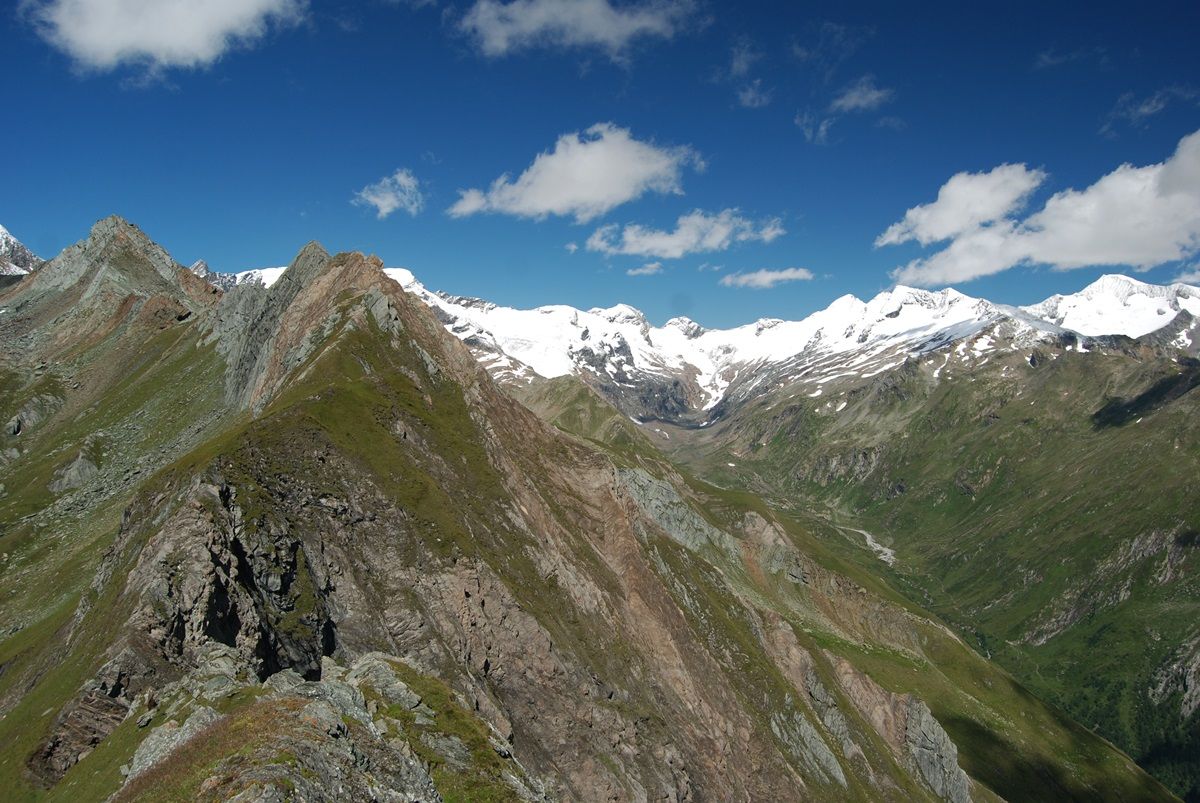
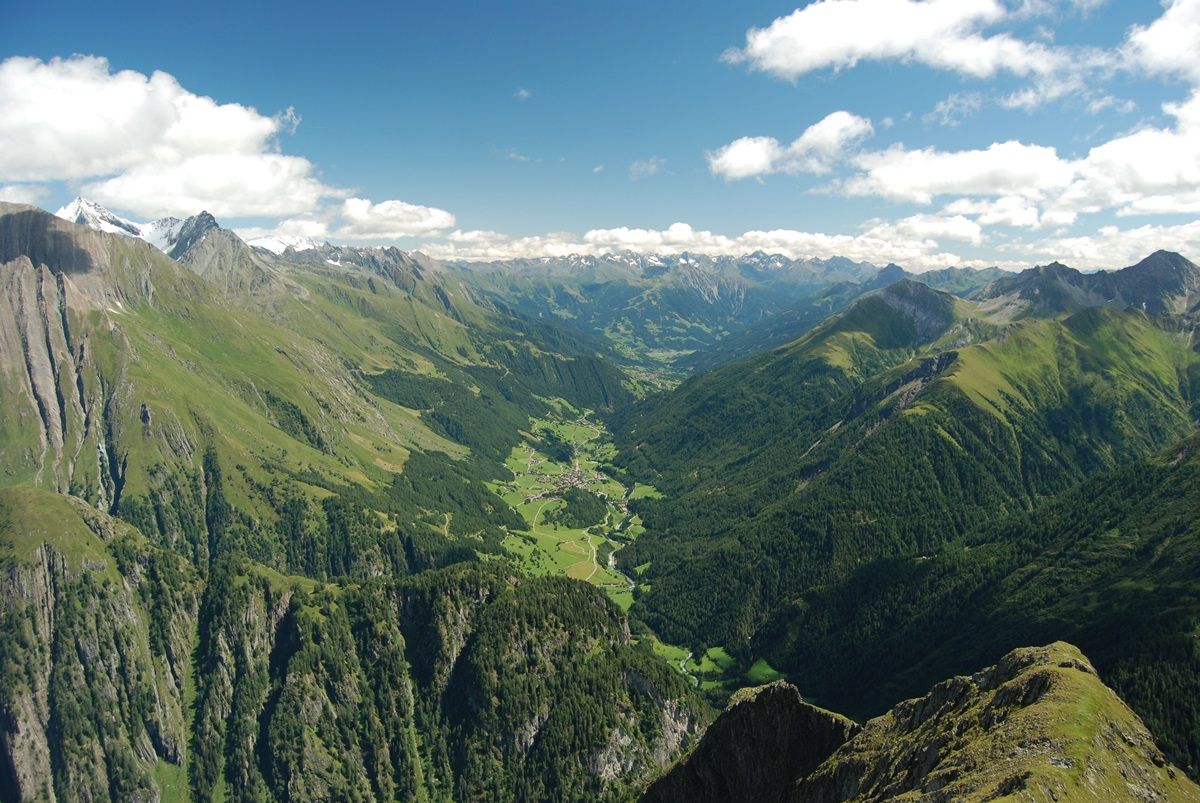
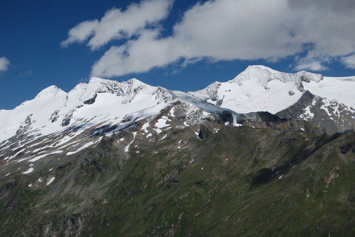
Unrivalled panoramic view of the ice giants of the Venediger group

Tour information

  • Requirement: medium
  • Length: 17.9 km
  • Duration: 8:00 h
  • Elevation uphill:1,375 hm
  • Elevation downhill:1,363 hm
Highest point2,768 m

Best time of year

  • January
  • February
  • March
  • April
  • May
  • June
  • July
  • August
  • September
  • October
  • November
  • December

Trail condition

Roter Bergweg - Schwierigkeit mittel gute Kondition, Trittsicher- und Schwindelfreiheit, genug zum Trinken!

Equipment

feste Bergschuhe, genug zum Triniken!
Source: TVB Osttirol

Description

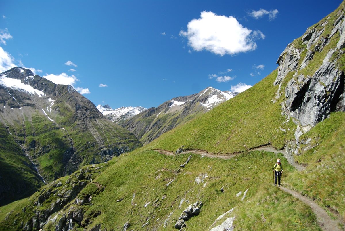
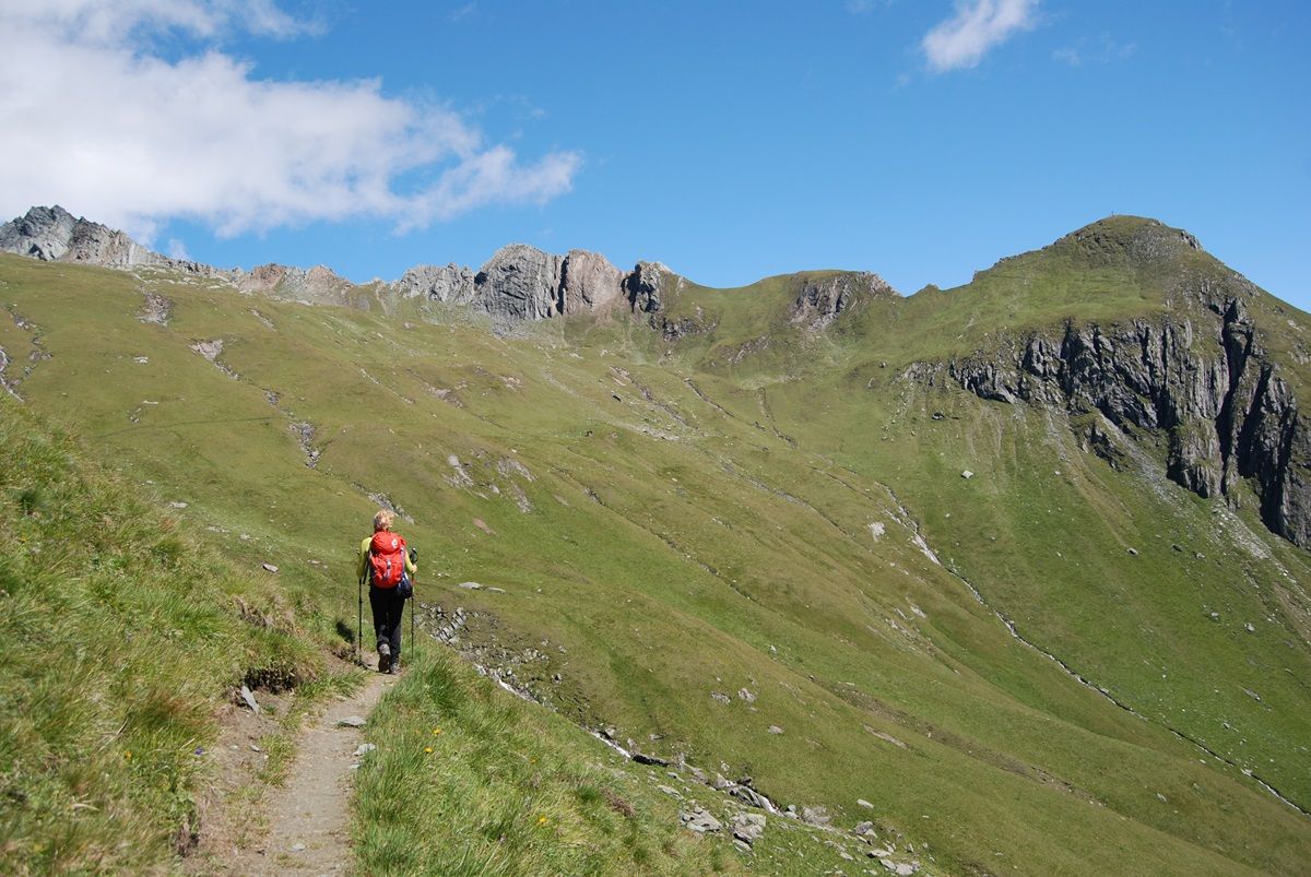
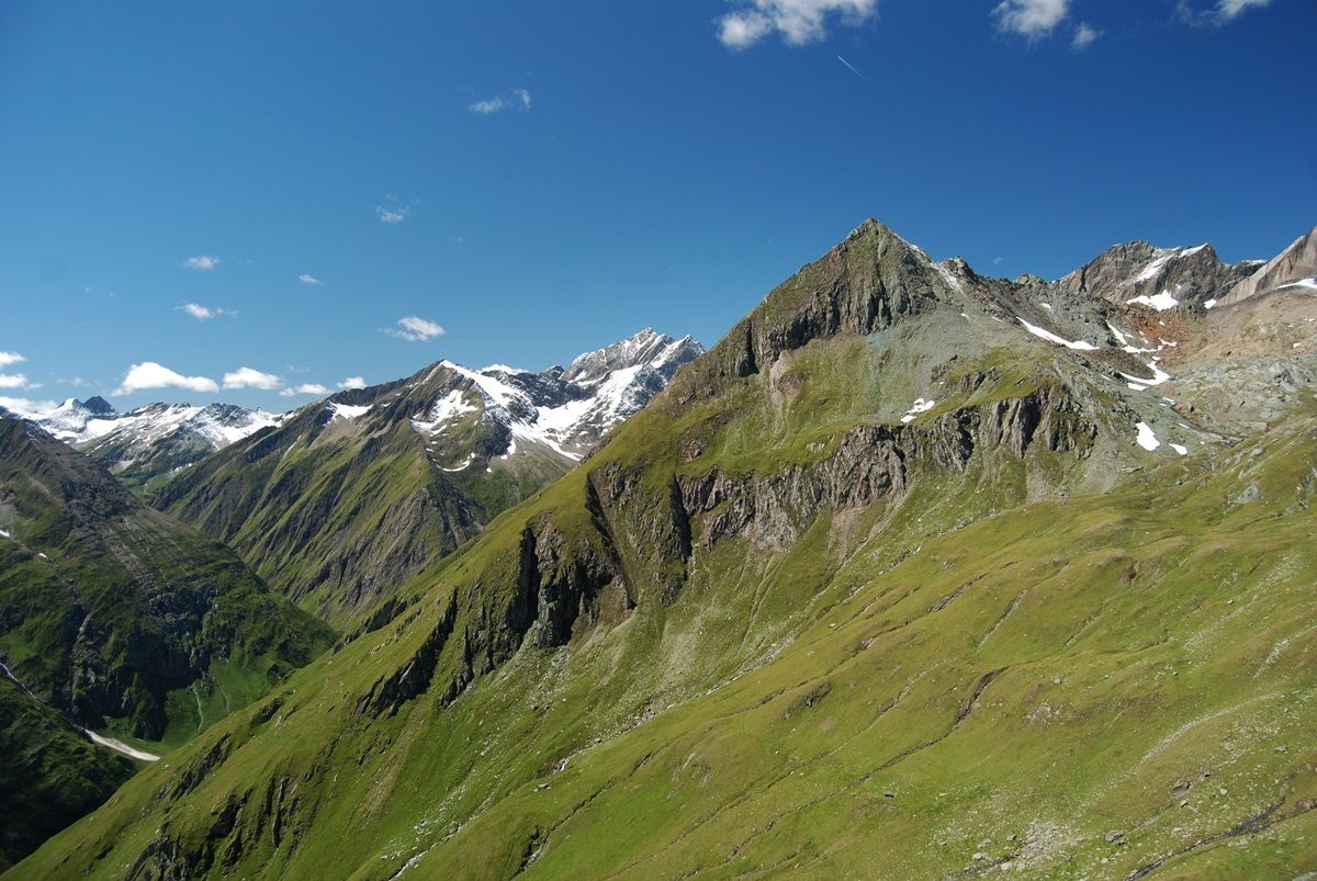
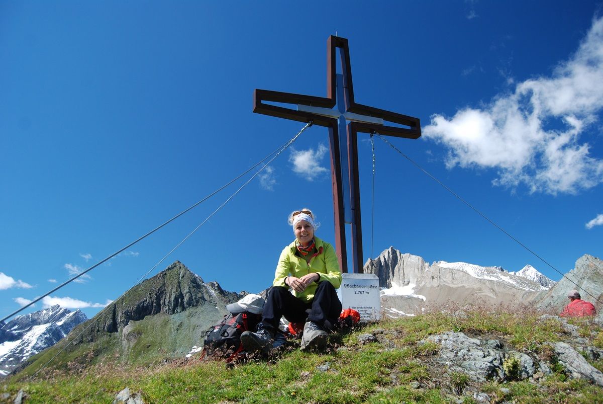
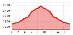
The trail leads from Ströden to the Pebell or Islitzeralm, and from there along the Umbalfälle waterfall path towards the Clarahütte. Leave the hiking trail 100 metres before the Reggenbach stream on a small hill (signpost!) and climb in a northerly direction, initially fairly steeply (rope insurance), then keep your eyes fixed on the southern flank of the Ogasil until you reach the junction that leads eastwards into the "Zopat". From here, the summit of the Wiesbauerspitze is already clearly visible and serves as a further orientation aid.
After a short ascent you reach the "Zopatbach" and after about 15 minutes the small Zopathütte at 2,581 metres. (Jägerhütte not serviced). Here you can enjoy a little refreshment before tackling the last section of the marvellous trail. The last few metres to the summit cross require some more strength until the window finally opens up in all directions.

Nearby huts and mountain restaurants

More tours in the surrounding area

  • Lasörling altitude trail

    Difficulty: medium
    Length: 57.0 km Duration: 25:00 h Elevation uphill: 3,740 m
  • Venediger altitude trail

    Difficulty: difficult
    Length: 55.5 km Duration: 27:00 h Elevation uphill: 3,915 m
  • Figerhorn

    Difficulty: difficult
    Length: 6.5 km Duration: 6:00 h Elevation uphill: 807 m
  • Hike to the Venedigerhaus Innergschlöß

    Difficulty: easy
    Length: 8.5 km Duration: 2:30 h Elevation uphill: 180 m
  • Rotenkogel

    Difficulty: difficult
    Length: 3.9 km Duration: 3:00 h Elevation uphill: 383 m
  • Lasörling 3.098m

    Difficulty: difficult
    Length: 21.9 km Duration: 12:00 h Elevation uphill: 1,940 m
  • Umbal waterfalls nature force trail

    Difficulty: easy
    Length: 5.8 km Duration: 2:30 h Elevation uphill: 250 m
  • Muhs panorama trail

    Difficulty: medium
    Length: 15.2 km Duration: 6:00 h Elevation uphill: 1,090 m
  • Hike to Neuen Reichenberger Hütte

    Difficulty: medium
    Length: 9.1 km Duration: 9:00 h Elevation uphill: 1,210 m
  • Hiking tour to Lasörlinghütte 2.350m

    Difficulty: medium
    Length: 14.6 km Duration: 7:10 h Elevation uphill: 1,080 m
  • Badener Hütte

    Difficulty: difficult
    Length: 23.2 km Duration: 11:30 h Elevation uphill: 1,750 m
  • Lucknerhaus - Stüdlhütte

    Difficulty: medium
    Length: 9.3 km Duration: 5:30 h Elevation uphill: 862 m
  • Hike to Kalser Tauernhaus

    Difficulty: medium
    Length: 12.2 km Duration: 4:00 h Elevation uphill: 244 m
  • Hiking tour to Neue Sajathütte 2.600m

    Difficulty: medium
    Length: 10.3 km Duration: 6:50 h Elevation uphill: 1,080 m
  • Böses Weibl

    Difficulty: difficult
    Length: 14.1 km Duration: 8:00 h Elevation uphill: 1,193 m
  • Eagle Walk Stage O1: Ströden - Johannis Hütte

    Difficulty: medium
    Length: 13.0 km Duration: 6:30 h Elevation uphill: 1,430 m
Newsletter

The mountain is calling? So does our newsletter!

In our monthly newsletter we reveal the best holiday tips for Tyrol.