Winter hike Winter hiking trail Berger Eck

closed
Prägraten am Großvenediger / Venedigergruppe
Difficulty ratings: easy
Route length: 9.7 km
Duration: 4:00 h

Superb views to the mountain village of Prägraten a. G.

Tour information

  • Requirement: easy
  • Length: 9.7 km
  • Duration: 4:00 h
  • Elevation uphill:390 hm
  • Elevation downhill:417 hm
Highest point1,610 m

Starting point

Tourist information Prägraten a. G., bus stop Wallhorn or sports ground

Finishing point

Tourist information Prägraten a. G., bus stop Wallhorn or sports ground
  • Fitness level 2 / 6
  • Technique 2 / 6

Features

  • Suitable for families

Best time of year

  • January
  • February
  • March
  • April
  • May
  • June
  • July
  • August
  • September
  • October
  • November
  • December

Trail condition

Asphalt road, forest path, prepared

Equipment

Winter-proof clothing and shoes, possibly gaiters
Source: Nationalparkregion Hohe Tauern Osttirol

Description

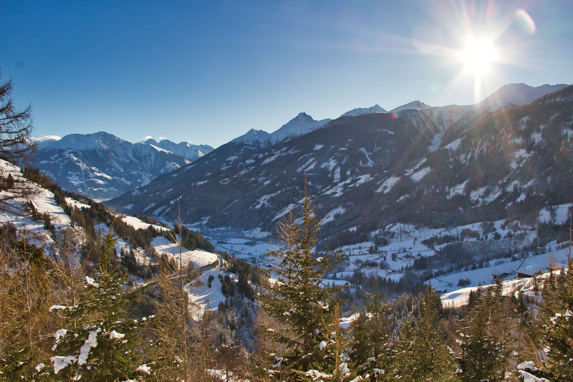
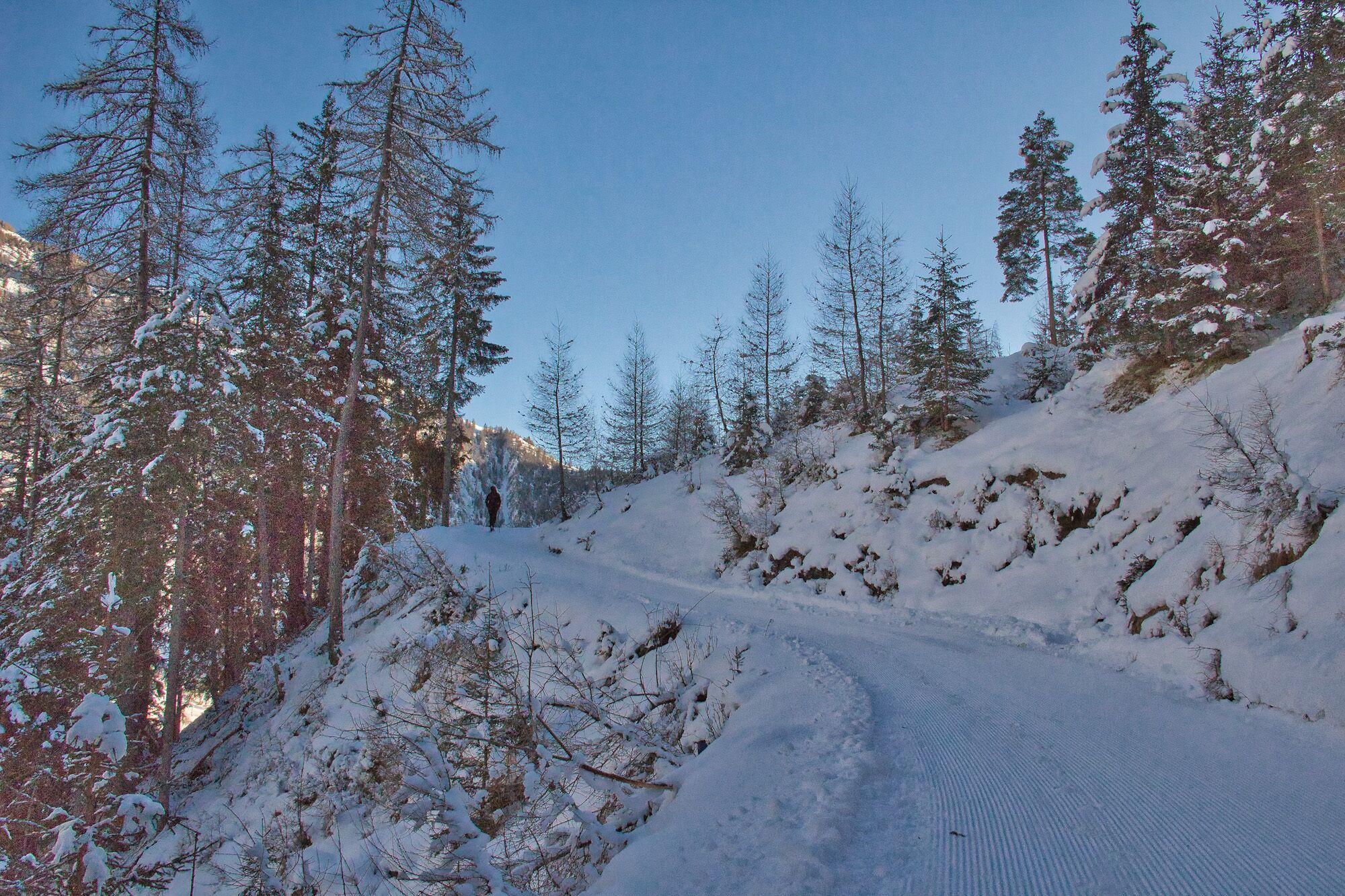
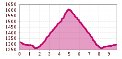
From the centre of the village, the path first leads along the road to the Wallhorn district. At the bus stop, turn right and follow the road to the sports field. From here the prepared winter hiking trail leads steadily uphill along a forest path to the Berger-Eck. Beautiful view of the two villages of Prägraten a. Großvenediger and Virgen.

Getting here

  • Arrival by public transport

    Prägraten a. G. Gemeindeamt (municipal office)
    Alternativ: Prägraten a. G. Wallhorn

  • Parking

    Prägraten a. G. Gemeindeamt (municipal office)
    Alternativ: Prägraten a. G. Wallhorn

More tours in the surrounding area

  • Hike to the Venedigerhaus Innergschlöß

    Difficulty: easy
    Length: 8.5 km Duration: 2:30 h Elevation uphill: 180 m
  • Muhs panorama trail

    Difficulty: medium
    Length: 15.2 km Duration: 6:00 h Elevation uphill: 1,090 m
  • Hike to Kalser Tauernhaus

    Difficulty: medium
    Length: 12.2 km Duration: 4:00 h Elevation uphill: 244 m
  • Hiking tour to Neue Sajathütte 2.600m

    Difficulty: medium
    Length: 10.3 km Duration: 6:50 h Elevation uphill: 1,080 m
  • Lucknerhaus - Stüdlhütte

    Difficulty: medium
    Length: 9.3 km Duration: 5:30 h Elevation uphill: 862 m
  • Hike to Neuen Reichenberger Hütte

    Difficulty: medium
    Length: 9.1 km Duration: 9:00 h Elevation uphill: 1,210 m
  • Hiking tour to Lasörlinghütte 2.350m

    Difficulty: medium
    Length: 14.6 km Duration: 7:10 h Elevation uphill: 1,080 m
  • Badener Hütte

    Difficulty: difficult
    Length: 23.2 km Duration: 11:30 h Elevation uphill: 1,750 m
  • Venediger altitude trail

    Difficulty: difficult
    Length: 55.5 km Duration: 27:00 h Elevation uphill: 3,915 m
  • Figerhorn

    Difficulty: difficult
    Length: 6.5 km Duration: 6:00 h Elevation uphill: 807 m
  • Lasörling altitude trail

    Difficulty: medium
    Length: 57.0 km Duration: 25:00 h Elevation uphill: 3,740 m
  • Lasörling 3.098m

    Difficulty: difficult
    Length: 21.9 km Duration: 12:00 h Elevation uphill: 1,940 m
  • Rotenkogel

    Difficulty: difficult
    Length: 3.9 km Duration: 3:00 h Elevation uphill: 383 m
  • Umbal waterfalls nature force trail

    Difficulty: easy
    Length: 5.8 km Duration: 2:30 h Elevation uphill: 250 m
  • Böses Weibl

    Difficulty: difficult
    Length: 14.1 km Duration: 8:00 h Elevation uphill: 1,193 m
Newsletter

The mountain is calling? So does our newsletter!

In our monthly newsletter we reveal the best holiday tips for Tyrol.