Winter hike Winter hiking trail Bodenalm 1.945m

open
Prägraten am Großvenediger / Venedigergruppe
Difficulty ratings: medium
Route length: 11.8 km
Duration: 4:20 h

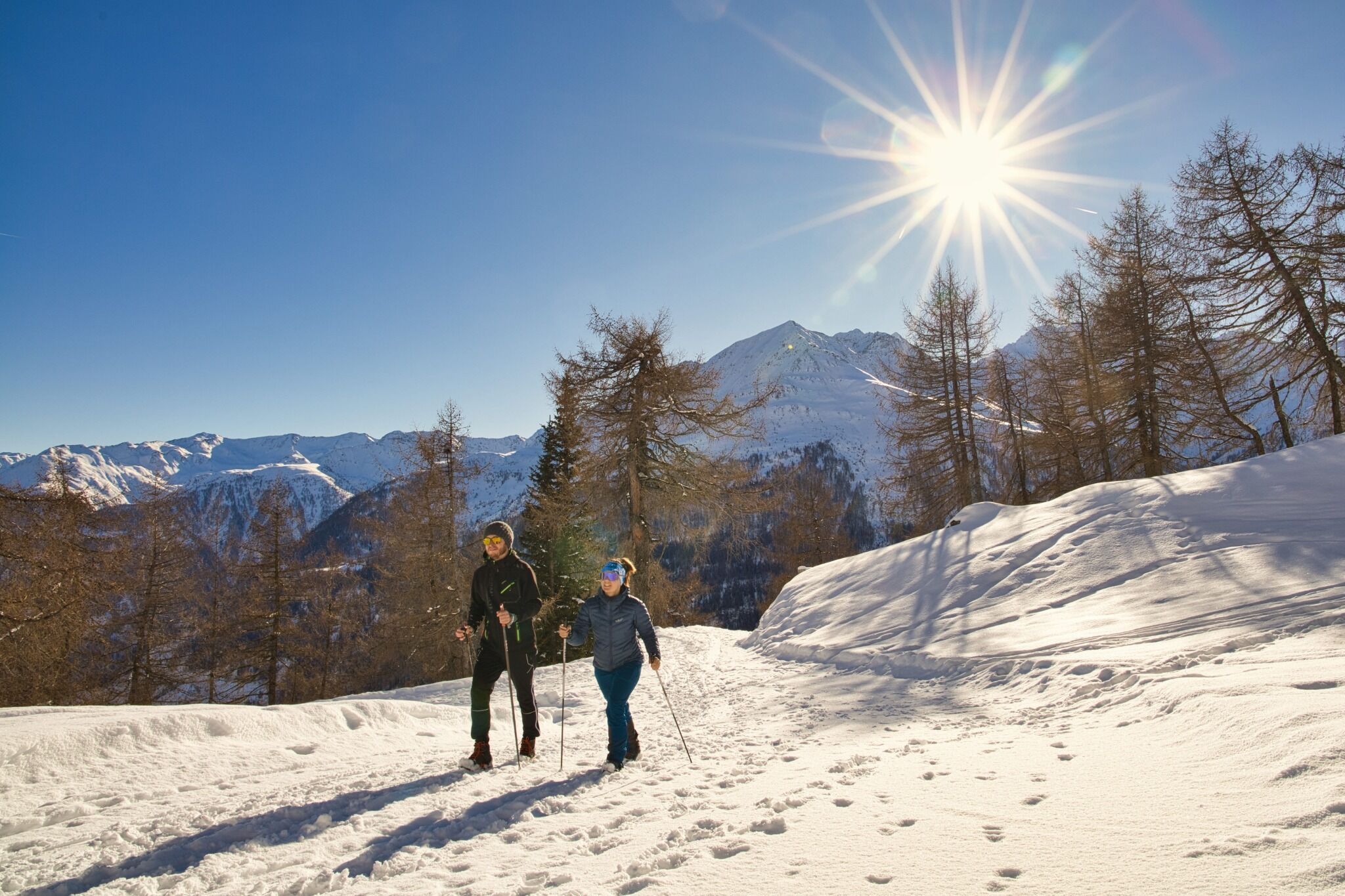
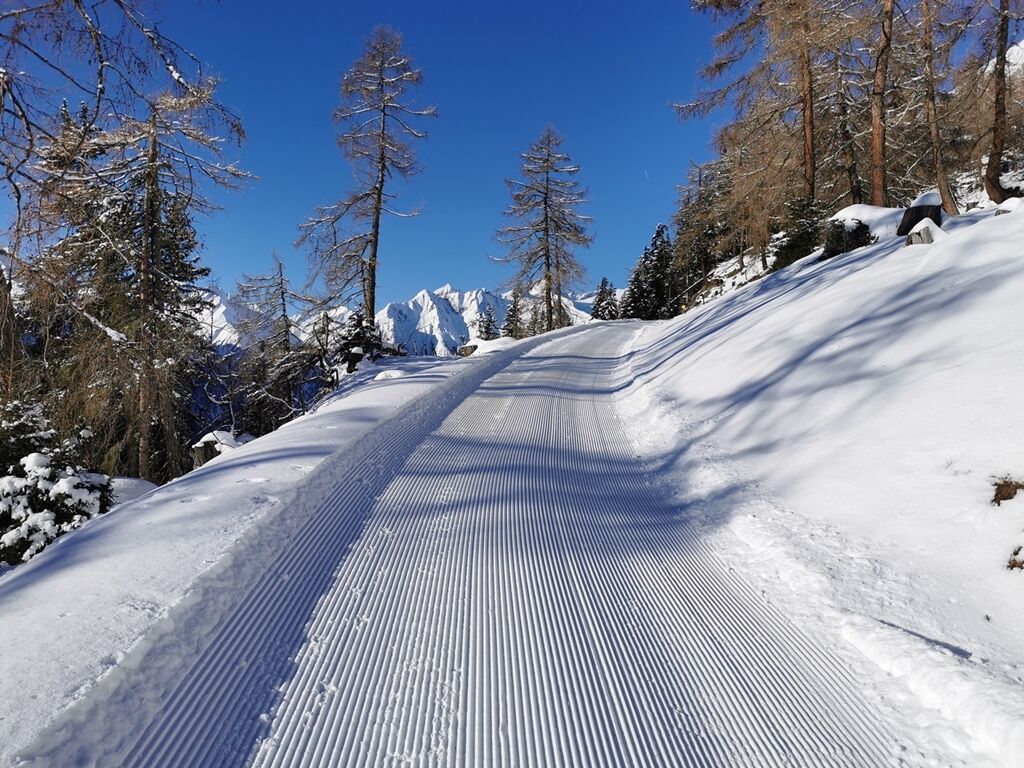
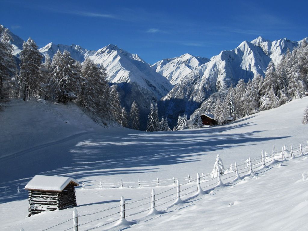
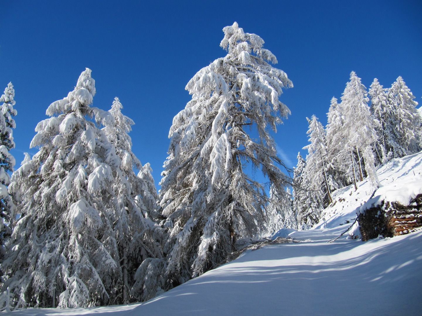
Superb winter hiking trail through snow-covered woodlands.

Tour information

  • Requirement: medium
  • Length: 11.8 km
  • Duration: 4:20 h
  • Elevation uphill:611 hm
  • Elevation downhill:611 hm
Highest point1,945 m

Starting point

Tourist information Prägraten a. G

Finishing point

Bodenalm (1.945m)
  • Fitness level 3 / 6
  • Technique 2 / 6

Features

  • Suitable for families

Best time of year

  • January
  • February
  • March
  • April
  • May
  • June
  • July
  • August
  • September
  • October
  • November
  • December

Trail condition

Asphalt road, forest path, prepared

Equipment

Winter-proof shoes, warm clothing, possibly gaiters; please note: Bodenalm is not open, bring your own food and warm drinks!
Source: Nationalparkregion Hohe Tauern Osttirol

Description

Starting point – tourist office in Prägraten or Wallhorn chapel.
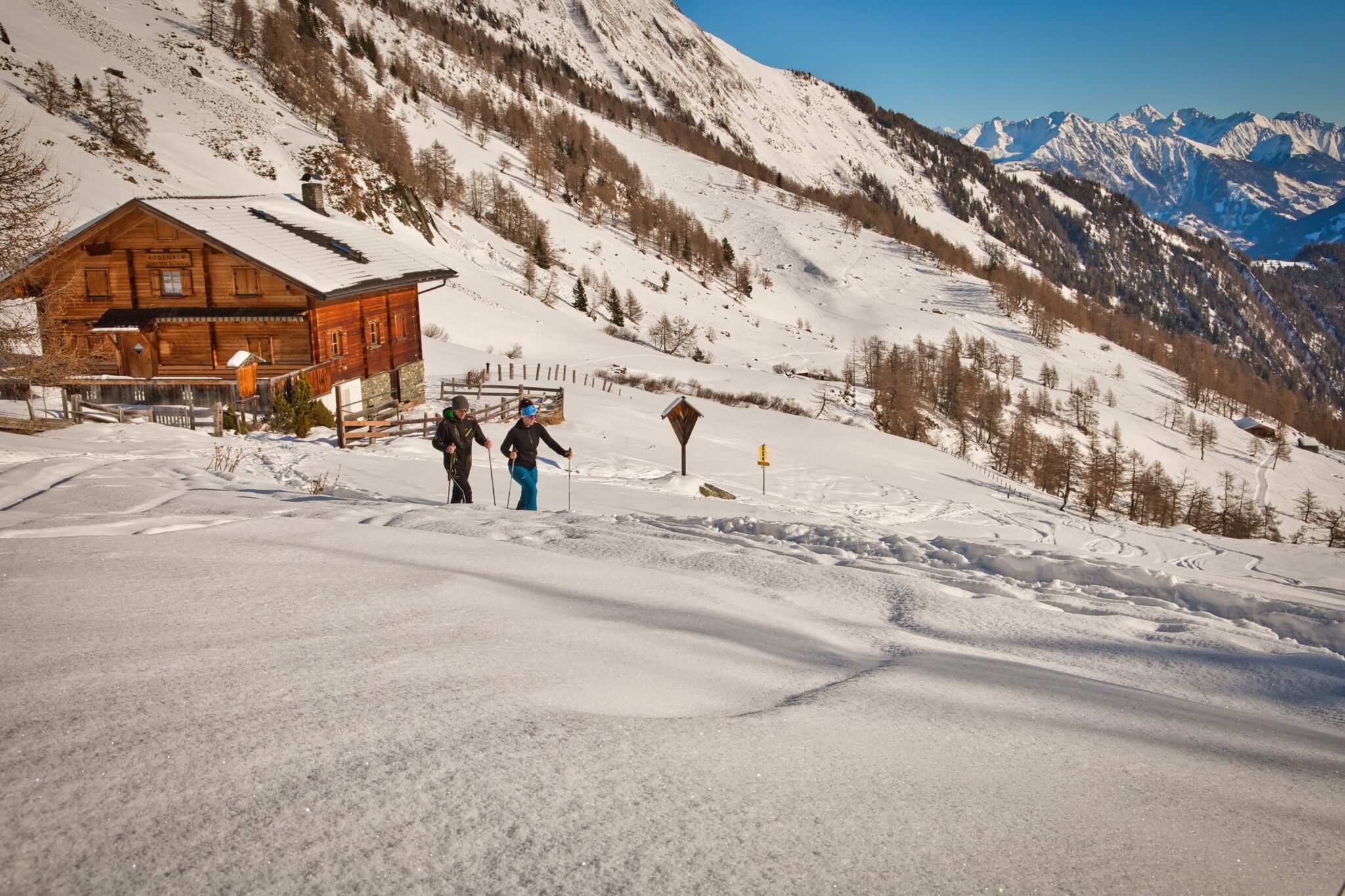
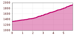
The route proceeds through the village in an easterly direction to the chapel in Wallhorn (car parking available), continuing from there via the road to the final farm, "Osema". The actual winter hiking trail starts there, proceeding in numerous hairpin bends to the "Grießeralm", then continuing to Bodenalm.

Alternative:
You could also park your car at the winter parking area in Wallhorn. From there, follow the signs for the "Wallhornrunde" winter hiking trail. First you walk across open terrain (prepared) in the direction of a detached house. Then head in a north-westerly direction up a moderately steep field path until you reach the municipal road. There you meet the "Bodenalm" winter hiking trail and follow it uphill.

Getting here

  • Arrival by public transport

    Prägraten a. G. Gemeindeamt (municipal office)
    Alternative: Prägraten a. G. Wallhorn

  • Parking

    Prägraten a. G. Gemeindeamt (municipal office)
    Alternative: Winter car parking Wallhorn

More tours in the surrounding area

  • Hike to the Venedigerhaus Innergschlöß

    Difficulty: easy
    Length: 8.5 km Duration: 2:30 h Elevation uphill: 180 m
  • Muhs panorama trail

    Difficulty: medium
    Length: 15.2 km Duration: 6:00 h Elevation uphill: 1,090 m
  • Hike to Kalser Tauernhaus

    Difficulty: medium
    Length: 12.2 km Duration: 4:00 h Elevation uphill: 244 m
  • Hiking tour to Neue Sajathütte 2.600m

    Difficulty: medium
    Length: 10.3 km Duration: 6:50 h Elevation uphill: 1,080 m
  • Lucknerhaus - Stüdlhütte

    Difficulty: medium
    Length: 9.3 km Duration: 5:30 h Elevation uphill: 862 m
  • Hike to Neuen Reichenberger Hütte

    Difficulty: medium
    Length: 9.1 km Duration: 9:00 h Elevation uphill: 1,210 m
  • Hiking tour to Lasörlinghütte 2.350m

    Difficulty: medium
    Length: 14.6 km Duration: 7:10 h Elevation uphill: 1,080 m
  • Badener Hütte

    Difficulty: difficult
    Length: 23.2 km Duration: 11:30 h Elevation uphill: 1,750 m
  • Venediger altitude trail

    Difficulty: difficult
    Length: 55.5 km Duration: 27:00 h Elevation uphill: 3,915 m
  • Figerhorn

    Difficulty: difficult
    Length: 6.5 km Duration: 6:00 h Elevation uphill: 807 m
  • Lasörling altitude trail

    Difficulty: medium
    Length: 57.0 km Duration: 25:00 h Elevation uphill: 3,740 m
  • Lasörling 3.098m

    Difficulty: difficult
    Length: 21.9 km Duration: 12:00 h Elevation uphill: 1,940 m
  • Rotenkogel

    Difficulty: difficult
    Length: 3.9 km Duration: 3:00 h Elevation uphill: 383 m
  • Umbal waterfalls nature force trail

    Difficulty: easy
    Length: 5.8 km Duration: 2:30 h Elevation uphill: 250 m
  • Böses Weibl

    Difficulty: difficult
    Length: 14.1 km Duration: 8:00 h Elevation uphill: 1,193 m
Newsletter

The mountain is calling? So does our newsletter!

In our monthly newsletter we reveal the best holiday tips for Tyrol.