Mountain hikes Across the Edelweiß meadows to Steiner Almen

Matrei in Osttirol / Granatspitzgruppe
Difficulty ratings: easy
Route length: 11.9 km
Duration: 5:00 h

High above Matrei i. O.

Tour information

  • Requirement: easy
  • Length: 11.9 km
  • Duration: 5:00 h
  • Elevation uphill:640 hm
  • Elevation downhill:640 hm
Highest point1,950 m

Starting point

Parking place Glanz

Finishing point

Parking place Glanz
  • Fitness level 2 / 6
  • Technique 2 / 6

Features

  • Suitable for families

Best time of year

  • January
  • February
  • March
  • April
  • May
  • June
  • July
  • August
  • September
  • October
  • November
  • December
Source: TVB Osttirol

Description

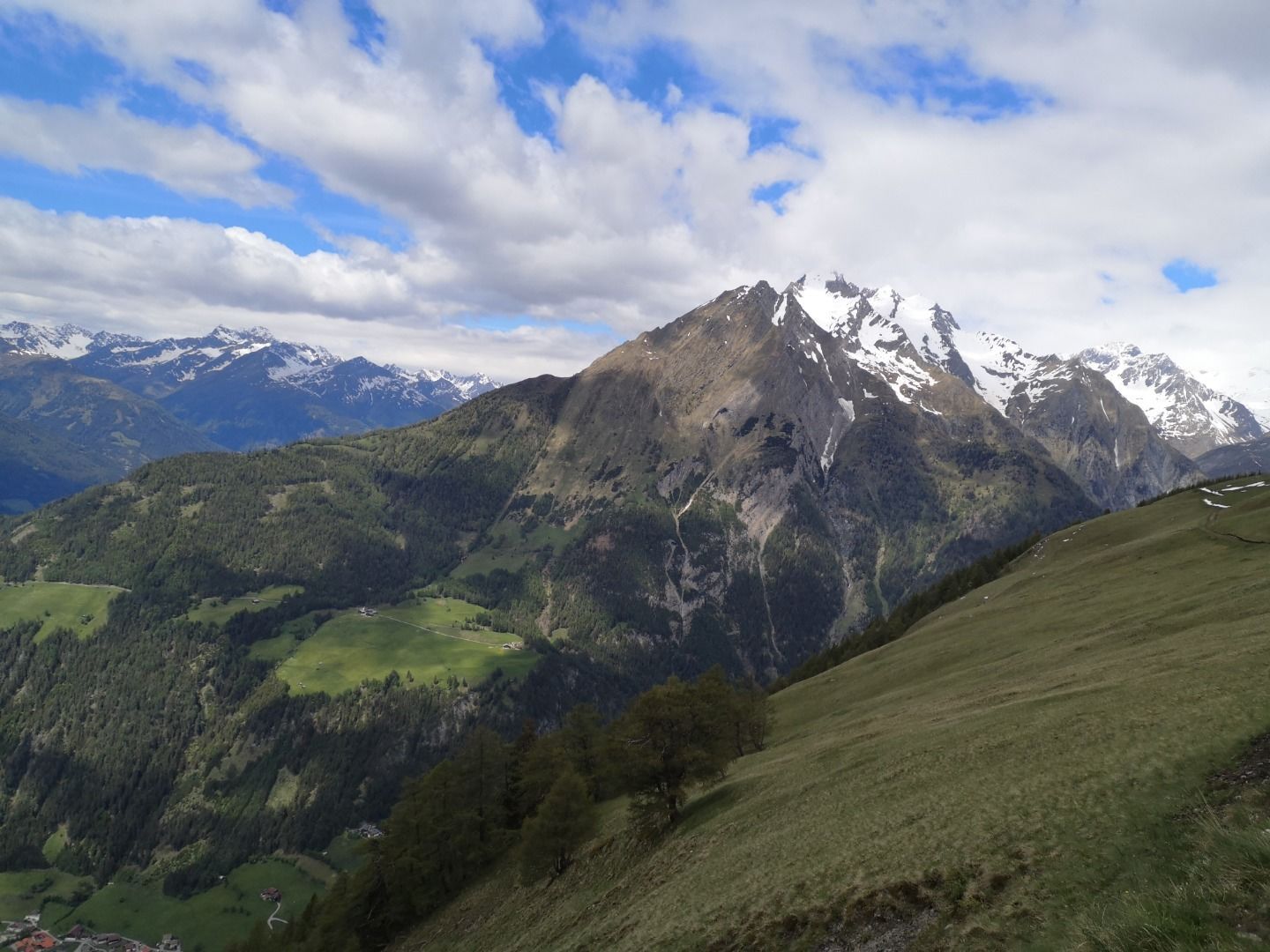
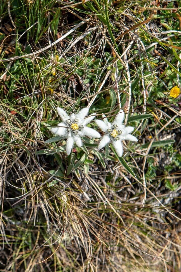
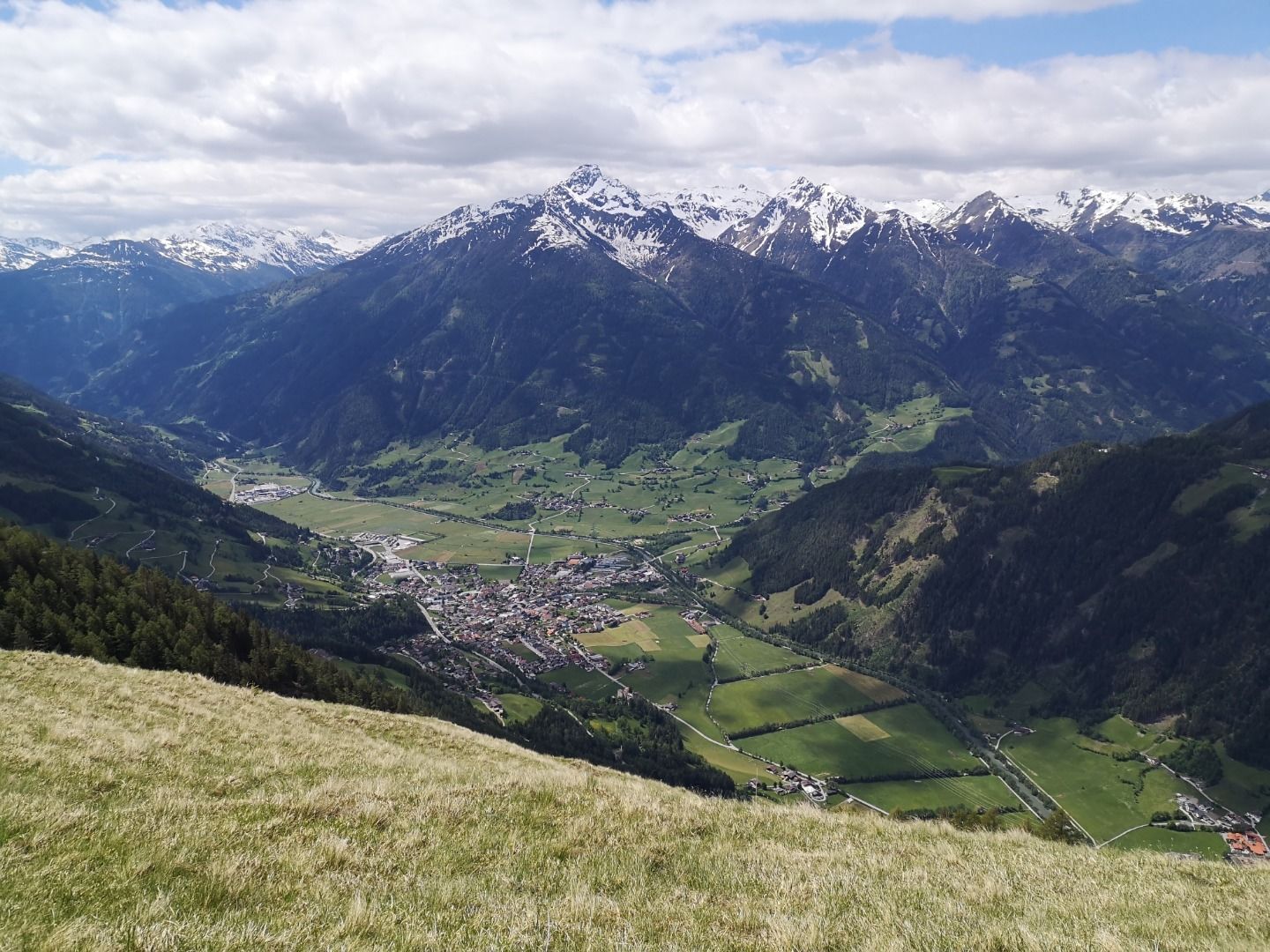
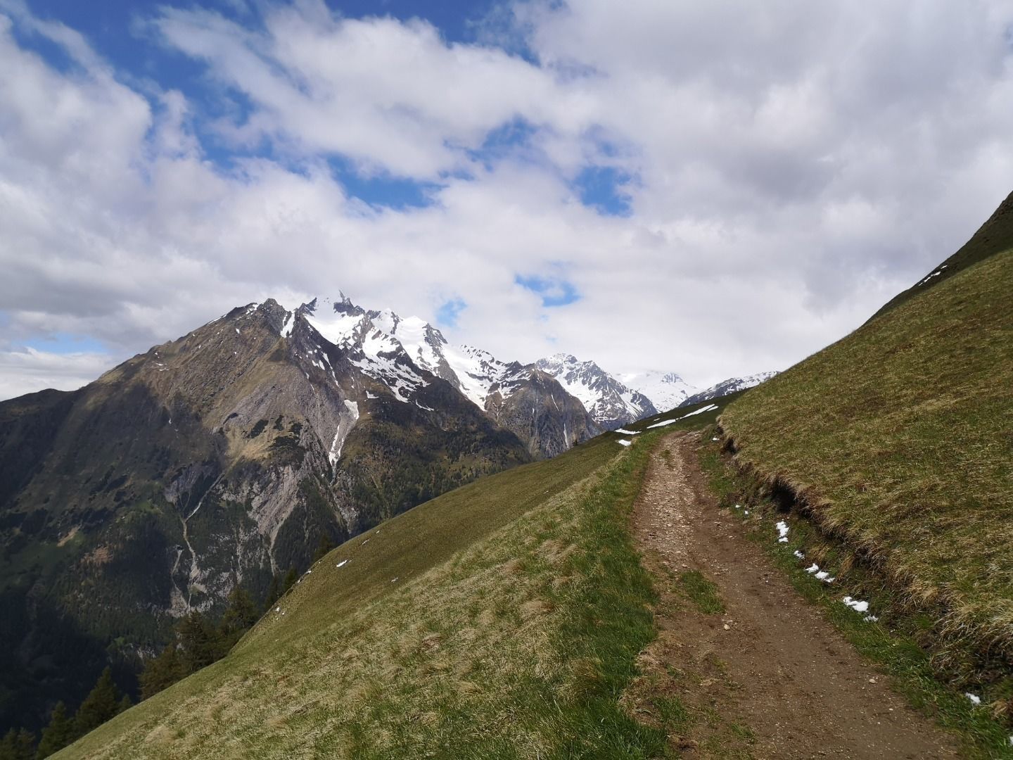
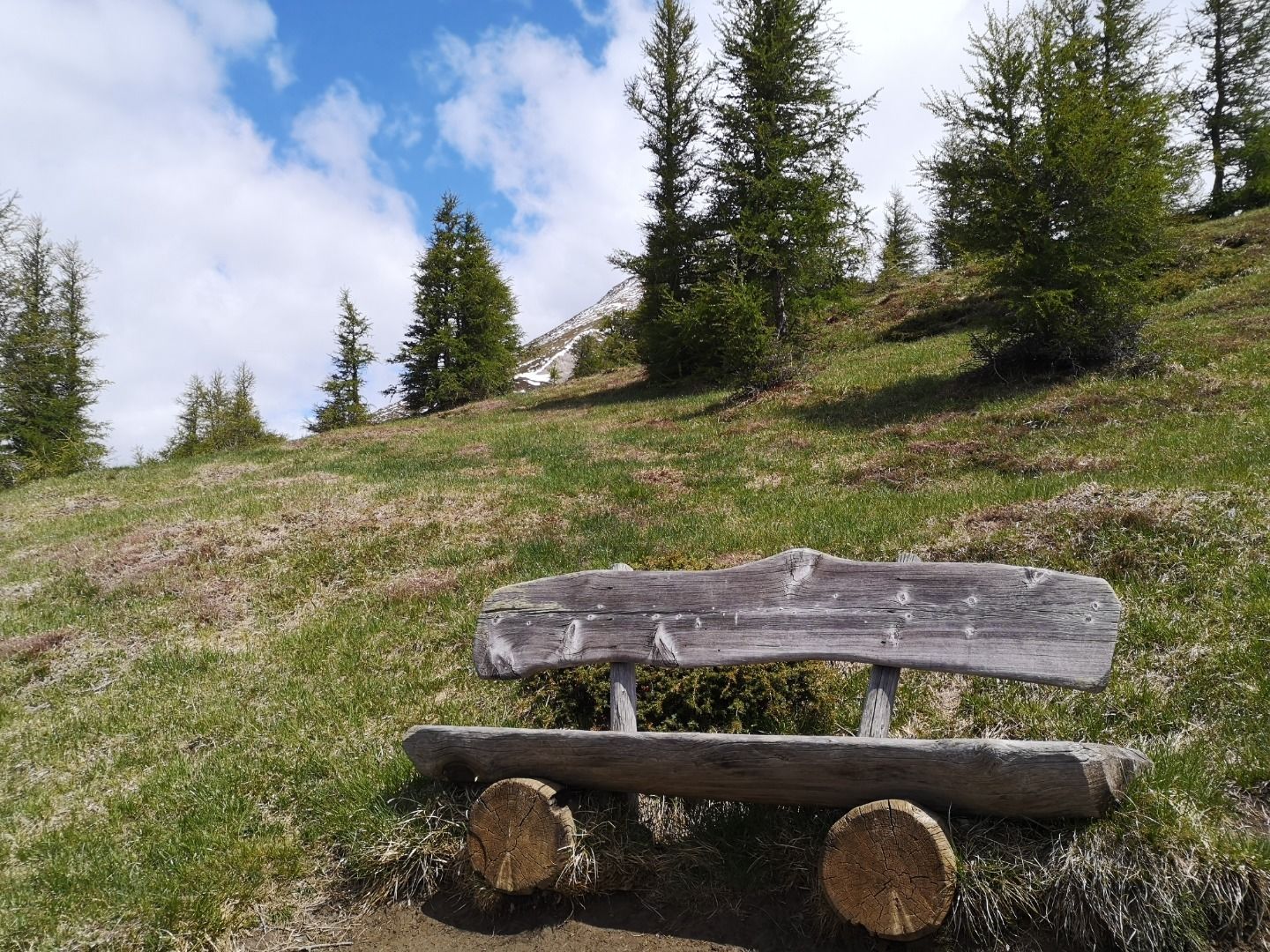
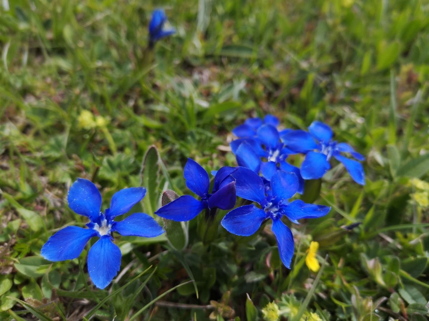
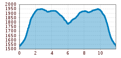
Route (no. 12) begins with a walk on a flat, wide trail crossing biodiverse mountain pastures. As well as the many colourful flowers there are also lots of insects to look at here. You also get to enjoy a wonderful view to Matrei and the Lasörling group here. At the end of this pasture (Begunitzen 1950m) a short trail takes you up to a spur of rock which has lots of Edelweiß and impressive panoramic views. The route then proceeds slightly downhill through a larch forest to Äußere Steineralm (1904m). Those who fancy it can enjoy a refreshment stop here or head directly to Hoanzeralm/Inneren Steineralm. The landscape on this section of the route is characterised with Alpine pastures, peppered with rock boulders, dwarf shrubs and sheep tracks. The route then proceeds down a few metres altitude through larch pastures and larch forests. Some 45 minutes away from Äußere Steineralm is the Hoanzeralm (1770m), built out of slate slabs. Culinary highlights here include the home-made sheep and goats milk products. From here follow route number 13 to Stein/Matrei. This proceeds through the Zlemwald, a shaded spruce forest. The path here is somewhat steeper but there are also downhill sections, making it completely suitable for children. After a further 40 minutes you change to route 514 heading for Stein. At this point as an alternative you can also head back on route 514 back to Äußere Steineralm (some 1 ½ hours), which makes this a circular route. The route to Stein proceeds past the impressive Steiner Waterfall, which thunders down to the depths below.

Nearby huts and mountain restaurants

Getting here

  • Arrival by public transport

    Matrei in Osttirol Korberplatz

  • Parking

    Parking place Glanz

More tours in the surrounding area

  • Hike to the Venedigerhaus Innergschlöß

    Difficulty:easy
    Length:8.6 kmDuration:2:30 hElevation uphill:184 m
  • Lucknerhaus - Stüdlhütte

    Difficulty:medium
    Length:9.3 kmDuration:5:30 hElevation uphill:862 m
  • Badener Hütte

    Difficulty:difficult
    Length:23.2 kmDuration:11:30 hElevation uphill:1,754 m
  • Theme path "Virgen crossroads"

    Difficulty:easy
    Length:3.2 kmDuration:1:00 hElevation uphill:104 m
  • Lasörling altitude trail

    Difficulty:medium
    Length:57.0 kmDuration:25:00 hElevation uphill:3,740 m
  • Venediger altitude trail

    Difficulty:difficult
    Length:55.5 kmDuration:27:00 hElevation uphill:3,915 m
  • Figerhorn

    Difficulty:difficult
    Length:6.5 kmDuration:6:00 hElevation uphill:807 m
  • Muhs panorama trail

    Difficulty:medium
    Length:15.2 kmDuration:6:00 hElevation uphill:1,090 m
  • Hike to Neuen Reichenberger Hütte

    Difficulty:medium
    Length:18.2 kmDuration:9:00 hElevation uphill:1,252 m
  • Hiking tour to Lasörlinghütte 2.350m

    Difficulty:medium
    Length:14.6 kmDuration:7:10 hElevation uphill:1,080 m
  • Hike to Kalser Tauernhaus

    Difficulty:medium
    Length:12.2 kmDuration:4:00 hElevation uphill:244 m
  • Hiking tour to Neue Sajathütte 2.600m

    Difficulty:medium
    Length:10.3 kmDuration:6:50 hElevation uphill:1,086 m
  • Rotenkogel

    Difficulty:difficult
    Length:3.9 kmDuration:3:00 hElevation uphill:383 m
  • Lasörling 3.098m

    Difficulty:difficult
    Length:21.9 kmDuration:12:00 hElevation uphill:1,940 m
  • Böses Weibl

    Difficulty:difficult
    Length:14.1 kmDuration:8:00 hElevation uphill:1,193 m
  • Umbal waterfalls nature force trail

    Difficulty:easy
    Length:6.0 kmDuration:2:30 hElevation uphill:257 m
  • Rollitour with Swiss Trac

    Difficulty:easy
    Length:3.2 kmDuration:1:30 hElevation uphill:135 m
  • Eagle Walk Stage O1: Ströden - Johannis Hütte

    Difficulty:medium
    Length:13.0 kmDuration:6:30 hElevation uphill:1,430 m
Newsletter

The mountain is calling? So does our newsletter!

In our monthly newsletter we reveal the best holiday tips for Tyrol.