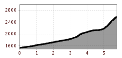
Mountain hikes Eggenkofel Hauptgipfel

Untertilliach / Gailtaler Alpen
Difficulty ratings: difficult
Route length: 5.8 km

Lohnenswertes Bergziel für geübte Bersteiger!

Tour information

  • Requirement: difficult
  • Length: 5.8 km
  • Elevation uphill:1,040 hm
  • Elevation downhill:0 hm
Highest point2,591 m
  • Fitness level 3 / 6
  • Technique 3 / 6

Best time of year

  • January
  • February
  • March
  • April
  • May
  • June
  • July
  • August
  • September
  • October
  • November
  • December

Trail condition

Anfangs Forstweg bis zur Kircher Alm, dort weiter über Bergwiesen und ab dem "Hals" schottriger Steig zum Gipfel

Equipment

Festes Schuhwerk, Regenschutz, evtl. Stöck für den Abstieg
Source: TVB Osttirol

Description

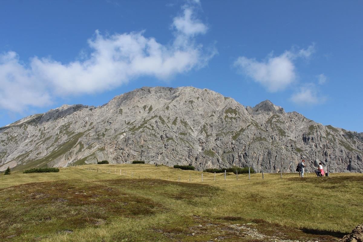
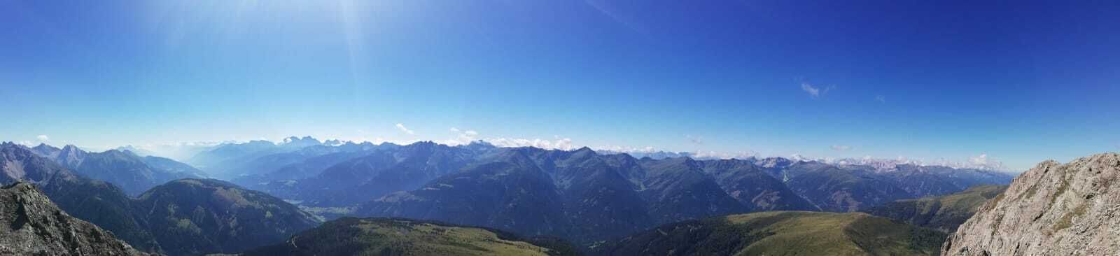
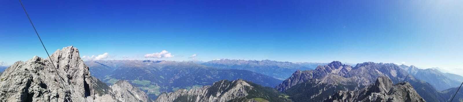
From the old parish church (1524m) follow the forest road. Then take a steep path to the Kircher Almen (2104m). From there, continue to Hals (2136m), where you will find the entrance to a steep gully. Continue, especially in the lower half of the trail, over gravel and boulders to the main summit of the Eggenkofel (2591m). Surefootedness and a head for heights are a prerequisite here!

More tours in the surrounding area

  • Herz-Ass Villgratental

    Difficulty: medium
    Length: 76.0 km Duration: 34:00 h Elevation uphill: 5,750 m
  • Lasörling altitude trail

    Difficulty: medium
    Length: 57.0 km Duration: 25:00 h Elevation uphill: 3,740 m
  • Venediger altitude trail

    Difficulty: difficult
    Length: 55.5 km Duration: 27:00 h Elevation uphill: 3,915 m
  • Figerhorn

    Difficulty: difficult
    Length: 6.5 km Duration: 6:00 h Elevation uphill: 807 m
  • Hike to the Venedigerhaus Innergschlöß

    Difficulty: easy
    Length: 8.5 km Duration: 2:30 h Elevation uphill: 180 m
  • Rotenkogel

    Difficulty: difficult
    Length: 3.9 km Duration: 3:00 h Elevation uphill: 383 m
  • Lasörling 3.098m

    Difficulty: difficult
    Length: 21.9 km Duration: 12:00 h Elevation uphill: 1,940 m
  • Toblacher Pfannhorn

    Difficulty: medium
    Length: 9.8 km Duration: 4:30 h Elevation uphill: 1,020 m
  • Schober trek

    Difficulty: medium
    Length: 33.0 km Duration: 30:00 h Elevation uphill: 3,200 m
  • Golzentipp 2.317 m

    Difficulty: easy
    Length: 5.6 km Duration: 2:00 h Elevation uphill: 267 m
  • Hike to Jagdhausalm 2.009m

    Difficulty: easy
    Length: 16.6 km Duration: 5:00 h Elevation uphill: 400 m
  • Große Kinigat

    Difficulty: difficult
    Length: 8.5 km Elevation uphill: 1,250 m
  • Oberseitsee - Seespitze 3.021 m

    Difficulty: difficult
    Length: 14.4 km Duration: 8:30 h Elevation uphill: 1,310 m
  • Umbal waterfalls nature force trail

    Difficulty: easy
    Length: 5.8 km Duration: 2:30 h Elevation uphill: 250 m
  • Lake Schwarzsee

    Difficulty: medium
    Length: 7.8 km Duration: 3:30 h Elevation uphill: 790 m
  • Rote Spitze 2,956 m

    Difficulty: medium
    Length: 10.2 km Duration: 5:30 h Elevation uphill: 1,260 m
  • Muhs panorama trail

    Difficulty: medium
    Length: 15.2 km Duration: 6:00 h Elevation uphill: 1,090 m
Newsletter

The mountain is calling? So does our newsletter!

In our monthly newsletter we reveal the best holiday tips for Tyrol.