Mountain hikes From Gasthof ‘Schöne Aussicht’ to Roaner Alm
Iselsberg-Stronach / Schober Group
Difficulty ratings: easy
Route length: 10.0 km
Duration: 4:00 h

From Gasthof ‘Schöne Aussicht’ to Roaner Alm
Tour information

  • Requirement: easy
  • Length: 10.0 km
  • Duration: 4:00 h
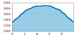
  • Elevation uphill:579 hm
  • Elevation downhill:580 hm
Highest point190 m

Starting point

Gasthof Schöne Aussicht

Finishing point

Roaner Alm
  • Fitness level 2 / 6
  • Technique 2 / 6

Best time of year

  • January
  • February
  • March
  • April
  • May
  • June
  • July
  • August
  • September
  • October
  • November
  • December
Source: TVB Osttirol

Description

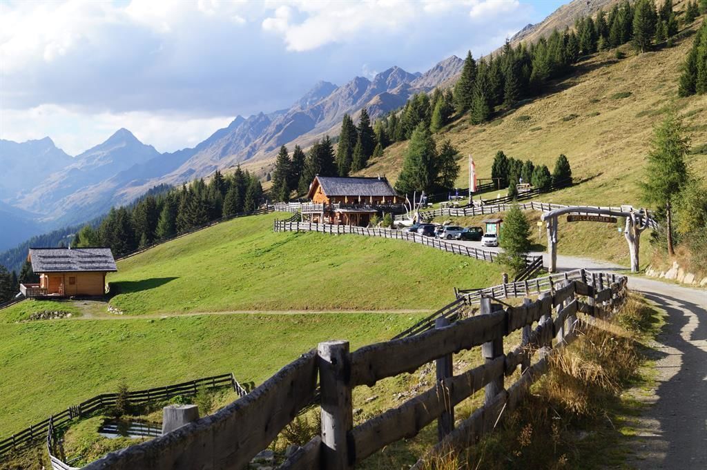
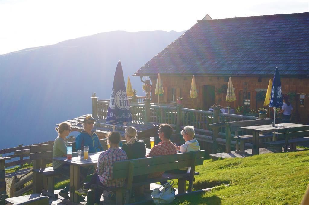
With superb views to the Schober group and the Dolomites, at around 1900m, Roaner Alm is a destination which is popular with hikers and families with children. The ambience is lovely, the food excellent, with some Mediterranean meals that you might not expect to find in an Alpine inn. Enjoy the sun and panorama on the terrace or at the traditional tables in the middle of the meadow. The snugs are cosy and homely – landlady and chef Lydia Pichler is happy to let you sneak a peek over her shoulder while she works.

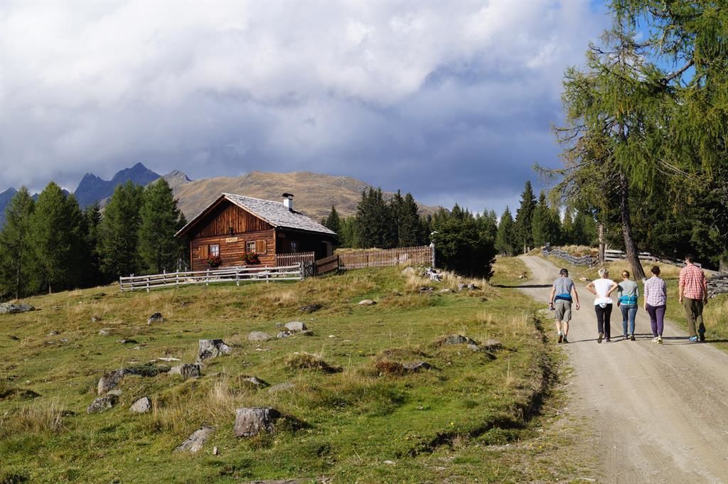
The popular hiking route starts at the car park right next to Gasthof "Schöne Aussicht". With a pleasant gradient, the route proceeds with slight bends initially along the south-east slope heading for Carinthia. After the impressive switchback, you then hike "out of the valley" again until you come to the forest ridge of the Waldrücken of the Strasskopf, where the Lugger Alm (1630m) – not open for business – is located. The route continues without much of a gradient up to Roaner Alm.

Nearby huts and mountain restaurants

Getting here

  • Arrival by public transport

    Mit dem Bus bis zur Bushaltestelle "Iselsberg Kopfsguter" dann haben Sie noch einen Fußweg von 25 Minuten bis zum Ausgangspunkt.

  • Parking

    Parkpatz Schöne Aussicht

More tours in the surrounding area

  • Muhs panorama trail

    Difficulty:medium
    Length:15.2 kmDuration:6:00 hElevation uphill:1,090 m
  • Herz-Ass Villgratental

    Difficulty:medium
    Length:75.6 kmDuration:34:00 hElevation uphill:5,703 m
  • Figerhorn

    Difficulty:difficult
    Length:6.6 kmDuration:6:00 hElevation uphill:811 m
  • Theme path "Virgen crossroads"

    Difficulty:easy
    Length:3.2 kmDuration:1:00 hElevation uphill:104 m
  • Circular walk church St. Nikolaus

    Difficulty:easy
    Length:5.4 kmDuration:1:39 hElevation uphill:150 m
  • Lasörling 3.098m

    Difficulty:difficult
    Length:22.0 kmDuration:12:00 hElevation uphill:1,940 m
  • Böses Weibl

    Difficulty:difficult
    Length:14.1 kmDuration:8:00 hElevation uphill:1,193 m
  • Badener Hütte

    Difficulty:difficult
    Length:23.2 kmDuration:12:00 hElevation uphill:1,754 m
  • Lucknerhaus - Stüdlhütte

    Difficulty:medium
    Length:9.3 kmDuration:4:30 hElevation uphill:862 m
  • Hiking tour to St. Pöltner Hütte and 3 lakes

    Difficulty:difficult
    Length:14.8 kmDuration:7:40 hElevation uphill:1,119 m
  • Hike to the Venedigerhaus Innergschlöß

    Difficulty:easy
    Length:8.6 kmDuration:2:30 hElevation uphill:184 m
  • Hike to Kalser Tauernhaus

    Difficulty:medium
    Length:12.2 kmDuration:4:00 hElevation uphill:244 m
  • Hiking tour to Neue Sajathütte 2.600m

    Difficulty:medium
    Length:10.3 kmDuration:6:50 hElevation uphill:1,086 m
  • Hiking tour to Zupalsee Hütte 2.350m

    Difficulty:medium
    Length:14.9 kmDuration:8:30 hElevation uphill:1,261 m
  • Hike to Neuen Reichenberger Hütte

    Difficulty:medium
    Length:18.2 kmDuration:9:00 hElevation uphill:1,252 m
  • Hiking tour to Lasörlinghütte 2.350m

    Difficulty:medium
    Length:14.6 kmDuration:7:50 hElevation uphill:1,135 m
Newsletter

The mountain is calling? So does our newsletter!

In our monthly newsletter we reveal the best holiday tips for Tyrol.