
Mountain hikes Kerschbaumer bothy via Googsteig

Amlach / Gailtal Alps
Difficulty ratings: medium
Route length: 16.8 km
Duration: 8:00 h

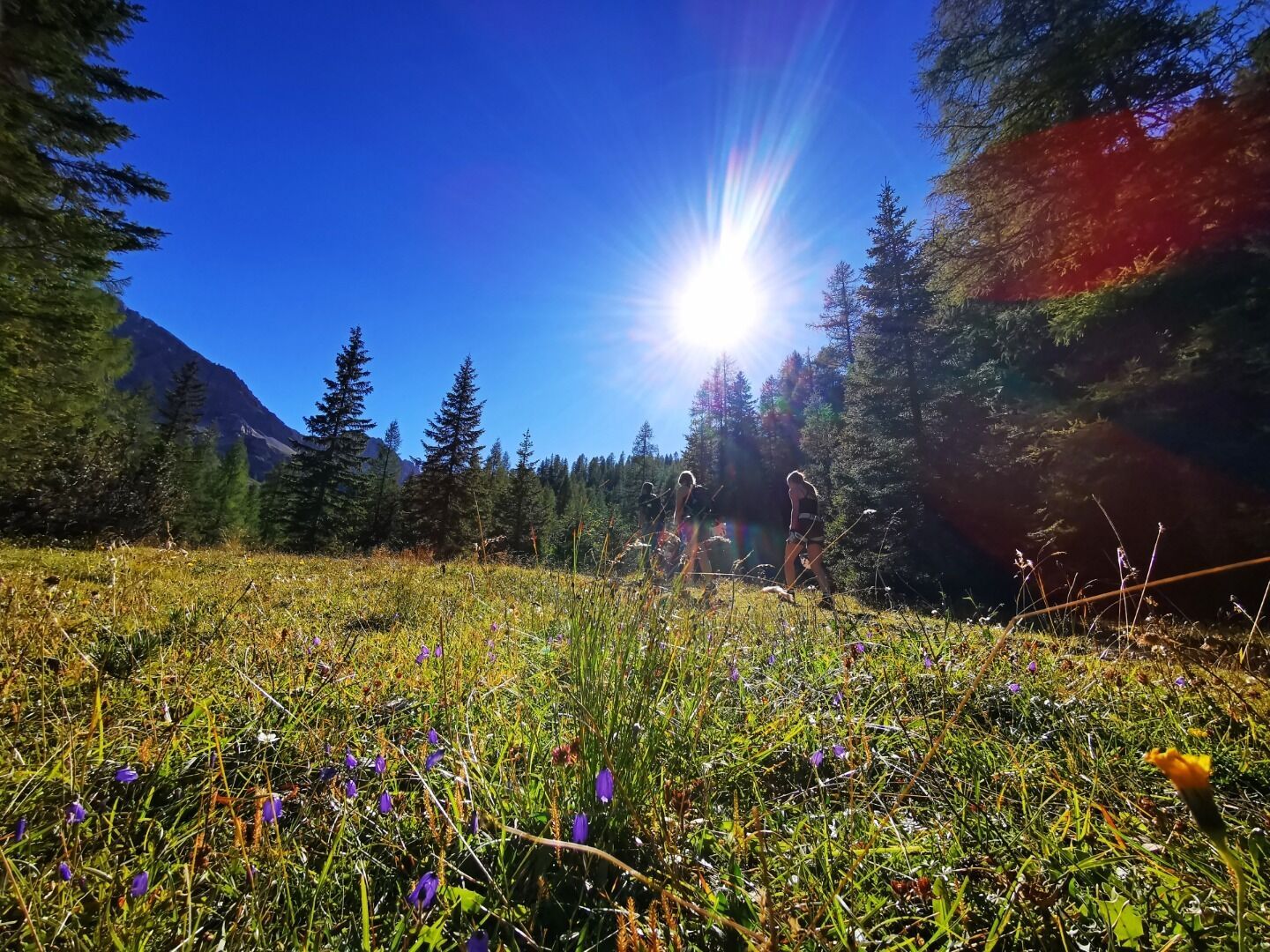
Kerschbaumeralm bothy is located at 1902m altitude in Kerschbaumeralmtal, north west of the main area of the Lienz Dolomites. Surrounded by numerous peaks which are Alpine in scale (Kreuzkofel, Eisenschuß, Weittalsspitze, Simonskopf, Große and Kleine Gamswiesenspitze), yet at the same time providing open views to the north, to the Schober group.
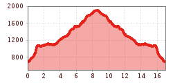
Tour information

  • Requirement: medium
  • Length: 16.8 km
  • Duration: 8:00 h
  • Elevation uphill:1,500 hm
  • Elevation downhill:1,350 hm
Highest point1,900 m

Starting point

Lienz, Amlach, forest grant

Finishing point

Kerschbaumeralm Schutzhaus
  • Fitness level 4 / 6
  • Technique 4 / 6

Best time of year

  • January
  • February
  • March
  • April
  • May
  • June
  • July
  • August
  • September
  • October
  • November
  • December

Equipment

Basic equipmentformountainhikingincludessturdy hiking bootswith a goodtread, a 30-35 literbackpack, and functionalclothingbased on thelayeringprinciple, includingsufficient spare clothes. Essential itemsare rain, cold, and sunprotection, adequatefluids and food, aswellas a first-aid kit and a charged mobile phone. A mapor a GPS devicesupportsorientation. 

The informationservesas a guideline and does not claimtobe exhaustive. Equipment mustalwaysbeadaptedtothe planned route, weatherconditions, season, naturalhazards, environmental influences, and personal needs. 

Source: TVB Osttirol

Description

From the car park at Amlach forest tavern (690m) via the steeply ascending Goggsteig to the Gogghüttl. Then follow the flat path to the Klammbrückl. (You can park here too if you want to shorten the tour and spare yourself tackling the steep Goggsteig). Then continue on the well signposted path up to Kerschbaumeralm bothy.

Nearby huts and mountain restaurants

Getting here

  • Arrival by public transport

    Mit dem Bus bis zur Bushaltestelle "Amlach Dorfplatz".

  • Parking

    Mit dem Auto über Amlach bis zum "Parkplatz Lienzer Dolomiten (Leisach)".
    Parkplatz Rodelbahn Lienzer Dolomiten (Leisach)

Weather

Today

clear sky
17°C/5°C
0%0l5 km/h

Tue

clear sky
17°C/2°C
35%1.3l5 km/h

Wed

partly Cloudy
19°C/6°C
40%0.2l5 km/h
Go to weather forecast

More tours in the surrounding area

  • Lasörling altitude trail

    Difficulty:medium
    Length:55.4 kmDuration:25:00 hElevation uphill:3,718 m
  • Venediger altitude trail

    Difficulty:difficult
    Length:55.5 kmDuration:27:00 hElevation uphill:3,975 m
  • Theme path "Virgen crossroads"

    Difficulty:easy
    Length:3.2 kmDuration:1:00 hElevation uphill:104 m
  • Figerhorn

    Difficulty:difficult
    Length:6.6 kmDuration:6:00 hElevation uphill:811 m
  • Iseltrail

    Difficulty:medium
    Length:75.3 kmDuration:24:30 hElevation uphill:2,347 m
  • Badener Hütte

    Difficulty:difficult
    Length:23.2 kmDuration:12:00 hElevation uphill:1,754 m
  • Lucknerhaus - Stüdlhütte

    Difficulty:medium
    Length:9.3 kmDuration:4:30 hElevation uphill:862 m
  • Hiking tour to St. Pöltner Hütte and 3 lakes

    Difficulty:difficult
    Length:14.8 kmDuration:7:40 hElevation uphill:1,119 m
  • Trail Virgentaler Sonnseitenweg

    Difficulty:medium
    Length:41.9 kmDuration:1 dayElevation uphill:2,641 m
  • The Höfe Trail

    Difficulty:easy
    Length:51.2 kmDuration:10:15 hElevation uphill:1,988 m
  • Hike to Neuen Reichenberger Hütte

    Difficulty:medium
    Length:18.2 kmDuration:9:00 hElevation uphill:1,252 m
  • Hiking tour to Lasörlinghütte 2.350m

    Difficulty:medium
    Length:14.6 kmDuration:7:50 hElevation uphill:1,135 m
  • Hiking tour to Zupalsee Hütte 2.350m

    Difficulty:medium
    Length:14.9 kmDuration:8:30 hElevation uphill:1,261 m
  • Hike to the Venedigerhaus Innergschlöß

    Difficulty:easy
    Length:8.6 kmDuration:2:30 hElevation uphill:184 m
  • Glödis via ferrata route

    Opening hours:open
    Difficulty:B
    Duration:1:00 hDuration:4:00 hElevation difference:230 m
  • Muhs panorama trail

    Difficulty:medium
    Length:15.2 kmDuration:6:00 hElevation uphill:1,090 m
  • Herz-Ass Villgratental

    Difficulty:medium
    Length:75.6 kmDuration:34:00 hElevation uphill:5,703 m
  • Böses Weibele

    Difficulty:easy
    Length:10.0 kmDuration:4:00 hElevation uphill:545 m
Newsletter

The mountain is calling? So does our newsletter!

In our monthly newsletter we reveal the best holiday tips for Tyrol.
