Mountain hikes Großer Zunig 2.776 m

Matrei in Osttirol / Venedigergruppe
Difficulty ratings: difficult
Route length: 20.5 km
Duration: 9:00 h

Großer Zunig 2.776 m

Tour information

  • Requirement: difficult
  • Length: 20.5 km
  • Duration: 9:00 h
  • Elevation uphill:1,820 hm
  • Elevation downhill:1,820 hm
Highest point2,770 m

Starting point

Parkplatz Guggenberg

Finishing point

Großer Zunig
  • Fitness level 4 / 6
  • Technique 4 / 6

Best time of year

  • January
  • February
  • March
  • April
  • May
  • June
  • July
  • August
  • September
  • October
  • November
  • December
Source: TVB Osttirol

Description

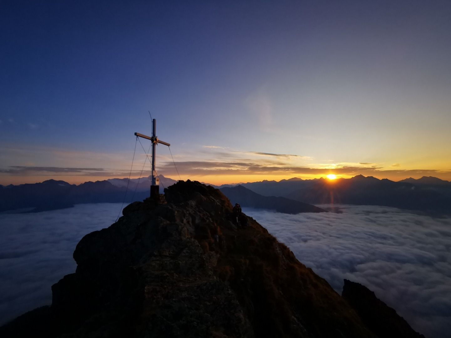
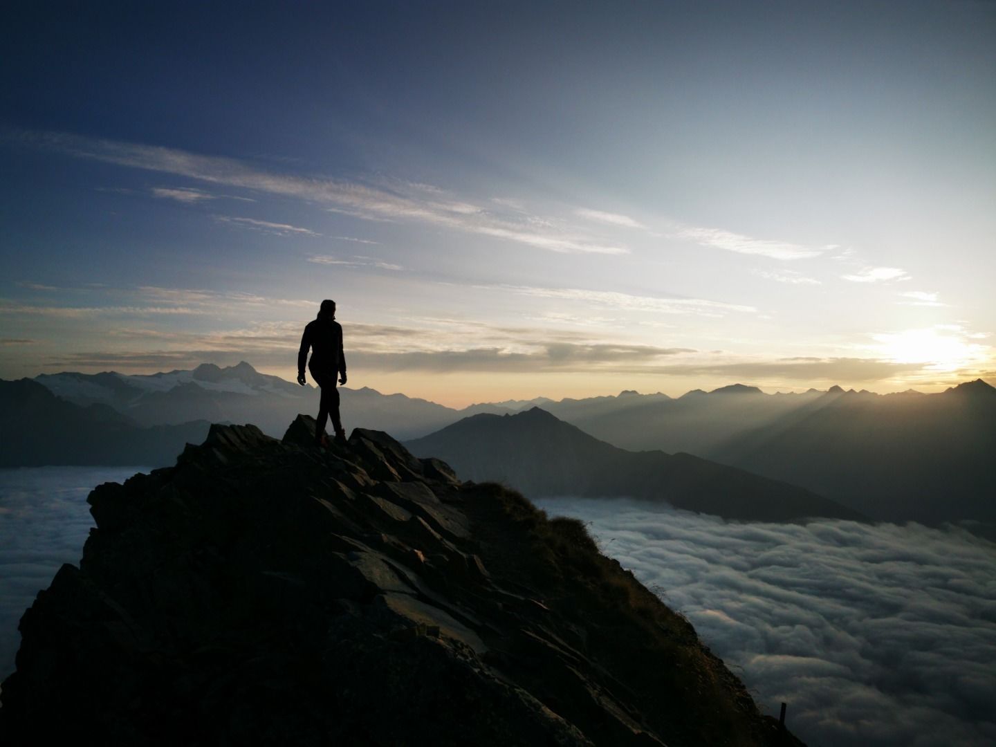
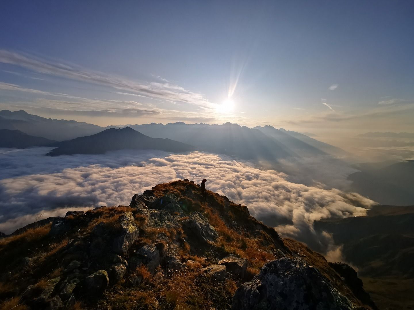
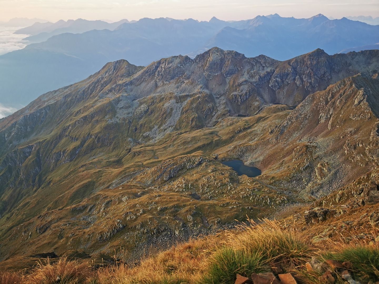
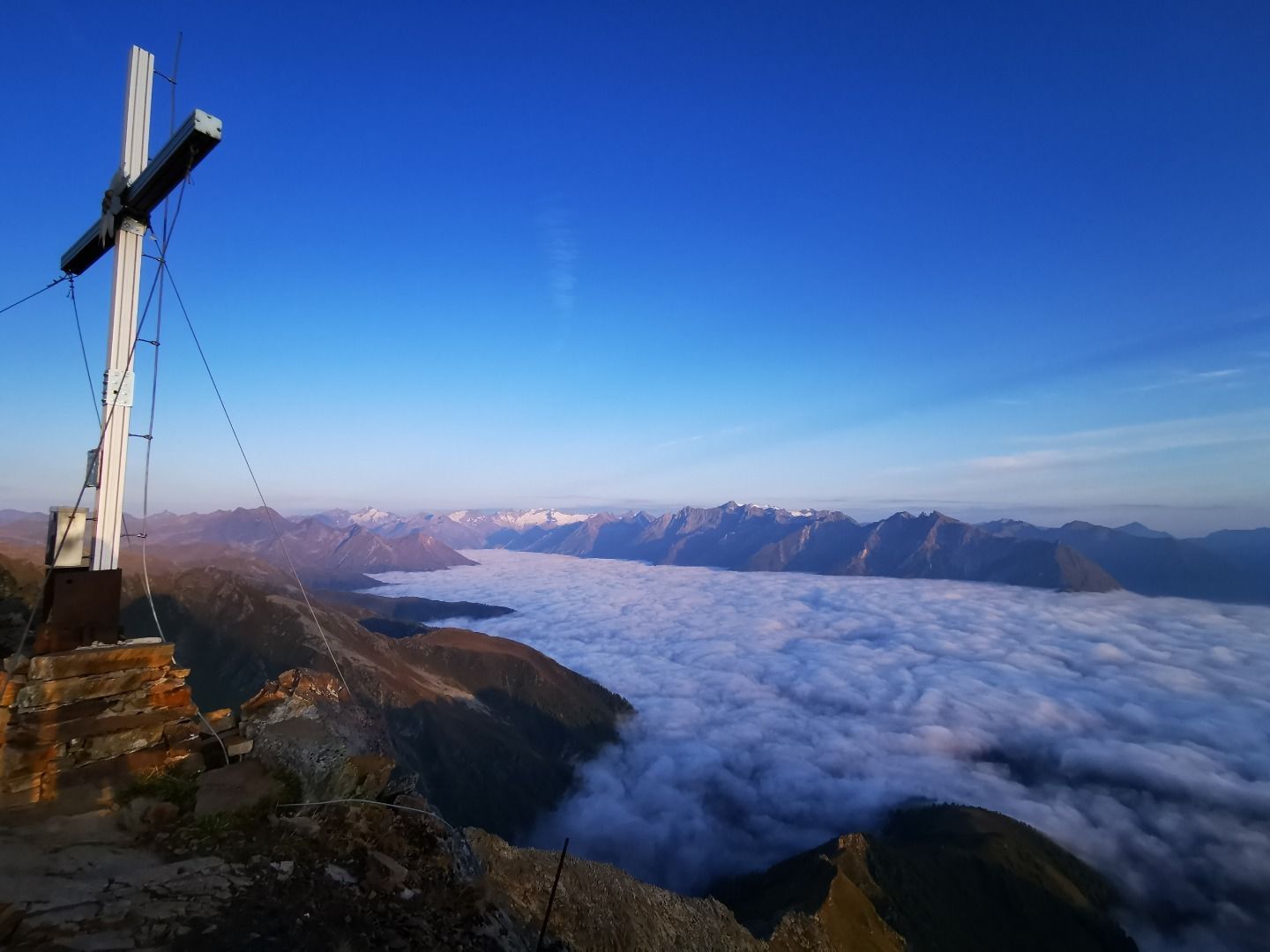
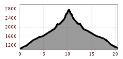
Thanks to its central location, the summit Großer Zunig provides breathtaking views. However 
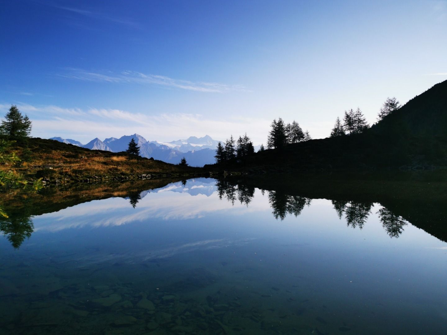
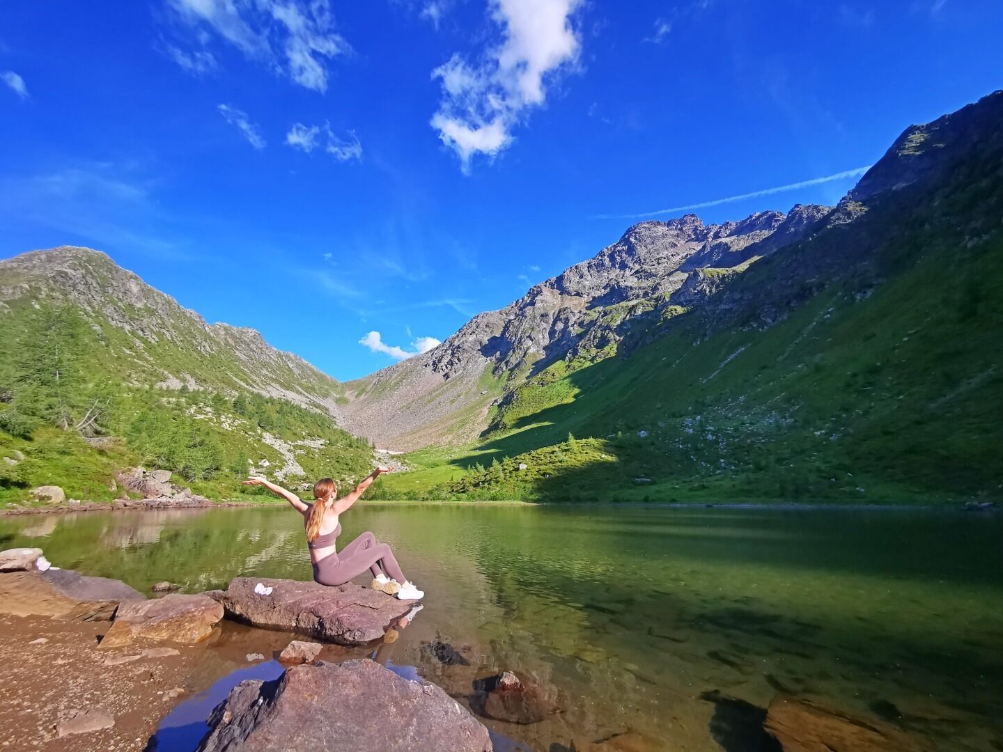
climbing it is very strenuous due to its enormous altitude difference. From the parking place Guggenberg you have to follow the forest road to the snack station Zunigalm (1.846 m). On a steep trail you get to the deep green mountain lake Zunigsee and hike then up on the mountain ridge to the col Zunigscharte. You reach the summit by following an easy to walk on, but quite steep north-eastern ridge. Arrived on the hiking destination, you can enjoy the superb panorama view to the massif Tauernmassiv and the Dolomites.

Nearby huts and mountain restaurants

  • Zunigalm 1.846m

    Opening hours:Today closed
    Place:Matrei in Osttirol
    :Alpine pasture / hut / mountain restaurant

Getting here

  • Arrival by public transport

    Matrei in Osttirol Auerfeld

  • Parking

    Parking place Guggenberg

More tours in the surrounding area

  • Hike to the Venedigerhaus Innergschlöß

    Difficulty:easy
    Length:8.6 kmDuration:2:30 hElevation uphill:184 m
  • Lucknerhaus - Stüdlhütte

    Difficulty:medium
    Length:9.3 kmDuration:5:30 hElevation uphill:862 m
  • Badener Hütte

    Difficulty:difficult
    Length:23.2 kmDuration:11:30 hElevation uphill:1,754 m
  • Theme path "Virgen crossroads"

    Difficulty:easy
    Length:3.2 kmDuration:1:00 hElevation uphill:104 m
  • Lasörling altitude trail

    Difficulty:medium
    Length:57.0 kmDuration:25:00 hElevation uphill:3,740 m
  • Venediger altitude trail

    Difficulty:difficult
    Length:55.5 kmDuration:27:00 hElevation uphill:3,915 m
  • Figerhorn

    Difficulty:difficult
    Length:6.5 kmDuration:6:00 hElevation uphill:807 m
  • Muhs panorama trail

    Difficulty:medium
    Length:15.2 kmDuration:6:00 hElevation uphill:1,090 m
  • Hike to Neuen Reichenberger Hütte

    Difficulty:medium
    Length:18.2 kmDuration:9:00 hElevation uphill:1,252 m
  • Hiking tour to Lasörlinghütte 2.350m

    Difficulty:medium
    Length:14.6 kmDuration:7:10 hElevation uphill:1,080 m
  • Hike to Kalser Tauernhaus

    Difficulty:medium
    Length:12.2 kmDuration:4:00 hElevation uphill:244 m
  • Hiking tour to Neue Sajathütte 2.600m

    Difficulty:medium
    Length:10.3 kmDuration:6:50 hElevation uphill:1,086 m
  • Rotenkogel

    Difficulty:difficult
    Length:3.9 kmDuration:3:00 hElevation uphill:383 m
  • Lasörling 3.098m

    Difficulty:difficult
    Length:21.9 kmDuration:12:00 hElevation uphill:1,940 m
  • Böses Weibl

    Difficulty:difficult
    Length:14.1 kmDuration:8:00 hElevation uphill:1,193 m
  • Umbal waterfalls nature force trail

    Difficulty:easy
    Length:6.0 kmDuration:2:30 hElevation uphill:257 m
  • Rollitour with Swiss Trac

    Difficulty:easy
    Length:3.2 kmDuration:1:30 hElevation uphill:135 m
  • Eagle Walk Stage O1: Ströden - Johannis Hütte

    Difficulty:medium
    Length:13.0 kmDuration:6:30 hElevation uphill:1,430 m
Newsletter

The mountain is calling? So does our newsletter!

In our monthly newsletter we reveal the best holiday tips for Tyrol.