Mountain hikes Stüdlhütte übers Teischnitztal

Kals am Großglockner / Glocknergruppe
Difficulty ratings: medium
Route length: 17.0 km
Duration: 7:00 h

Stüdlhütte übers Teischnitztal

Tour information

  • Requirement: medium
  • Length: 17.0 km
  • Duration: 7:00 h
  • Elevation uphill:1,290 hm
  • Elevation downhill:1,289 hm
Highest point2,802 m

Starting point

Parkplatz Dorfertal

Finishing point

Parkplatz Dorfertal
Source: Nationalparkregion Hohe Tauern Osttirol

Description

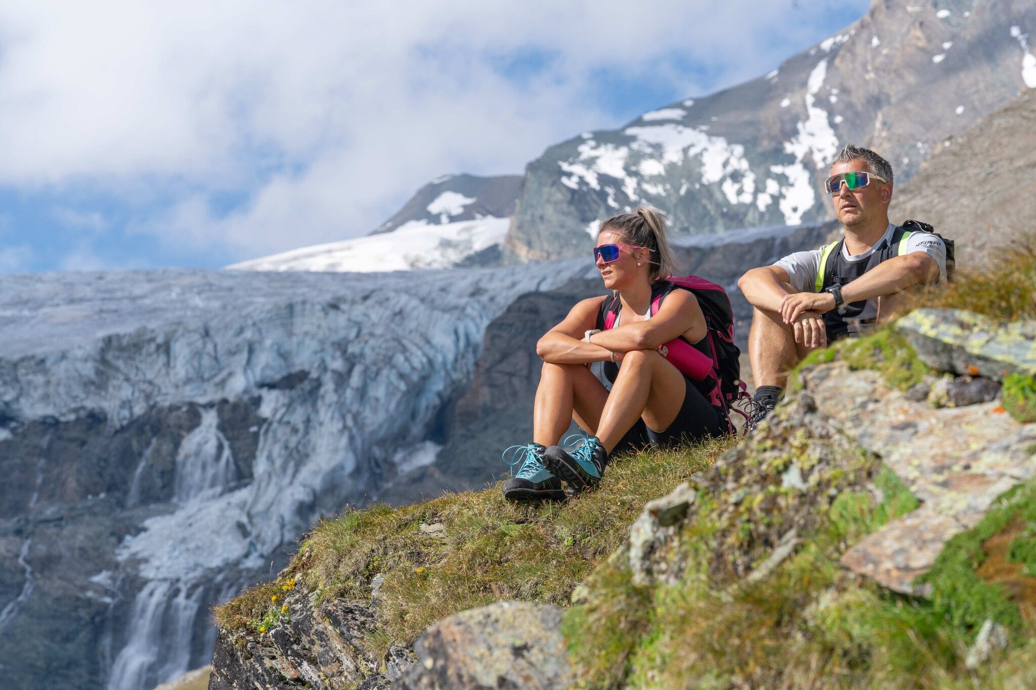
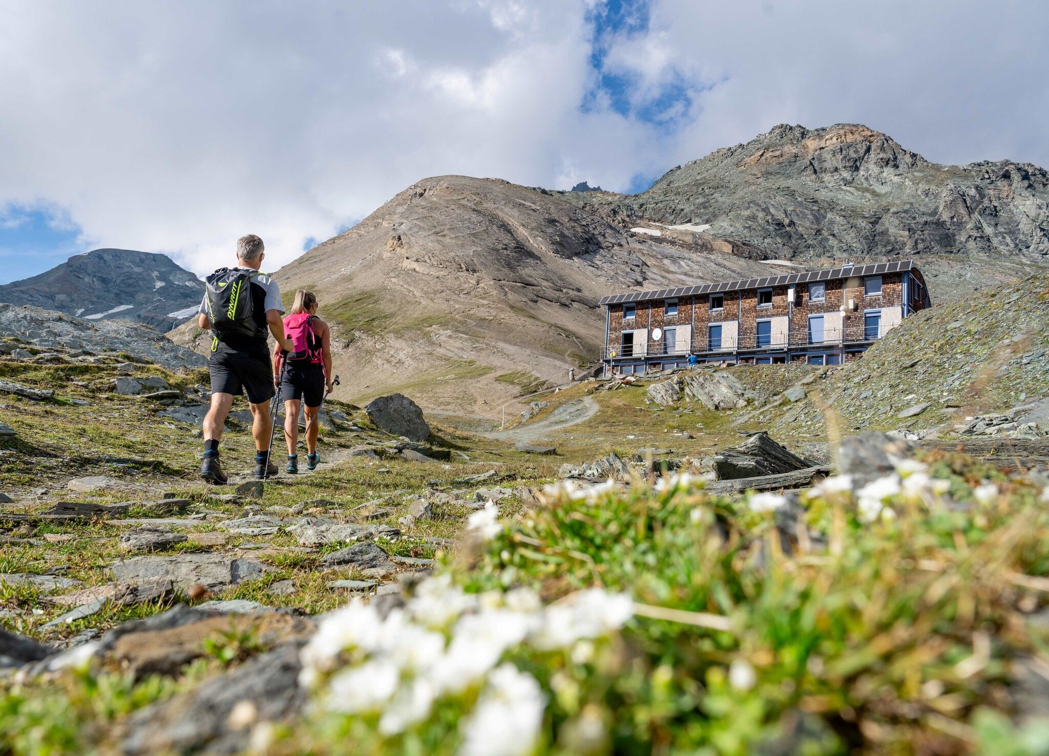
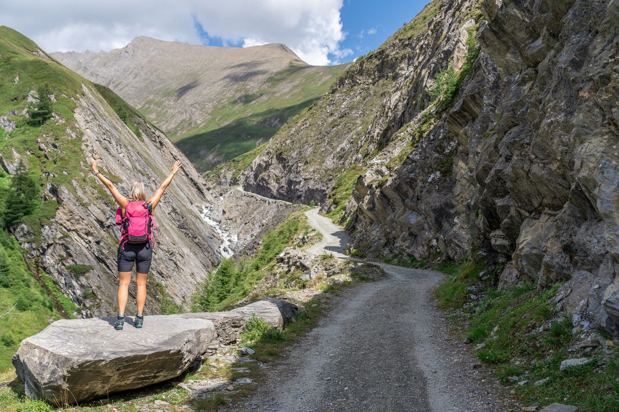
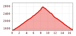
From the Dorfertal car park, via the Moa-Alm-Strasse (alpine road), you come to the Teischnitzbach bridge, where a forest path branches off to the right and leads up to the Teischnitzebene Plains, from where you can enjoy an interesting view of the Teischnitz glacier and the Glocknerwand. After the gorge, the trail begins and leads up to the Stuedlhuette on the right side of the slope. For hikers without the opportunity to travel, a hiking trail leads from the Taurer (post bus stop) up to the Teischnitzbach bridge.
Also possible as a circular tour- Descent via the Lucknerhuette in Koednitztal and to the Lucknerhaus (post bus stop). Walking time descent Stuedlhuette - Lucknerhaus - 2 hours;

Nearby huts and mountain restaurants

More tours in the surrounding area

  • Hike to Neuen Reichenberger Hütte

    Difficulty: medium
    Length: 9.1 km Duration: 9:00 h Elevation uphill: 1,210 m
  • Badener Hütte

    Difficulty: difficult
    Length: 23.2 km Duration: 11:30 h Elevation uphill: 1,750 m
  • Hiking tour to Lasörlinghütte 2.350m

    Difficulty: medium
    Length: 14.6 km Duration: 7:10 h Elevation uphill: 1,080 m
  • Hiking tour to Neue Sajathütte 2.600m

    Difficulty: medium
    Length: 10.3 km Duration: 6:50 h Elevation uphill: 1,080 m
  • Venediger altitude trail

    Difficulty: difficult
    Length: 55.5 km Duration: 27:00 h Elevation uphill: 3,915 m
  • Muhs panorama trail

    Difficulty: medium
    Length: 15.2 km Duration: 6:00 h Elevation uphill: 1,090 m
  • Lasörling altitude trail

    Difficulty: medium
    Length: 57.0 km Duration: 25:00 h Elevation uphill: 3,740 m
  • Figerhorn

    Difficulty: difficult
    Length: 6.5 km Duration: 6:00 h Elevation uphill: 807 m
  • Böses Weibl

    Difficulty: difficult
    Length: 14.1 km Duration: 8:00 h Elevation uphill: 1,193 m
  • Lasörling 3.098m

    Difficulty: difficult
    Length: 21.9 km Duration: 12:00 h Elevation uphill: 1,940 m
  • Hike to Kalser Tauernhaus

    Difficulty: medium
    Length: 12.2 km Duration: 4:00 h Elevation uphill: 244 m
  • Lucknerhaus - Stüdlhütte

    Difficulty: medium
    Length: 9.3 km Duration: 5:30 h Elevation uphill: 862 m
  • Hike to the Venedigerhaus Innergschlöß

    Difficulty: easy
    Length: 8.5 km Duration: 2:30 h Elevation uphill: 180 m
Newsletter

The mountain is calling? So does our newsletter!

In our monthly newsletter we reveal the best holiday tips for Tyrol.