Long-distance hike Adlerweg trail. Stage 7: Sudetendeutsche Hütte – Kalser Tauernhaus

Matrei in Osttirol / Granatspitzgruppe
Difficulty ratings: medium
Route length: 8.0 km
Duration: 4:00 h

Adlerweg trail. Stage 7: Sudetendeutsche Hütte – Kalser Tauernhaus

Tour information

  • Requirement: medium
  • Length: 8.0 km
  • Duration: 4:00 h
  • Elevation uphill:209 hm
  • Elevation downhill:1,107 hm
Highest point2,820 m

Starting point

Sudetendeutsche Hütte

Finishing point

Kalser Tauernhaus
  • Fitness level 3 / 6
  • Technique 3 / 6
Source: TVB Osttirol

Description

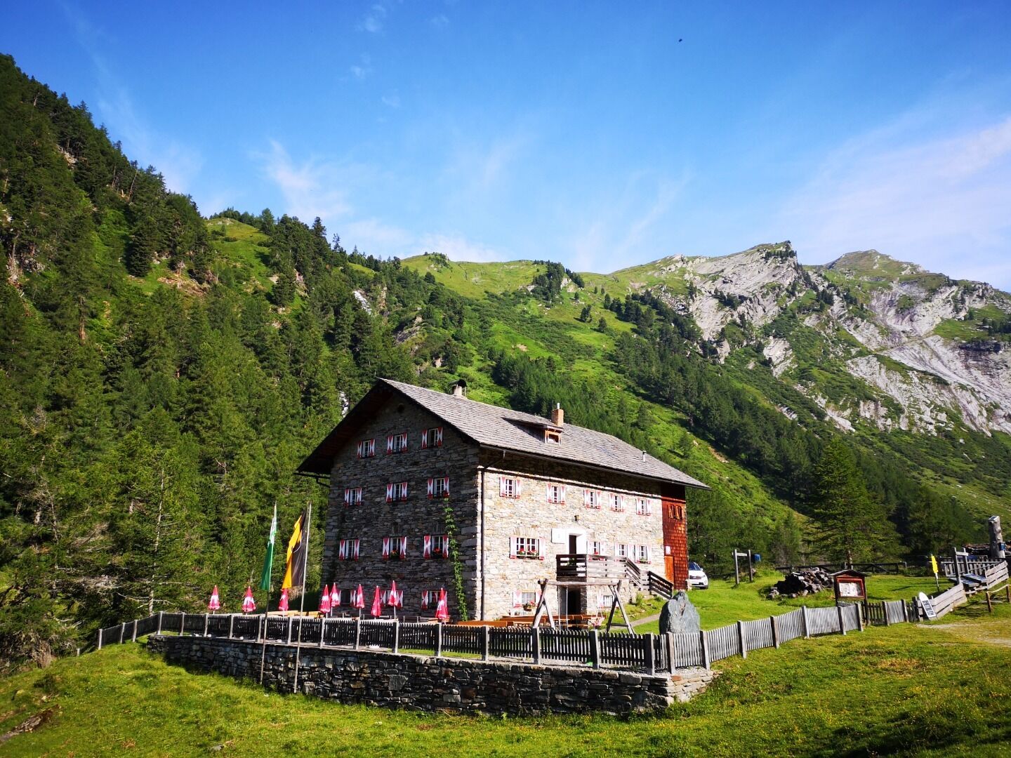
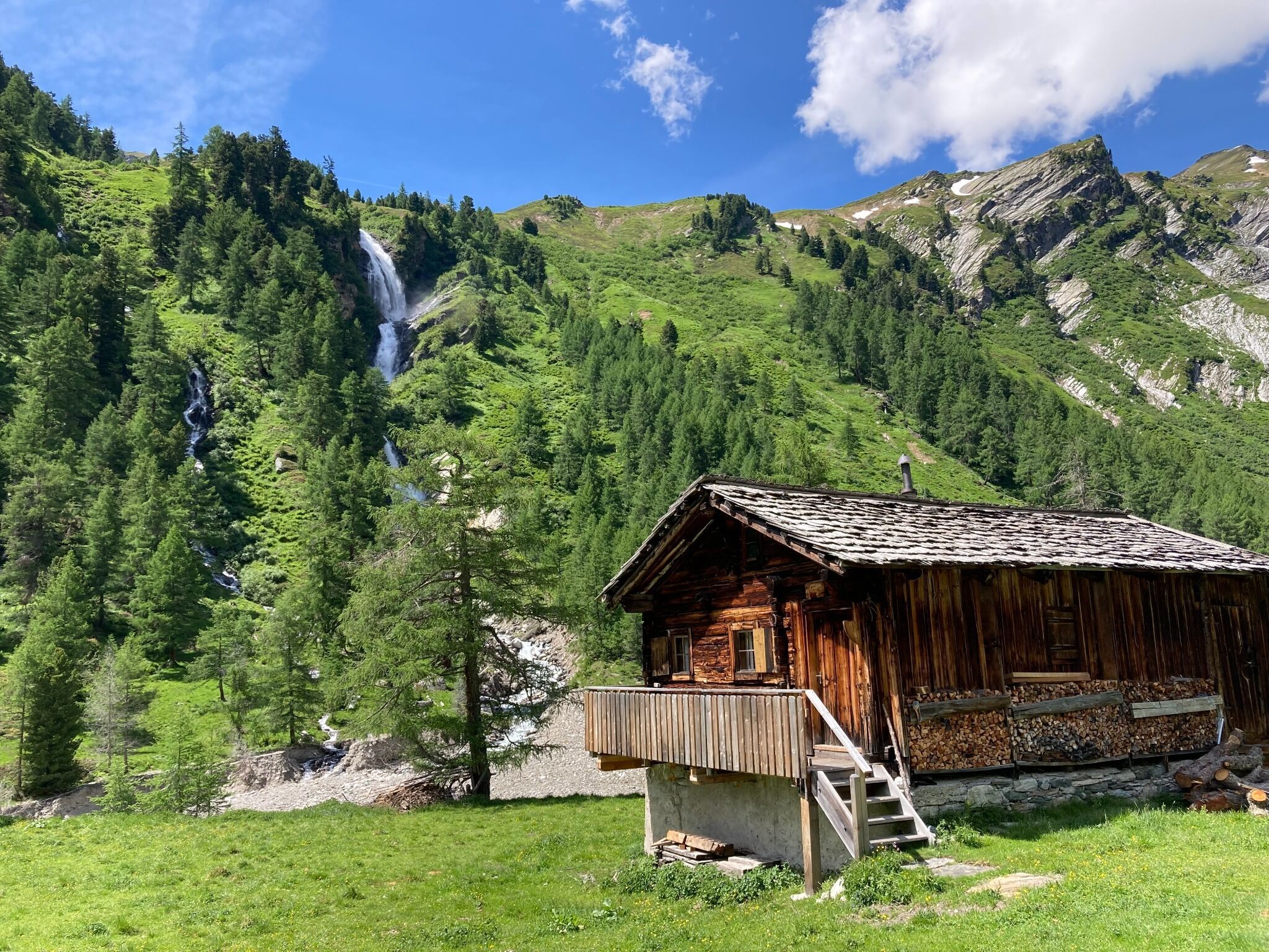
From Sudetendeutschen Hütte hike past the memorial cross and a little mountain lake which is close to the lodge via a grassy ridge and mossy trough up to the outlet area of the Gradötzkees, where a lake has built up and impressive moraines characterise the landscape. You finally get to Gradötzsattel (2826 metres), then head down to the Bloipalfen (2684 metres). Continue downhill afterwards via a section of pastureland and gorge-like rock formations. At some 2500 metres altitude the route branches off into Silesiaweg. It is a few minutes‘ walk on the rocky Muntanitzschneid, which provides wonderful views, staying on the Adlerweg trail, bearing right and finally reaching the Muntanitzbach, which is not so easy when there is considerable water flow to tackle – in particular the base. A section above the Ochsenalm area you walk around the ridge of the Muntanitzschneid. The route is very well developed here, in the lower section you walk on a small sharp bend and there is a rocky section. Continue down across the pasture slopes and head in a northerly direction through a small Swiss stone pine woodland. You eventually come to an information board at the bridge on the Stotzbach which the Loamesbach flows into. At the route signpost which is a bit further down opt for route 514 A, to Kalser Tauernhaus. Hike now on numerous narrow hairpin bends on the Wilhelm-Ernst trail between alders, ash trees and larch trees, zigzagging into the valley, past the National Park viewing turret, where a waterfall at the Stotzbach swirls down below to the depths via a trough shoulder created by glaciers from the Ice Age. Finally head to the Dorferbach, to the destination for this stage, the cosy Kalser Tauernhaus (1755 metres). Located in the lower section of the Dorfertal, just a short section beneath the point where the Stotzbach meets the Dorferbach.

Nearby huts and mountain restaurants

More tours in the surrounding area

  • Lasörling altitude trail

    Difficulty: medium
    Length: 57.0 km Duration: 25:00 h Elevation uphill: 3,740 m
  • Venediger altitude trail

    Difficulty: difficult
    Length: 55.5 km Duration: 27:00 h Elevation uphill: 3,915 m
  • Figerhorn

    Difficulty: difficult
    Length: 6.5 km Duration: 6:00 h Elevation uphill: 807 m
  • Hike to the Venedigerhaus Innergschlöß

    Difficulty: easy
    Length: 8.5 km Duration: 2:30 h Elevation uphill: 180 m
  • Rotenkogel

    Difficulty: difficult
    Length: 3.9 km Duration: 3:00 h Elevation uphill: 383 m
  • Lasörling 3.098m

    Difficulty: difficult
    Length: 21.9 km Duration: 12:00 h Elevation uphill: 1,940 m
  • Umbal waterfalls nature force trail

    Difficulty: easy
    Length: 5.8 km Duration: 2:30 h Elevation uphill: 250 m
  • Muhs panorama trail

    Difficulty: medium
    Length: 15.2 km Duration: 6:00 h Elevation uphill: 1,090 m
  • Hike to Neuen Reichenberger Hütte

    Difficulty: medium
    Length: 9.1 km Duration: 9:00 h Elevation uphill: 1,210 m
  • Hiking tour to Lasörlinghütte 2.350m

    Difficulty: medium
    Length: 14.6 km Duration: 7:10 h Elevation uphill: 1,080 m
  • Badener Hütte

    Difficulty: difficult
    Length: 23.2 km Duration: 11:30 h Elevation uphill: 1,750 m
  • Lucknerhaus - Stüdlhütte

    Difficulty: medium
    Length: 9.3 km Duration: 5:30 h Elevation uphill: 862 m
  • Hike to Kalser Tauernhaus

    Difficulty: medium
    Length: 12.2 km Duration: 4:00 h Elevation uphill: 244 m
  • Hiking tour to Neue Sajathütte 2.600m

    Difficulty: medium
    Length: 10.3 km Duration: 6:50 h Elevation uphill: 1,080 m
  • Böses Weibl

    Difficulty: difficult
    Length: 14.1 km Duration: 8:00 h Elevation uphill: 1,193 m
  • Eagle Walk Stage O1: Ströden - Johannis Hütte

    Difficulty: medium
    Length: 13.0 km Duration: 6:30 h Elevation uphill: 1,430 m
Newsletter

The mountain is calling? So does our newsletter!

In our monthly newsletter we reveal the best holiday tips for Tyrol.