Mountain hikes Große Kinigat

Kartitsch / Carnic Main Crest
Difficulty ratings: difficult
Route length: 8.5 km

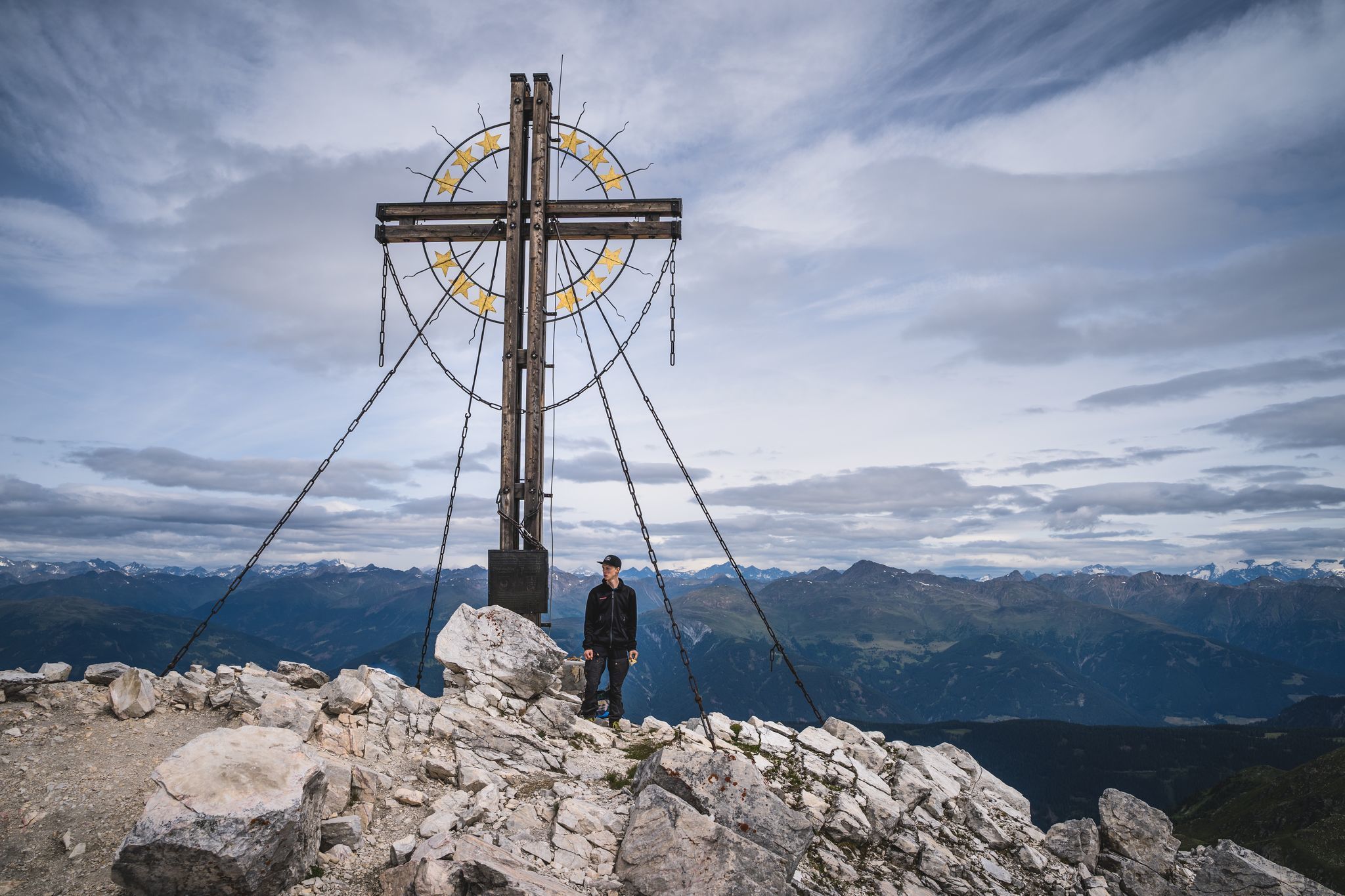
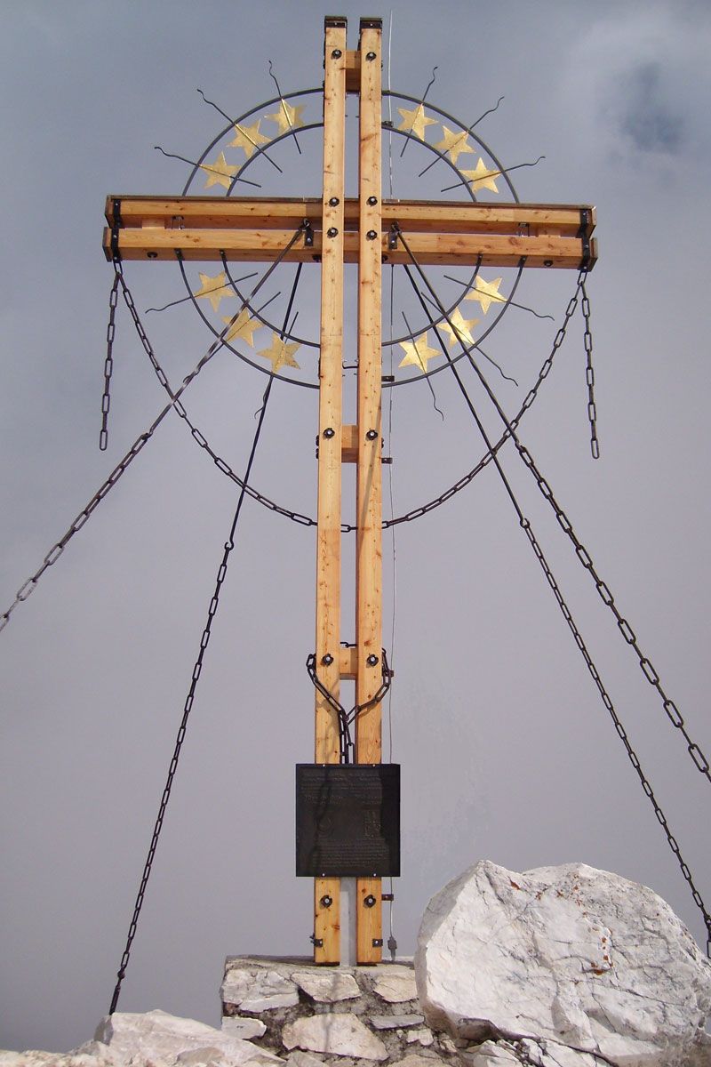
The Große Kinigat was once fiercely contested, but now mountaineers fight their way up to the magnificent viewpoint. They are greeted by a simple, beautiful European peace cross.

Tour character

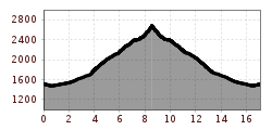
The Königstour in the East Tyrolean part of the Carnic ridge on the Königswand and the Große Kinigat (2,689 m) starts in the center of Kartitsch. The third-highest mountain in the Carnic Alps is not exactly modest in its demands, with an 18-kilometre route on partly difficult, exposed climbs and an altitude difference of 1,350 meters. On the other hand, it offers generous views to all those who reach its summit cross with its message of peace.
Tour information

  • Requirement: difficult
  • Length: 8.5 km
  • Elevation uphill:1,250 hm
  • Elevation downhill:80 hm
Highest point2,567 m

Starting point

Parking lot Rauchenbach/Kartitsch

Finishing point

Gr. Kinigat
  • Fitness level 5 / 6
  • Technique 4 / 6

Best time of year

  • January
  • February
  • March
  • April
  • May
  • June
  • July
  • August
  • September
  • October
  • November
  • December

Equipment

Basic equipmentformountainhikingincludessturdy hiking bootswith a goodtread, a 30-35 literbackpack, and functionalclothingbased on thelayeringprinciple, includingsufficient spare clothes. Essential itemsare rain, cold, and sunprotection, adequatefluids and food, aswellas a first-aid kit and a charged mobile phone. A mapor a GPS devicesupportsorientation. 

The informationservesas a guideline and does not claimtobe exhaustive. Equipment mustalwaysbeadaptedtothe planned route, weatherconditions, season, naturalhazards, environmental influences, and personal needs. 

Source: TVB Osttirol

Description

Through Erschbaumertal along the forest trail to the head of the valley. In hairpin bends follow the path to the left, up to the Tscharre. On route 403, between Kinigat and Liköfelwand, to the Hintersattel. Option to descend to Filmoor-Standschützenhütte. Continue to Filmoorsattel and via the scree field to the south of the Königswand for around 400 m in a westerly direction. Keep the right, very steep through the steep scree slope to the cliffs, where a secured section with a summit corrie, some 100 m in length and continue right to the European Cross at the summit, which is the highest elevation in the Carnic ridge.

Getting here

  • Arrival by public transport

    Mit dem Bus bis zur Haltestelle "Kartitsch Rauchenbach"

  • Parking

    Mit dem Auto bis nach Rauchenbach
    Parkplatz Rauchenbach

More tours in the surrounding area

  • Herz-Ass Villgratental

    Difficulty:medium
    Length:75.6 kmDuration:34:00 hElevation uphill:5,703 m
  • Muhs panorama trail

    Difficulty:medium
    Length:15.2 kmDuration:6:00 hElevation uphill:1,090 m
  • Figerhorn

    Difficulty:difficult
    Length:6.6 kmDuration:6:00 hElevation uphill:811 m
  • Lasörling altitude trail

    Difficulty:medium
    Length:55.4 kmDuration:25:00 hElevation uphill:3,718 m
  • Venediger altitude trail

    Difficulty:difficult
    Length:55.5 kmDuration:27:00 hElevation uphill:3,975 m
  • Theme path "Virgen crossroads"

    Difficulty:easy
    Length:3.2 kmDuration:1:00 hElevation uphill:104 m
  • Children's mile Golzentipp

    Difficulty:easy
    Length:3.7 kmDuration:2:00 hElevation uphill:140 m
  • Lucknerhaus - Stüdlhütte

    Difficulty:medium
    Length:9.3 kmDuration:4:30 hElevation uphill:862 m
  • Iseltrail

    Difficulty:medium
    Length:75.3 kmDuration:24:30 hElevation uphill:2,347 m
  • Hiking tour to St. Pöltner Hütte and 3 lakes

    Difficulty:difficult
    Length:14.8 kmDuration:7:40 hElevation uphill:1,119 m
  • Trail Virgentaler Sonnseitenweg

    Difficulty:medium
    Length:41.9 kmDuration:1 dayElevation uphill:2,641 m
  • Badener Hütte

    Difficulty:difficult
    Length:23.2 kmDuration:12:00 hElevation uphill:1,754 m
  • Hike to the Venedigerhaus Innergschlöß

    Difficulty:easy
    Length:8.6 kmDuration:2:30 hElevation uphill:184 m
  • Hike to Neuen Reichenberger Hütte

    Difficulty:medium
    Length:18.2 kmDuration:9:00 hElevation uphill:1,252 m
  • Hiking tour to Lasörlinghütte 2.350m

    Difficulty:medium
    Length:14.6 kmDuration:7:50 hElevation uphill:1,135 m
  • The Höfe Trail

    Difficulty:easy
    Length:51.2 kmDuration:10:15 hElevation uphill:1,988 m
  • Hike to Kalser Tauernhaus

    Difficulty:medium
    Length:12.2 kmDuration:4:00 hElevation uphill:244 m
Newsletter

The mountain is calling? So does our newsletter!

In our monthly newsletter we reveal the best holiday tips for Tyrol.