Mountain hikes Großvenediger 3.657 m (Defregger Haus)

Prägraten am Großvenediger / Venedigergruppe
Difficulty ratings: difficult
Route length: 8.1 km
Duration: 4:00 h

"Wenn sich mehrere Dörfer mit dem Beisatz schmücken, 'am Fuße des Großvenedigers gelegen', so trifft dies touristisch am ehesten für Prägraten zu, das unstreitbar die kürzeste und leichteste Anstiegsroute zum Hochgipfel der Gruppe vermittelt." (Prof. Louis Oberwalder)

Tour information

  • Requirement: difficult
  • Length: 8.1 km
  • Duration: 4:00 h
  • Elevation uphill:680 hm
  • Elevation downhill:680 hm
Highest point3,657 m

Starting point

Defreggerhaus

Finishing point

Großvenediger
  • Fitness level 4 / 6
  • Technique 4 / 6

Best time of year

  • January
  • February
  • March
  • April
  • May
  • June
  • July
  • August
  • September
  • October
  • November
  • December

Trail condition

Gletschergelände (Achtung Gletscherspalten - unbedingt anseilen!)

Equipment

Seil, Pickel, Steigeisen Koordinaten Rainerstange:
Source: TVB Osttirol

Description

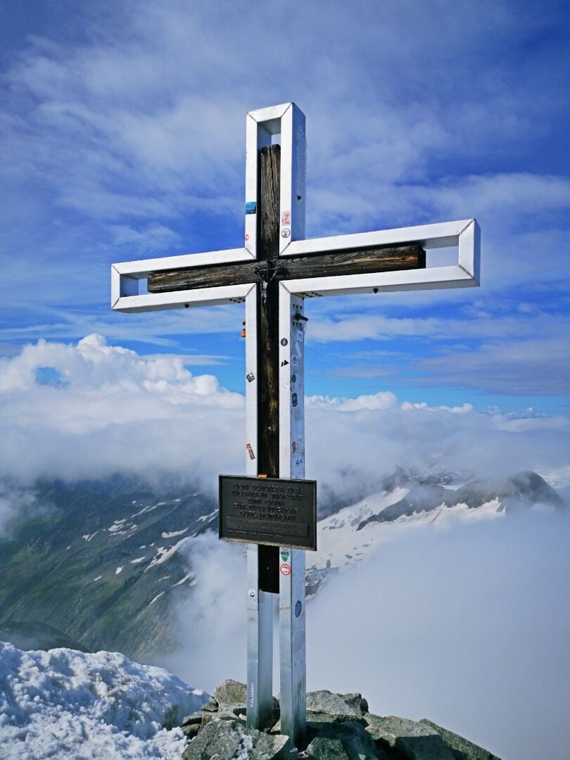
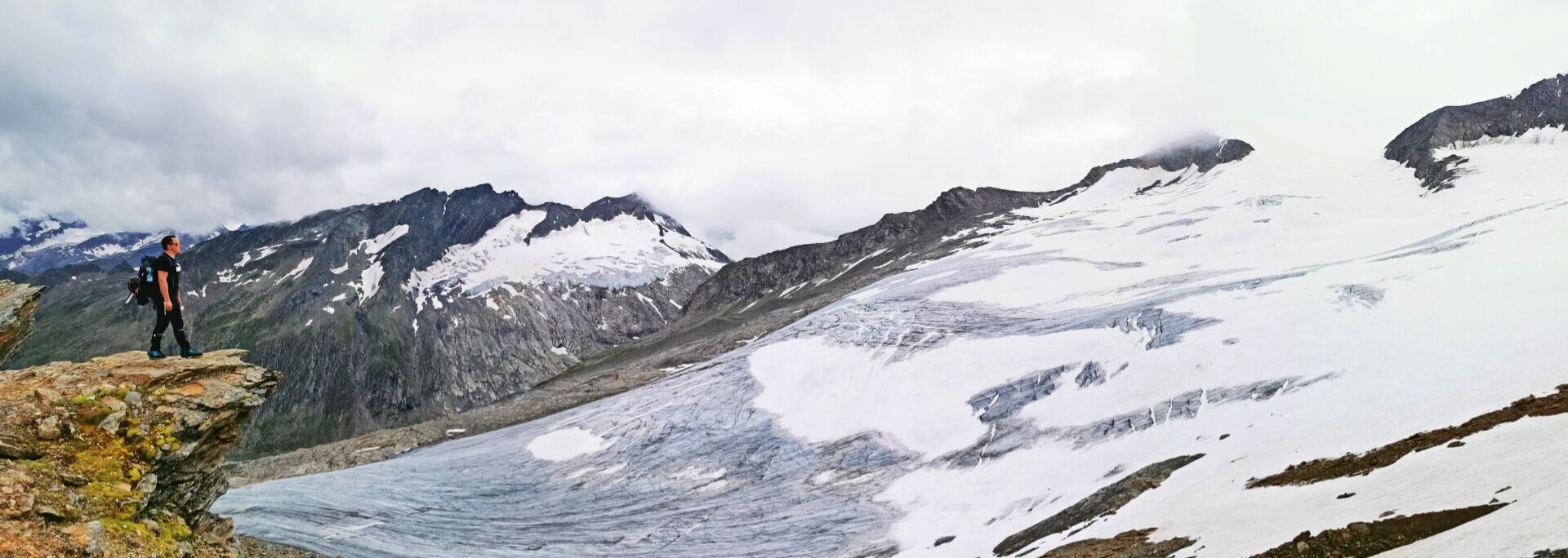
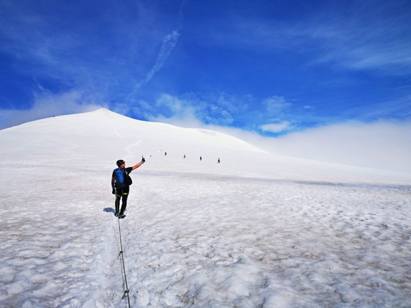
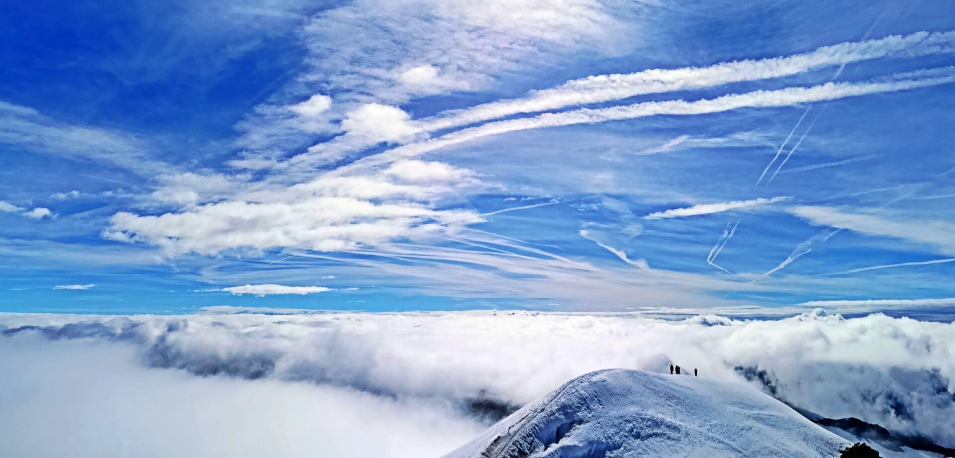
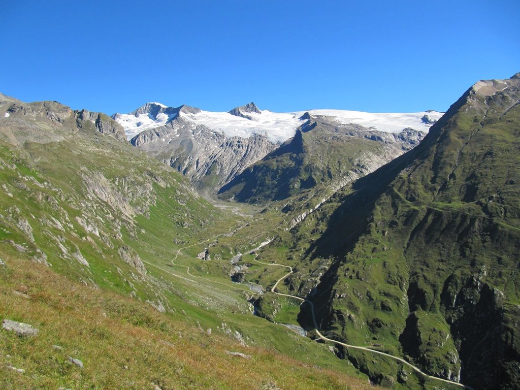
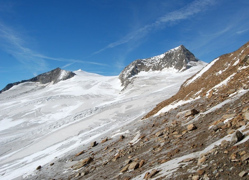
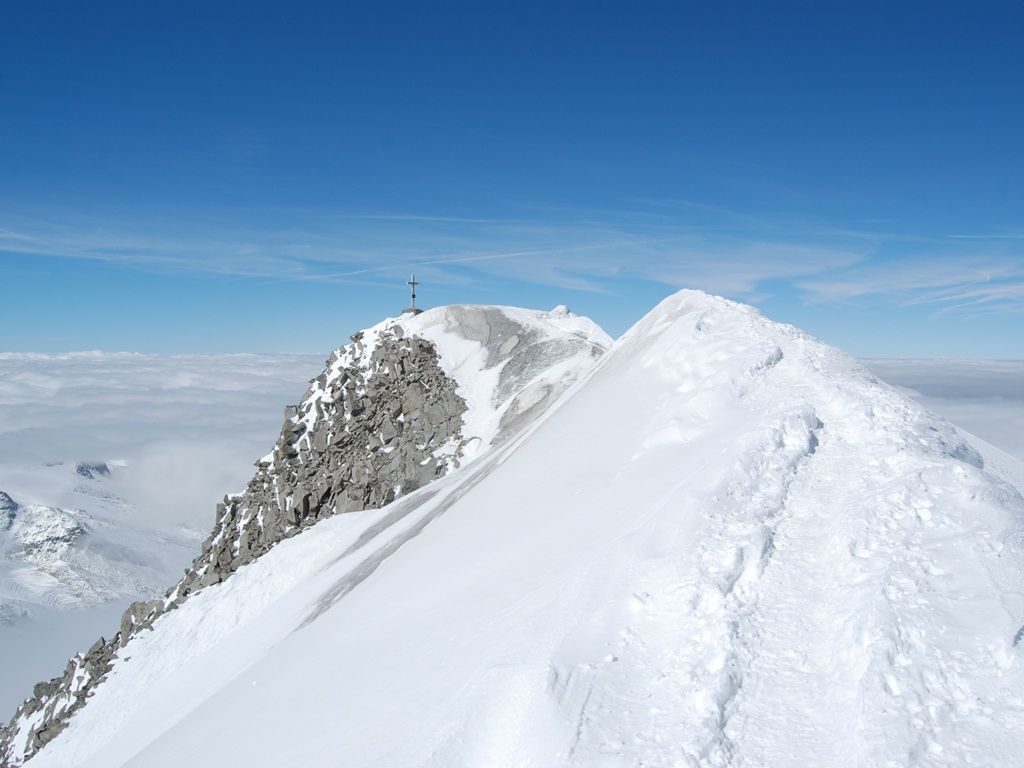
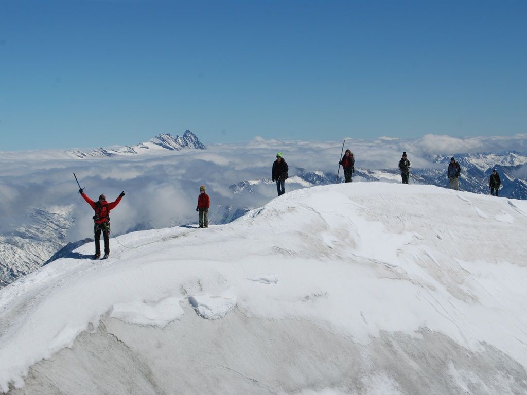
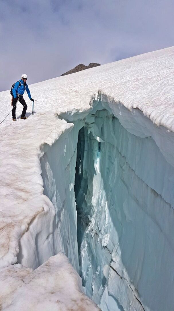
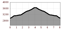
The route begins in Hinterbichl and follows the Alpine cart track to Dorfertal and the Johannis Hütte (2121 m). The taxi shuttle service shortens the ascent. To Defreggerhaus (2964 m) with views up to the shimmering white firn snow of the widely glaciated area. After the Mullwitzaderl (3241 m) the ascent of the glacier begins. Crampons, rope and being accompanied by a mountain guide will provide you with safe passage. The route proceeds via Rainer Törl to the icy summit of the Großvenediger (3666 m). Enjoy a dreamy all-round view across the Hohe Tauern National Park and the surrounding mountains including the Dolomites, the Dachstein mountains and many others. Educational trail (pocket guide available).
The ascent with a mountain guide is highly recommended!

Nearby huts and mountain restaurants

More tours in the surrounding area

  • Lasörling altitude trail

    Difficulty: medium
    Length: 57.0 km Duration: 25:00 h Elevation uphill: 3,740 m
  • Venediger altitude trail

    Difficulty: difficult
    Length: 55.5 km Duration: 27:00 h Elevation uphill: 3,915 m
  • Figerhorn

    Difficulty: difficult
    Length: 6.5 km Duration: 6:00 h Elevation uphill: 807 m
  • Hike to the Venedigerhaus Innergschlöß

    Difficulty: easy
    Length: 8.5 km Duration: 2:30 h Elevation uphill: 180 m
  • Rotenkogel

    Difficulty: difficult
    Length: 3.9 km Duration: 3:00 h Elevation uphill: 383 m
  • Lasörling 3.098m

    Difficulty: difficult
    Length: 21.9 km Duration: 12:00 h Elevation uphill: 1,940 m
  • Umbal waterfalls nature force trail

    Difficulty: easy
    Length: 5.8 km Duration: 2:30 h Elevation uphill: 250 m
  • Muhs panorama trail

    Difficulty: medium
    Length: 15.2 km Duration: 6:00 h Elevation uphill: 1,090 m
  • Hike to Neuen Reichenberger Hütte

    Difficulty: medium
    Length: 9.1 km Duration: 9:00 h Elevation uphill: 1,210 m
  • Hiking tour to Lasörlinghütte 2.350m

    Difficulty: medium
    Length: 14.6 km Duration: 7:10 h Elevation uphill: 1,080 m
  • Badener Hütte

    Difficulty: difficult
    Length: 23.2 km Duration: 11:30 h Elevation uphill: 1,750 m
  • Lucknerhaus - Stüdlhütte

    Difficulty: medium
    Length: 9.3 km Duration: 5:30 h Elevation uphill: 862 m
  • Hike to Kalser Tauernhaus

    Difficulty: medium
    Length: 12.2 km Duration: 4:00 h Elevation uphill: 244 m
  • Hiking tour to Neue Sajathütte 2.600m

    Difficulty: medium
    Length: 10.3 km Duration: 6:50 h Elevation uphill: 1,080 m
  • Böses Weibl

    Difficulty: difficult
    Length: 14.1 km Duration: 8:00 h Elevation uphill: 1,193 m
  • Eagle Walk Stage O1: Ströden - Johannis Hütte

    Difficulty: medium
    Length: 13.0 km Duration: 6:30 h Elevation uphill: 1,430 m
Newsletter

The mountain is calling? So does our newsletter!

In our monthly newsletter we reveal the best holiday tips for Tyrol.