Mountain hikes Hohe Grube 2.700m

Prägraten am Großvenediger / Venedigergruppe
Difficulty ratings: difficult
Route length: 16.1 km
Duration: 7:30 h

Unknown beauty in the Umbaltal valley

Tour information

  • Requirement: difficult
  • Length: 16.1 km
  • Duration: 7:30 h
  • Elevation uphill:1,310 hm
  • Elevation downhill:1,310 hm
Highest point2,700 m

Starting point

Parkplatz Ströden 1.400m

Finishing point

Hohe Grube 2.680m
  • Fitness level 4 / 6
  • Technique 4 / 6

Best time of year

  • January
  • February
  • March
  • April
  • May
  • June
  • July
  • August
  • September
  • October
  • November
  • December

Trail condition

partly pathless terrain - only for experienced hikers!
Source: TVB Osttirol

Description

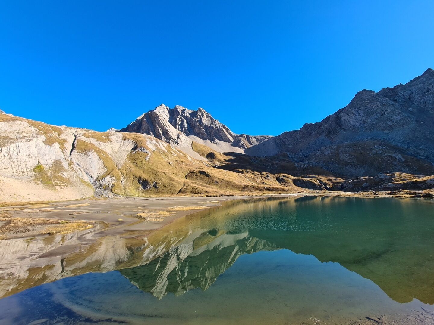
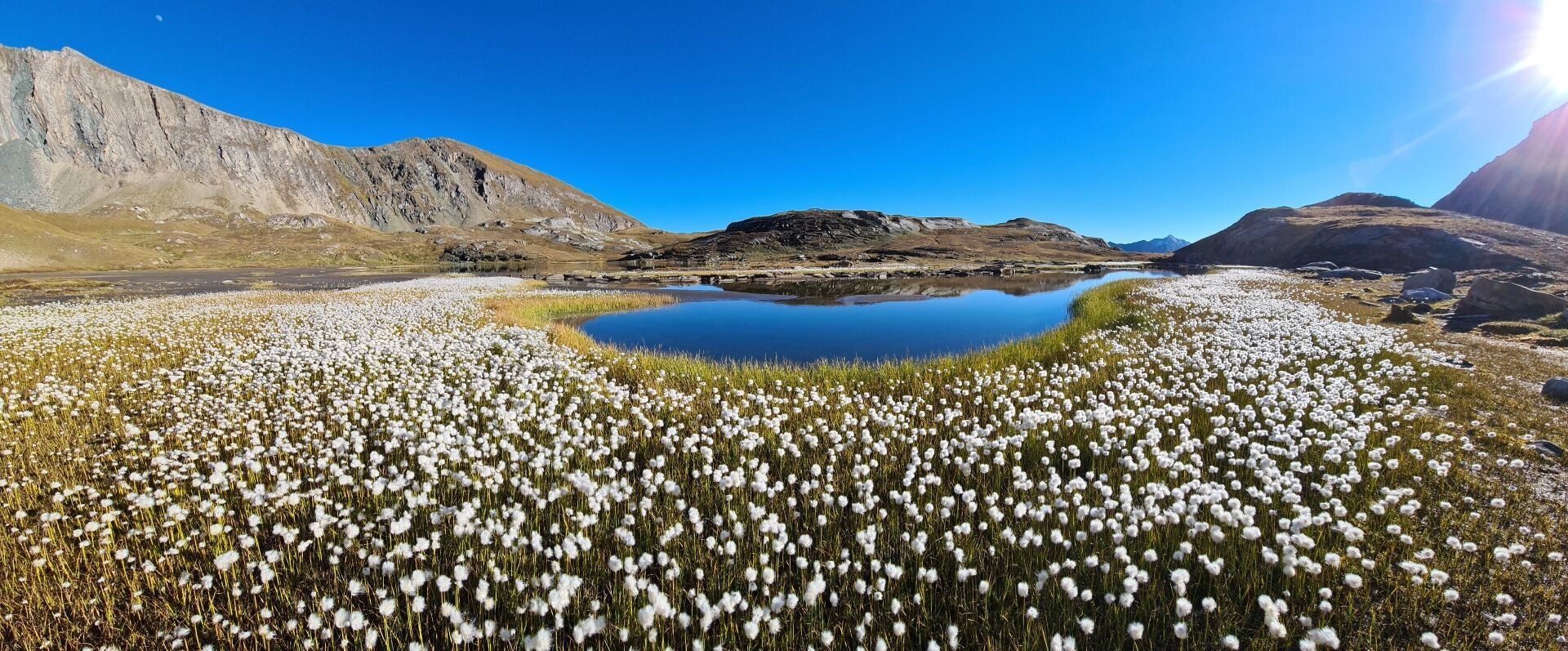
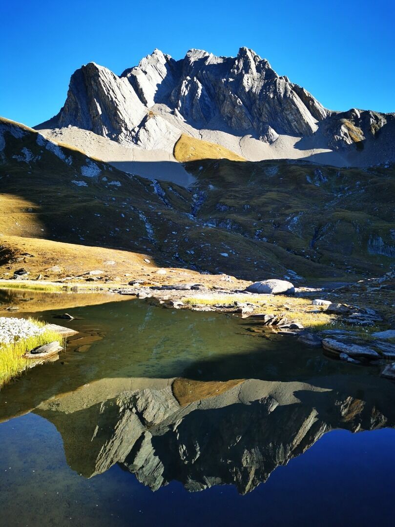
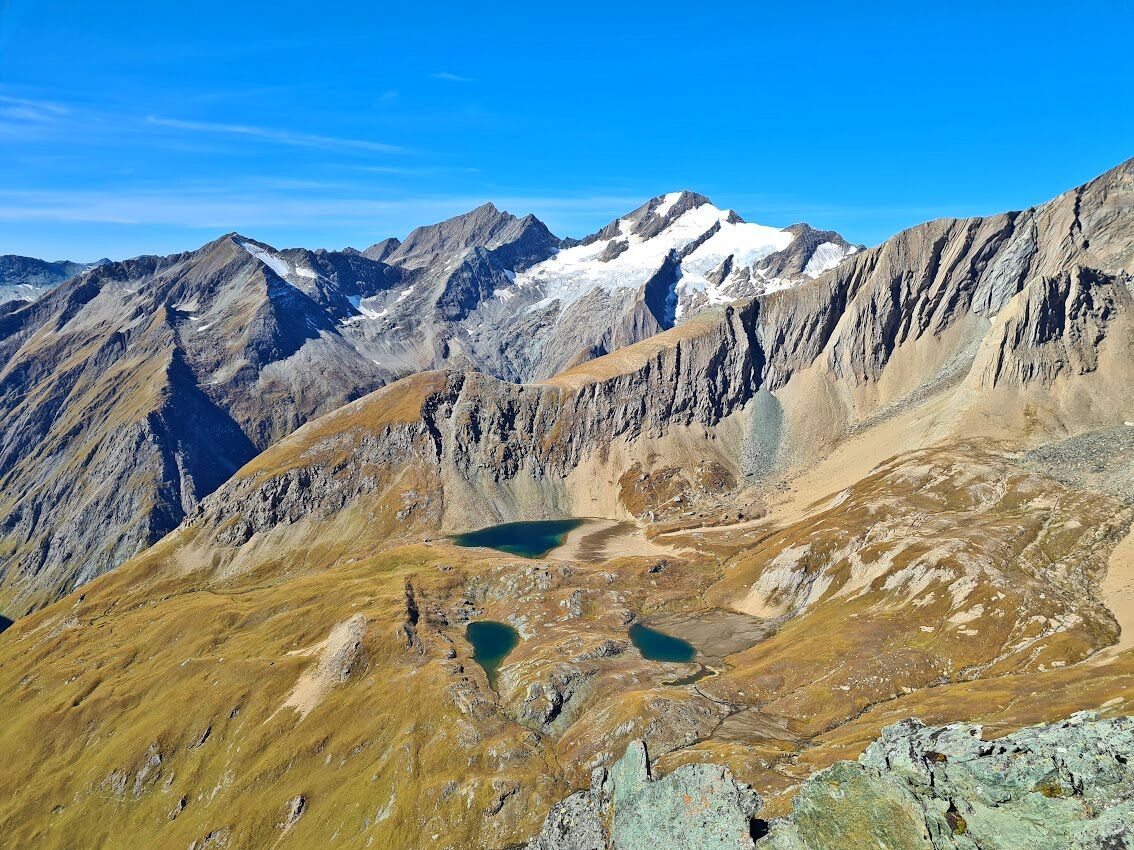
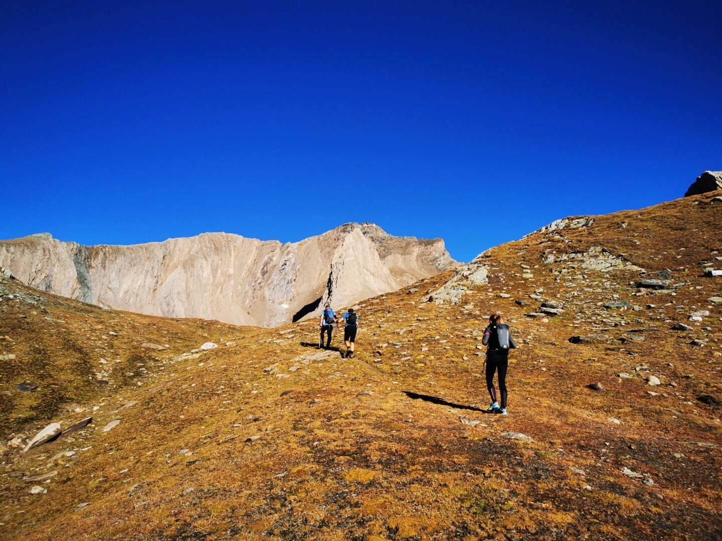
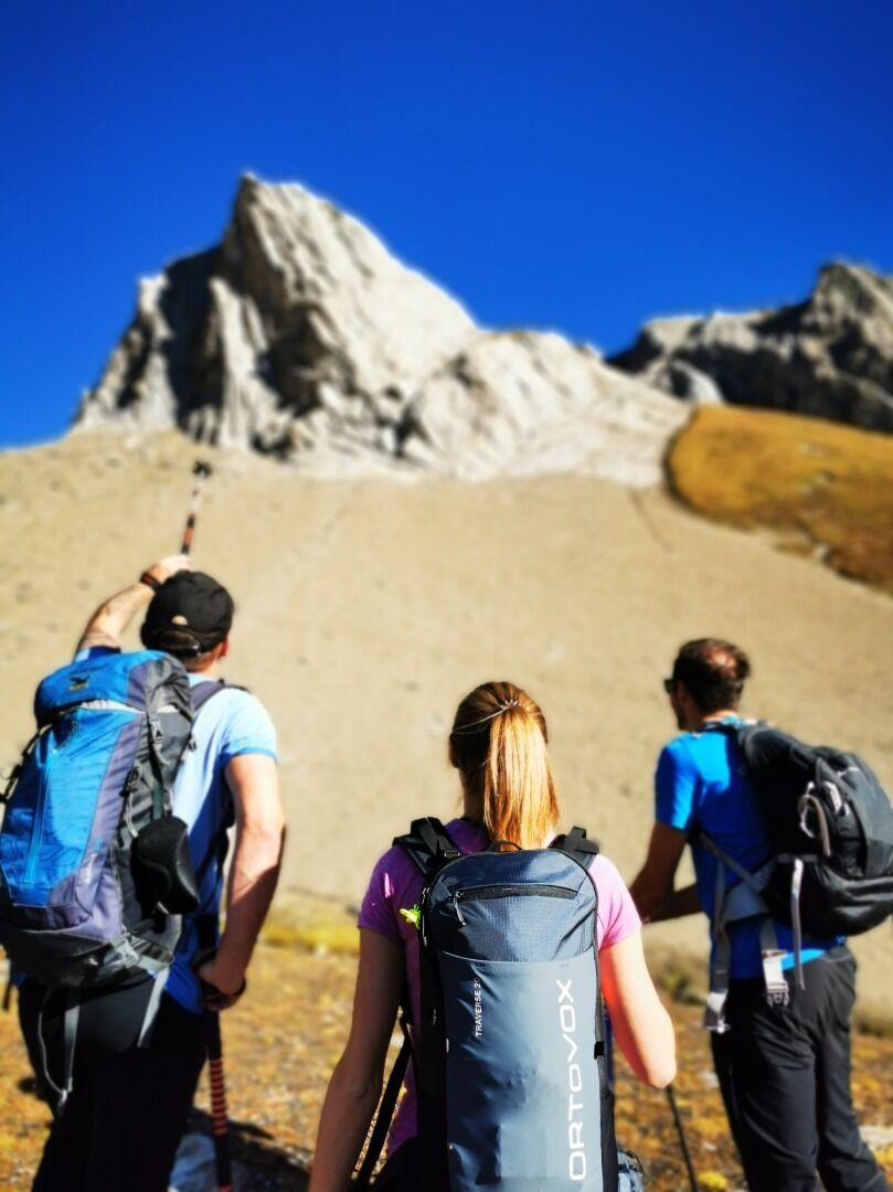
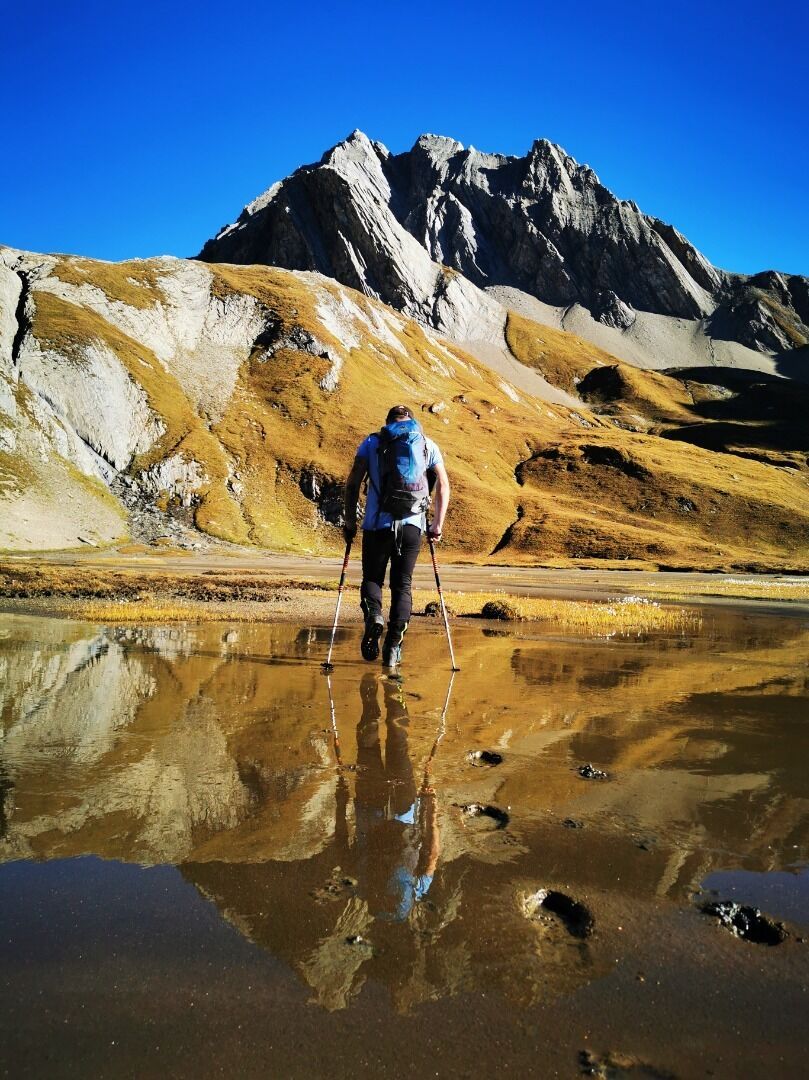
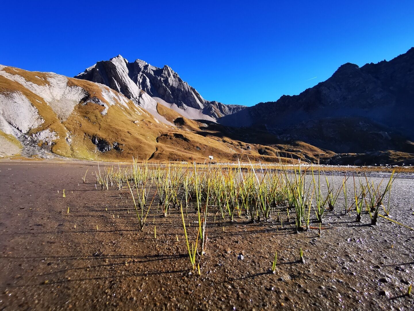
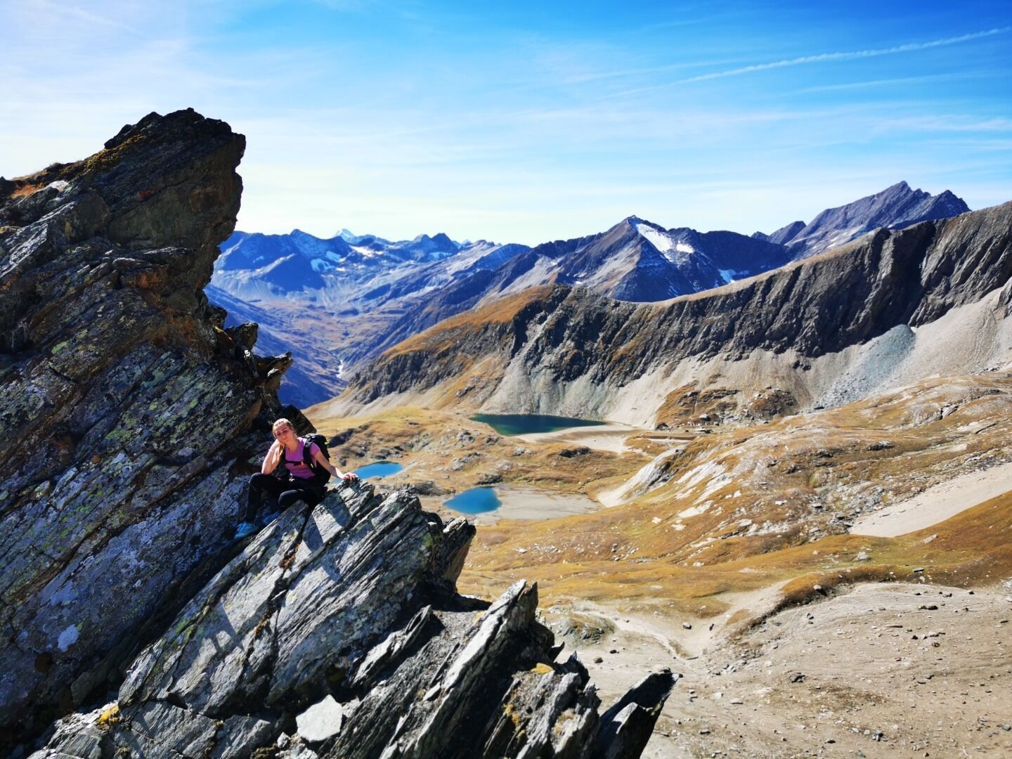
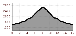
If you are looking for unknown paths and uniquely beautiful mountain lakes, this tour is just right for you. From the car park Ströden, first take the wide gravel path to the Islitzeralm. There past the Umbal falls in the direction of the Clarahütte. Above the Upper Umbal falls you cross the Umbal river and shortly thereafter you turn right, in the direction of Wiesbauerspitze (Mullwitzkogel). From here the path becomes very steep. Absolute concentration is required here and the path should in no case be walked in wet conditions, as the high grass is enormously slippery. In numerous serpentines you quickly gain altitude here. At just under 2,300 meters, you then turn left into trackless terrain. From here it is an alpine route. A slight trace indicates the ascent - if you do not recognize this, it is best to keep to the right of the stream, always going in the direction of Malhamhorn or Quirl. After about 4.5 hours of walking you will reach the rewarding destination - the Hohe Grube also called "Hohe Gruben". From here, further summit tours are possible (Steinbrubenkogel, Ogasilspitze, Hohe Grubenscharte, Quirl (climbing tour). The descent is via the same path, or you cross the Hohe Grubenscharte and descend via the Hochkar to the ascent path.

Nearby huts and mountain restaurants

More tours in the surrounding area

  • Hike to the Venedigerhaus Innergschlöß

    Difficulty:easy
    Length:8.6 kmDuration:2:30 hElevation uphill:184 m
  • Lucknerhaus - Stüdlhütte

    Difficulty:medium
    Length:9.3 kmDuration:5:30 hElevation uphill:862 m
  • Badener Hütte

    Difficulty:difficult
    Length:23.2 kmDuration:11:30 hElevation uphill:1,754 m
  • Theme path "Virgen crossroads"

    Difficulty:easy
    Length:3.2 kmDuration:1:00 hElevation uphill:104 m
  • Lasörling altitude trail

    Difficulty:medium
    Length:57.0 kmDuration:25:00 hElevation uphill:3,740 m
  • Venediger altitude trail

    Difficulty:difficult
    Length:55.5 kmDuration:27:00 hElevation uphill:3,915 m
  • Figerhorn

    Difficulty:difficult
    Length:6.5 kmDuration:6:00 hElevation uphill:807 m
  • Muhs panorama trail

    Difficulty:medium
    Length:15.2 kmDuration:6:00 hElevation uphill:1,090 m
  • Hike to Neuen Reichenberger Hütte

    Difficulty:medium
    Length:18.2 kmDuration:9:00 hElevation uphill:1,252 m
  • Hiking tour to Lasörlinghütte 2.350m

    Difficulty:medium
    Length:14.6 kmDuration:7:10 hElevation uphill:1,080 m
  • Hike to Kalser Tauernhaus

    Difficulty:medium
    Length:12.2 kmDuration:4:00 hElevation uphill:244 m
  • Hiking tour to Neue Sajathütte 2.600m

    Difficulty:medium
    Length:10.3 kmDuration:6:50 hElevation uphill:1,086 m
  • Rotenkogel

    Difficulty:difficult
    Length:3.9 kmDuration:3:00 hElevation uphill:383 m
  • Lasörling 3.098m

    Difficulty:difficult
    Length:21.9 kmDuration:12:00 hElevation uphill:1,940 m
  • Böses Weibl

    Difficulty:difficult
    Length:14.1 kmDuration:8:00 hElevation uphill:1,193 m
  • Umbal waterfalls nature force trail

    Difficulty:easy
    Length:6.0 kmDuration:2:30 hElevation uphill:257 m
  • Rollitour with Swiss Trac

    Difficulty:easy
    Length:3.2 kmDuration:1:30 hElevation uphill:135 m
  • Eagle Walk Stage O1: Ströden - Johannis Hütte

    Difficulty:medium
    Length:13.0 kmDuration:6:30 hElevation uphill:1,430 m
Newsletter

The mountain is calling? So does our newsletter!

In our monthly newsletter we reveal the best holiday tips for Tyrol.