Mountain hikes Blauspitze 2.575 m

Matrei in Osttirol / Granatspitze Group
Difficulty ratings: difficult
Route length: 8.4 km
Duration: 4:20 h

Blauspitze 2.575 m

Tour information

  • Requirement: difficult
  • Length: 8.4 km
  • Duration: 4:20 h
  • Elevation uphill:642 hm
  • Elevation downhill:642 hm
Highest point2,588 m

Starting point

Adler Lounge (2.421m)

Finishing point

Adler Lounge (2.421m)
  • Fitness level 3 / 6
  • Technique 4 / 6

Best time of year

  • January
  • February
  • March
  • April
  • May
  • June
  • July
  • August
  • September
  • October
  • November
  • December

Trail condition

Gravel, hiking trail
Source: TVB Osttirol

Description

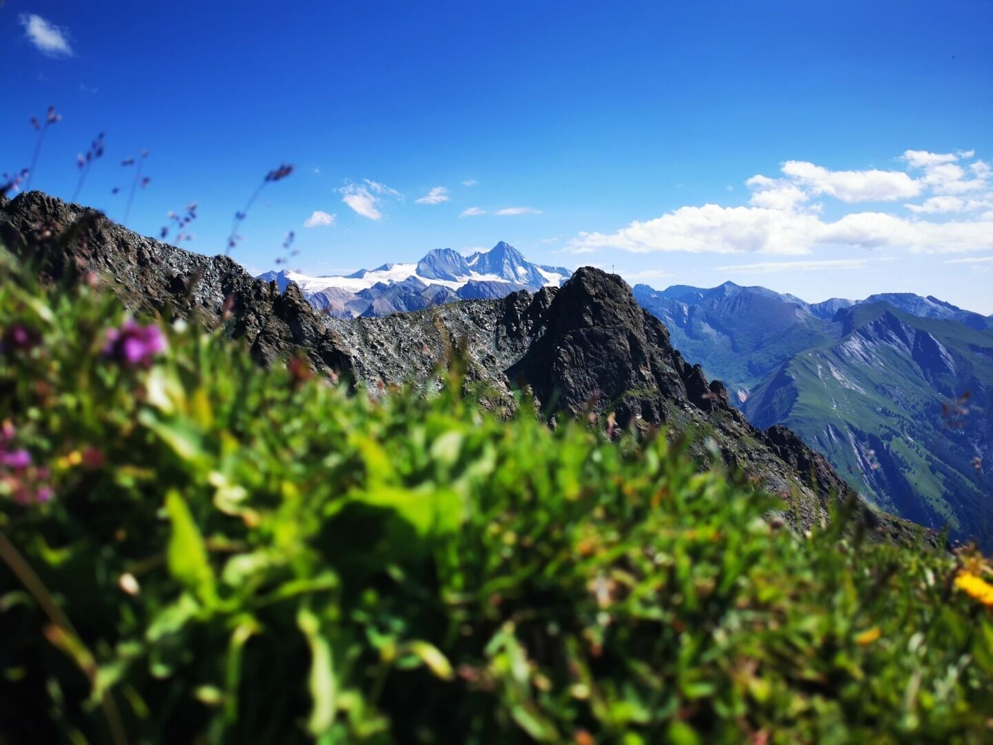
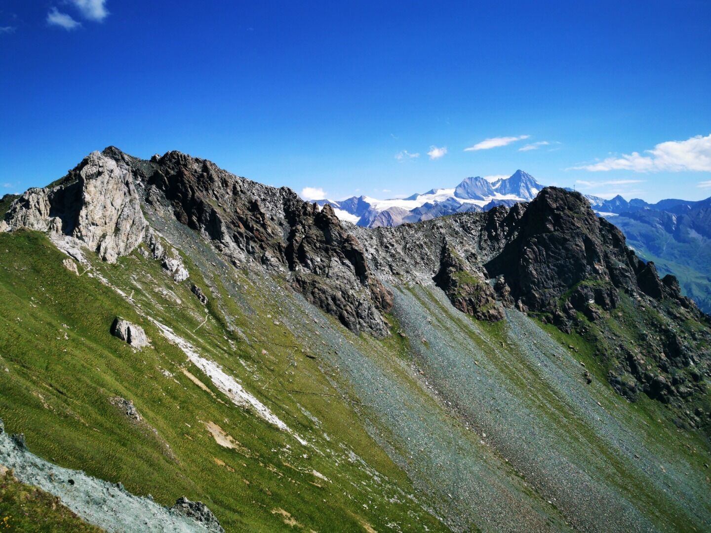
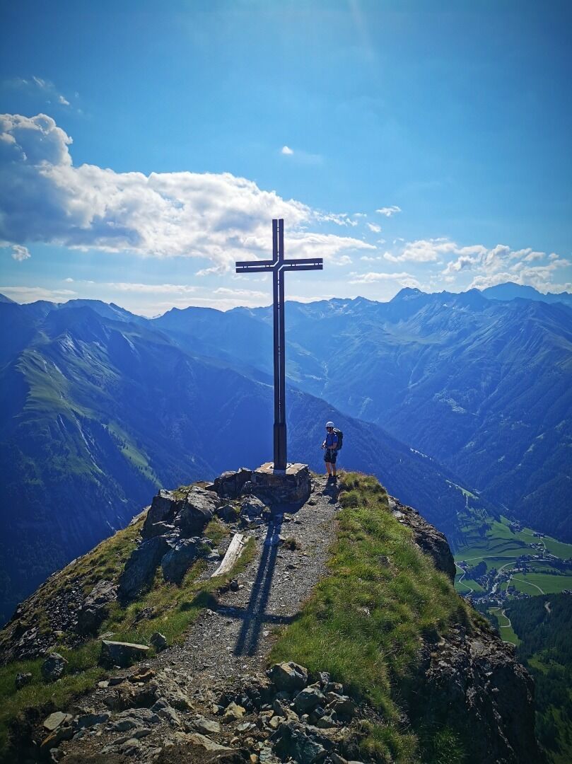
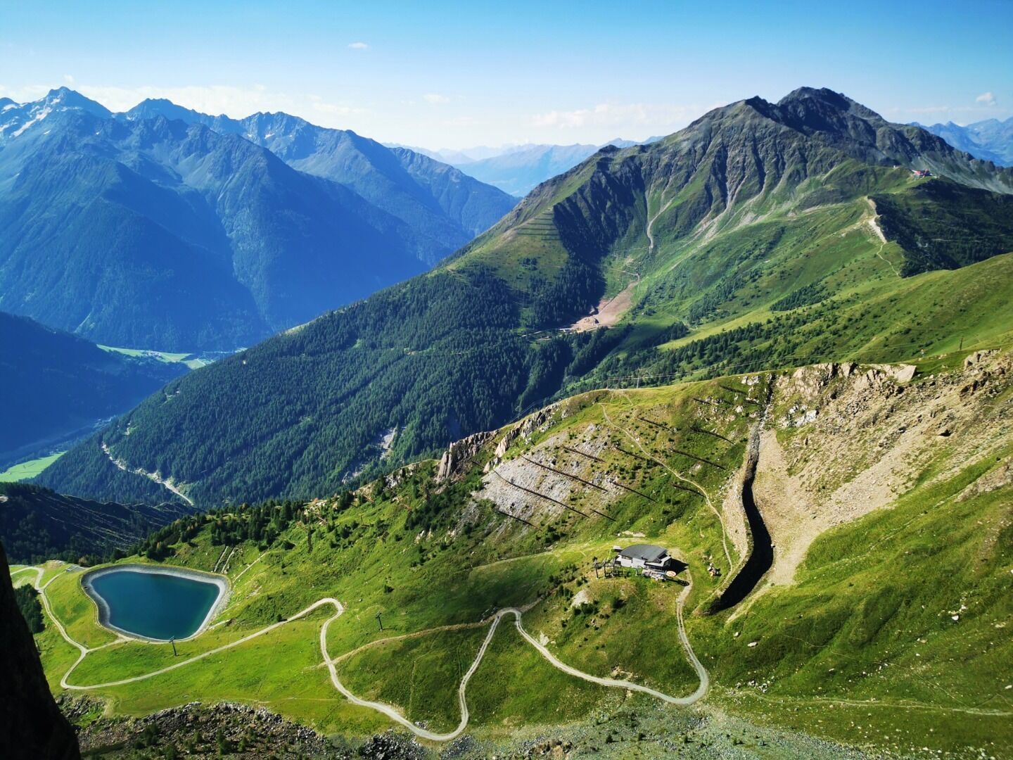
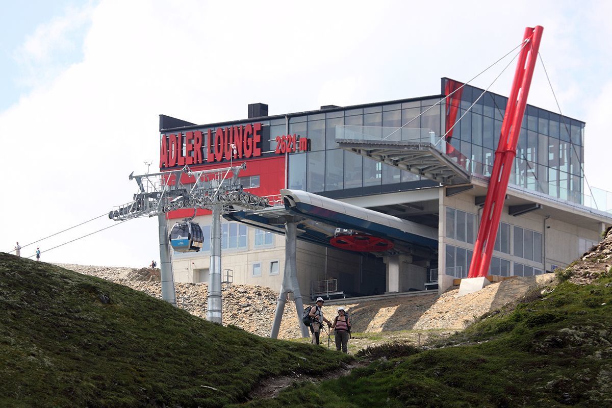
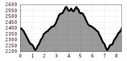
Adlerlounge (2.405m) - Kals-Matreier-Törl (2.207m) - Kalser Höhe (2.434m) - Blauspitze (2.575m)

Ascent with the gondola lift to the Adlerlounge; for experienced hikers- up to the Kalser Höhe an easy hiking trail, from there a marked trail with several rope belays leads in a northerly direction in the direction of "Weißer Knopf" and up to the "Blauspitze" (unconditional requirement of freedom from vertigo and surefootedness!);

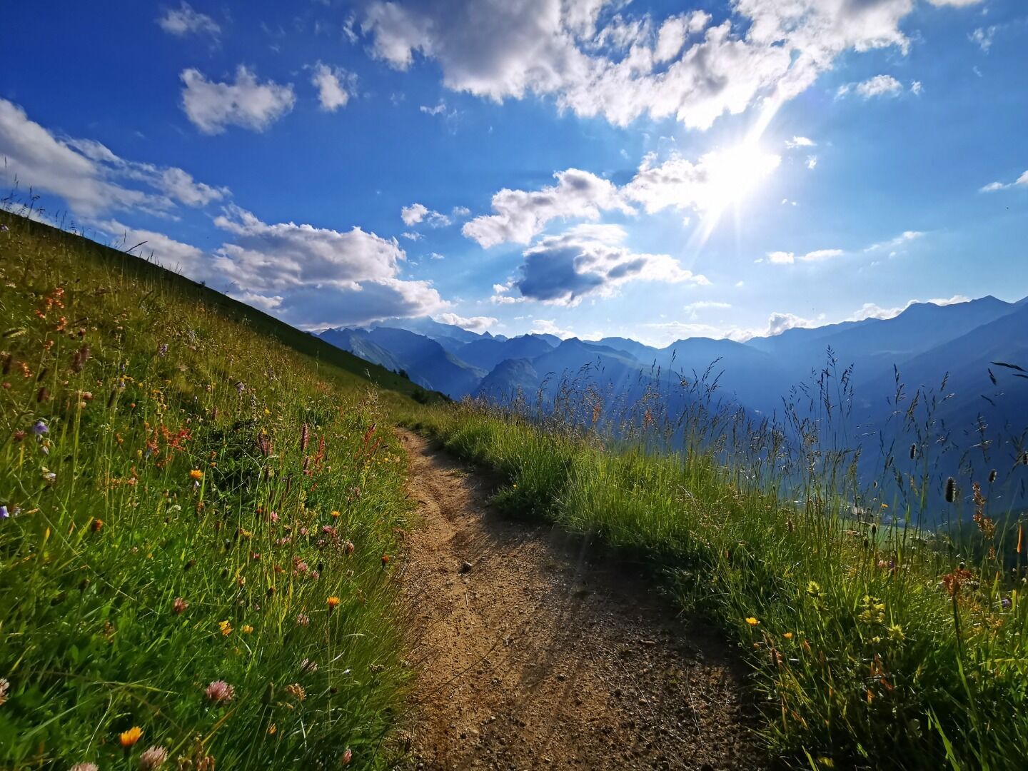
a descent option runs in a northerly direction down to the Aussig-Teplitzerweg (AV 516), in the direction of the Panoramarestaurant Blauspitz, Bergrestaurant Glocknerblick and to Kals/Großdorf - duration of this descent option approx. 2.5 to 3 hours;
beautiful panoramic location, can also be combined as a circular tour, botanically very versatile (herb and flower trail on the descent into the valley).

Nearby huts and mountain restaurants

More tours in the surrounding area

  • Hike to the Venedigerhaus Innergschlöß

    Difficulty:easy
    Length:8.6 kmDuration:2:30 hElevation uphill:184 m
  • Böses Weibl

    Difficulty:difficult
    Length:14.1 kmDuration:8:00 hElevation uphill:1,193 m
  • Rotenkogel

    Difficulty:difficult
    Length:3.9 kmDuration:3:00 hElevation uphill:383 m
  • Glacier trail Innergschlöss/Schlatenkees

    Difficulty:medium
    Length:9.4 kmDuration:4:50 hElevation uphill:680 m
  • Umbal waterfalls nature force trail

    Difficulty:easy
    Length:6.0 kmDuration:2:30 hElevation uphill:257 m
  • Hiking tour to Lasörlinghütte 2.350m

    Difficulty:medium
    Length:14.6 kmDuration:7:50 hElevation uphill:1,135 m
  • Badener Hütte

    Difficulty:difficult
    Length:23.2 kmDuration:12:00 hElevation uphill:1,754 m
  • Hiking tour to St. Pöltner Hütte and 3 lakes

    Difficulty:difficult
    Length:14.8 kmDuration:7:40 hElevation uphill:1,119 m
  • Hike to Neuen Reichenberger Hütte

    Difficulty:medium
    Length:18.2 kmDuration:9:00 hElevation uphill:1,252 m
  • Hiking tour to Zupalsee Hütte 2.350m

    Difficulty:medium
    Length:14.9 kmDuration:8:30 hElevation uphill:1,261 m
  • Hike to Kalser Tauernhaus

    Difficulty:medium
    Length:12.2 kmDuration:4:00 hElevation uphill:244 m
  • Hiking tour to Neue Sajathütte 2.600m

    Difficulty:medium
    Length:10.3 kmDuration:6:50 hElevation uphill:1,086 m
  • Lucknerhaus - Stüdlhütte

    Difficulty:medium
    Length:9.3 kmDuration:4:30 hElevation uphill:862 m
  • Figerhorn

    Difficulty:difficult
    Length:6.5 kmDuration:6:00 hElevation uphill:807 m
  • Lasörling altitude trail

    Difficulty:medium
    Length:57.0 kmDuration:25:00 hElevation uphill:3,740 m
  • Venediger altitude trail

    Difficulty:difficult
    Length:55.5 kmDuration:27:00 hElevation uphill:3,915 m
  • Theme path "Virgen crossroads"

    Difficulty:easy
    Length:3.2 kmDuration:1:00 hElevation uphill:104 m
  • Muhs panorama trail

    Difficulty:medium
    Length:15.2 kmDuration:6:00 hElevation uphill:1,090 m
Newsletter

The mountain is calling? So does our newsletter!

In our monthly newsletter we reveal the best holiday tips for Tyrol.