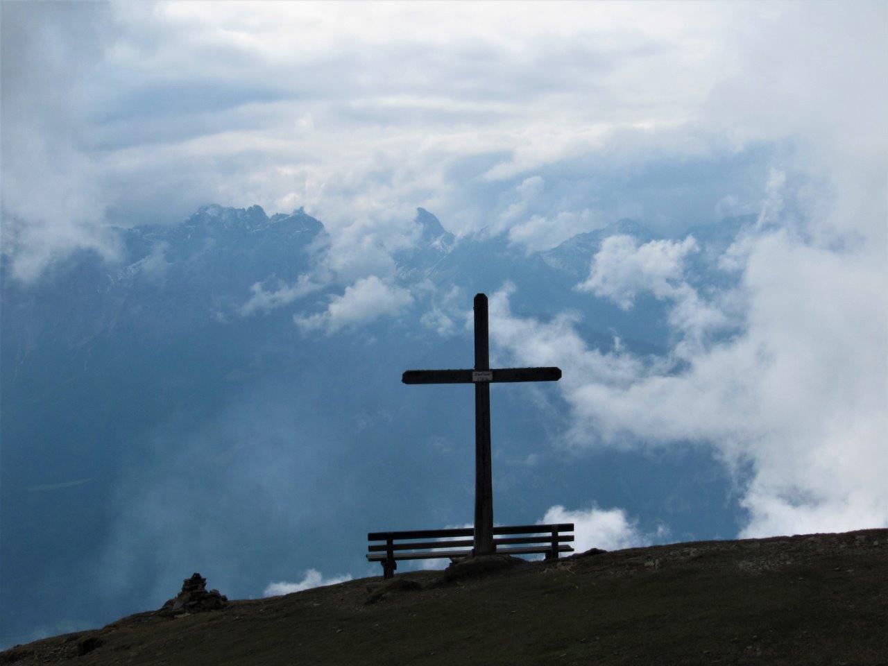
Mountain hikes Steinermandl via Rotmannalm

Gaimberg / Schober Group
Difficulty ratings: easy
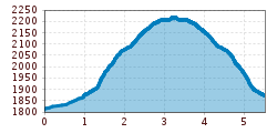
Route length: 5.5 km
Duration: 2:00 h

Steinermandl via Rotmannalm

Tour information

  • Requirement: easy
  • Length: 5.5 km
  • Duration: 2:00 h
  • Elevation uphill:400 hm
  • Elevation downhill:340 hm
Highest point2,220 m

Starting point

trail station, Bergstation der Einseilumlaufbahn Zettersfeld

Finishing point

hut, Rotmannalm
  • Fitness level 2 / 6
  • Technique 1 / 6

Best time of year

  • January
  • February
  • March
  • April
  • May
  • June
  • July
  • August
  • September
  • October
  • November
  • December
Source: TVB Osttirol

Description

Where Helenental Alpine Road comes to its peak near Zettersfeld (20 minutes northwest of the ropeway’s upper terminal), a path leads across mountain pastures to Rotmannalm, 5 minutes. On the western edge of Zettersfeld, a highly frequented path leads upwards. Where wind railings hold back the snow on a stage of slope in winter, we are already close to artificial Lake Lackenbodensee on 2080 metres above sea level, 40 minutes. The lake reflects the Schleinitz in summer and feeds the snow making machines in winter. It just takes a last little ascent to visit the Steinermandl in the northeast and north of Schoberköpfl (tow lift).

Getting here

  • Arrival by public transport

    Mit dem Bus bis zur Bushaltestelle "Gaimberg Zettersfeldbahn" und dann mit der Gondel hinauf fahren.

  • Parking

    Parkplatz Talstation Zettersfeldbahn

Weather

Today

light rain showers
19°C/4°C
70%4.5l5 km/h

Fri

clear sky
20°C/4°C
0%0l5 km/h

Sat

clear sky
21°C/4°C
0%0l5 km/h

More tours in the surrounding area

  • Lasörling altitude trail

    Difficulty:medium
    Length:55.4 kmDuration:25:00 hElevation uphill:3,718 m
  • Venediger altitude trail

    Difficulty:difficult
    Length:55.5 kmDuration:27:00 hElevation uphill:3,975 m
  • Theme path "Virgen crossroads"

    Difficulty:easy
    Length:3.2 kmDuration:1:00 hElevation uphill:104 m
  • Figerhorn

    Difficulty:difficult
    Length:6.6 kmDuration:6:00 hElevation uphill:811 m
  • Muhs panorama trail

    Difficulty:medium
    Length:15.2 kmDuration:6:00 hElevation uphill:1,090 m
  • Herz-Ass Villgratental

    Difficulty:medium
    Length:75.6 kmDuration:34:00 hElevation uphill:5,703 m
  • Lasörling 3.098m

    Difficulty:difficult
    Length:22.0 kmDuration:12:00 hElevation uphill:1,940 m
  • Circular walk church St. Nikolaus

    Difficulty:easy
    Length:5.4 kmDuration:1:39 hElevation uphill:150 m
  • Iseltrail

    Difficulty:medium
    Length:75.3 kmDuration:24:30 hElevation uphill:2,347 m
  • Badener Hütte

    Difficulty:difficult
    Length:23.2 kmDuration:12:00 hElevation uphill:1,754 m
  • Lucknerhaus - Stüdlhütte

    Difficulty:medium
    Length:9.3 kmDuration:4:30 hElevation uphill:862 m
  • Hiking tour to St. Pöltner Hütte and 3 lakes

    Difficulty:difficult
    Length:14.8 kmDuration:7:40 hElevation uphill:1,119 m
  • Trail Virgentaler Sonnseitenweg

    Difficulty:medium
    Length:41.9 kmDuration:19:00 hElevation uphill:2,641 m
  • Hike to Kalser Tauernhaus

    Difficulty:medium
    Length:12.2 kmDuration:4:00 hElevation uphill:244 m
  • Hiking tour to Neue Sajathütte 2.600m

    Difficulty:medium
    Length:10.3 kmDuration:6:50 hElevation uphill:1,086 m
  • The Höfe Trail

    Difficulty:easy
    Length:51.2 kmDuration:10:15 hElevation uphill:1,988 m
  • Hike to Neuen Reichenberger Hütte

    Difficulty:medium
    Length:18.2 kmDuration:9:00 hElevation uphill:1,252 m
  • Hiking tour to Lasörlinghütte 2.350m

    Difficulty:medium
    Length:14.6 kmDuration:7:50 hElevation uphill:1,135 m
Newsletter

The mountain is calling? So does our newsletter!

In our monthly newsletter we reveal the best holiday tips for Tyrol.