Mountain hikes Circular hike Bretterwandbach

Matrei in Osttirol / Granatspitze Group
Difficulty ratings: medium
Route length: 12.2 km
Duration: 5:40 h

Circular hike Bretterwandbach

Tour information

  • Requirement: medium
  • Length: 12.2 km
  • Duration: 5:40 h
  • Elevation uphill:800 hm
  • Elevation downhill:800 hm
Highest point1,754 m

Starting point

Matrei i. O. Center 960m

Finishing point

Matrei i. O. Center 960m
  • Fitness level 4 / 6
  • Technique 3 / 6

Features

  • Circular route

Best time of year

  • January
  • February
  • March
  • April
  • May
  • June
  • July
  • August
  • September
  • October
  • November
  • December

Trail condition

Trail, forest path

Equipment

Hiking equipment
Source: TVB Osttirol

Description

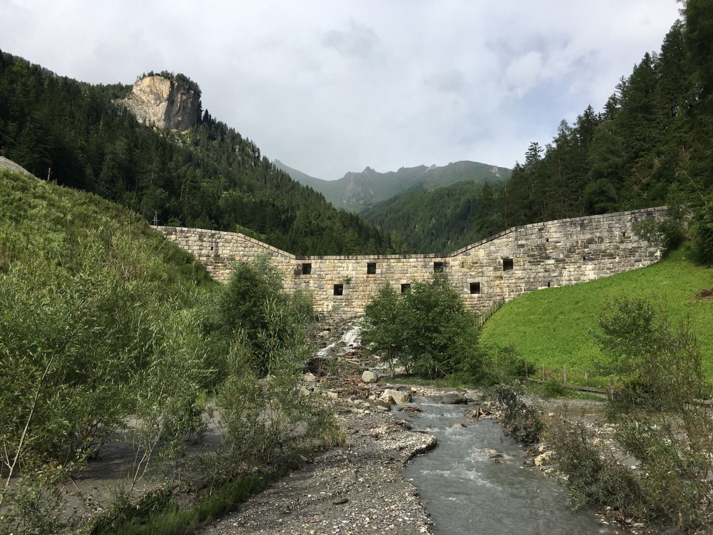
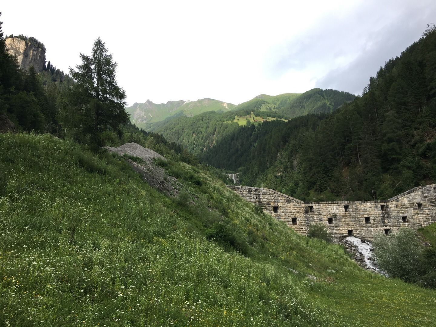
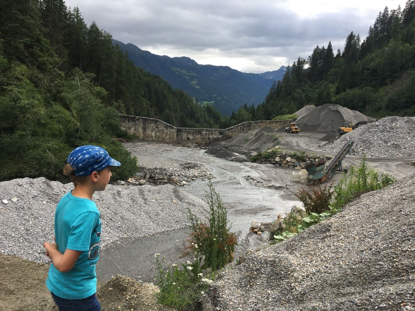
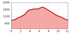
The torrent hike starts in the centre of Matrei in Osttirol and hike up between the walls of the stream Bretterwandbach. Follow the path across the curling rink to the level of the chapel Bach Kirchl and cross the bridge. Follow the ditch path, always along the orographic (flow direction) right bank of the stream Bretterwandbach. You will pass numerous torrent obstructions, such as the imposing Kalkofensperre.

Take the turnoff to the district Preßlab. The steep trail leads you to the highest district of Matrei in Osttirol, called Preßlab. Follow the wide path over Lichtegg until reaching the hiking trail Goldriedriese. 15 minutes uphill, the huts Jagatee Stub'n and Kuenzer Alm invite you to take a break. Via the Goldriedriese and Innerklaunz you will find your way back to Matrei in Osttirol.

Nearby huts and mountain restaurants

Getting here

  • Arrival by public transport

    Matrei i. O. Mittelschule

  • Parking

    Matrei in Osttirol Kirchplatz

More tours in the surrounding area

  • Hike to the Venedigerhaus Innergschlöß

    Difficulty:easy
    Length:8.6 kmDuration:2:30 hElevation uphill:184 m
  • Böses Weibl

    Difficulty:difficult
    Length:14.1 kmDuration:8:00 hElevation uphill:1,193 m
  • Rotenkogel

    Difficulty:difficult
    Length:3.9 kmDuration:3:00 hElevation uphill:383 m
  • Glacier trail Innergschlöss/Schlatenkees

    Difficulty:medium
    Length:9.4 kmDuration:4:50 hElevation uphill:680 m
  • Umbal waterfalls nature force trail

    Difficulty:easy
    Length:6.0 kmDuration:2:30 hElevation uphill:257 m
  • Hiking tour to Lasörlinghütte 2.350m

    Difficulty:medium
    Length:14.6 kmDuration:7:50 hElevation uphill:1,135 m
  • Badener Hütte

    Difficulty:difficult
    Length:23.2 kmDuration:12:00 hElevation uphill:1,754 m
  • Hiking tour to St. Pöltner Hütte and 3 lakes

    Difficulty:difficult
    Length:14.8 kmDuration:7:40 hElevation uphill:1,119 m
  • Hike to Neuen Reichenberger Hütte

    Difficulty:medium
    Length:18.2 kmDuration:9:00 hElevation uphill:1,252 m
  • Hiking tour to Zupalsee Hütte 2.350m

    Difficulty:medium
    Length:14.9 kmDuration:8:30 hElevation uphill:1,261 m
  • Hike to Kalser Tauernhaus

    Difficulty:medium
    Length:12.2 kmDuration:4:00 hElevation uphill:244 m
  • Hiking tour to Neue Sajathütte 2.600m

    Difficulty:medium
    Length:10.3 kmDuration:6:50 hElevation uphill:1,086 m
  • Lucknerhaus - Stüdlhütte

    Difficulty:medium
    Length:9.3 kmDuration:4:30 hElevation uphill:862 m
  • Figerhorn

    Difficulty:difficult
    Length:6.5 kmDuration:6:00 hElevation uphill:807 m
  • Lasörling altitude trail

    Difficulty:medium
    Length:57.0 kmDuration:25:00 hElevation uphill:3,740 m
  • Venediger altitude trail

    Difficulty:difficult
    Length:55.5 kmDuration:27:00 hElevation uphill:3,915 m
  • Theme path "Virgen crossroads"

    Difficulty:easy
    Length:3.2 kmDuration:1:00 hElevation uphill:104 m
  • Muhs panorama trail

    Difficulty:medium
    Length:15.2 kmDuration:6:00 hElevation uphill:1,090 m
Newsletter

The mountain is calling? So does our newsletter!

In our monthly newsletter we reveal the best holiday tips for Tyrol.