Mountain hikes Themed path "Albin-Egger-Lienz trail"
Lienz / Schober Group
Difficulty ratings: easy
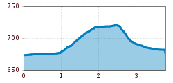
Route length: 3.9 km
Duration: 2:00 h

Themed path "Albin-Egger-Lienz trail"

Tour information

  • Requirement: easy
  • Length: 3.9 km
  • Duration: 2:00 h
  • Elevation uphill:50 hm
  • Elevation downhill:40 hm
Highest point720 m

Starting point

Chapel of St. Anthony

Finishing point

Bruck castle
  • Fitness level 1 / 6
  • Technique 1 / 6

Features

  • Suitable for families
  • suitable for pushchairs

Best time of year

  • January
  • February
  • March
  • April
  • May
  • June
  • July
  • August
  • September
  • October
  • November
  • December

Equipment

Basic equipmentformountainhikingincludessturdy hiking bootswith a goodtread, a 30-35 literbackpack, and functionalclothingbased on thelayeringprinciple, includingsufficient spare clothes. Essential itemsare rain, cold, and sunprotection, adequatefluids and food, aswellas a first-aid kit and a charged mobile phone. A mapor a GPS devicesupportsorientation. 

The informationservesas a guideline and does not claimtobe exhaustive. Equipment mustalwaysbeadaptedtothe planned route, weatherconditions, season, naturalhazards, environmental influences, and personal needs. 


Source: TVB Osttirol

Description

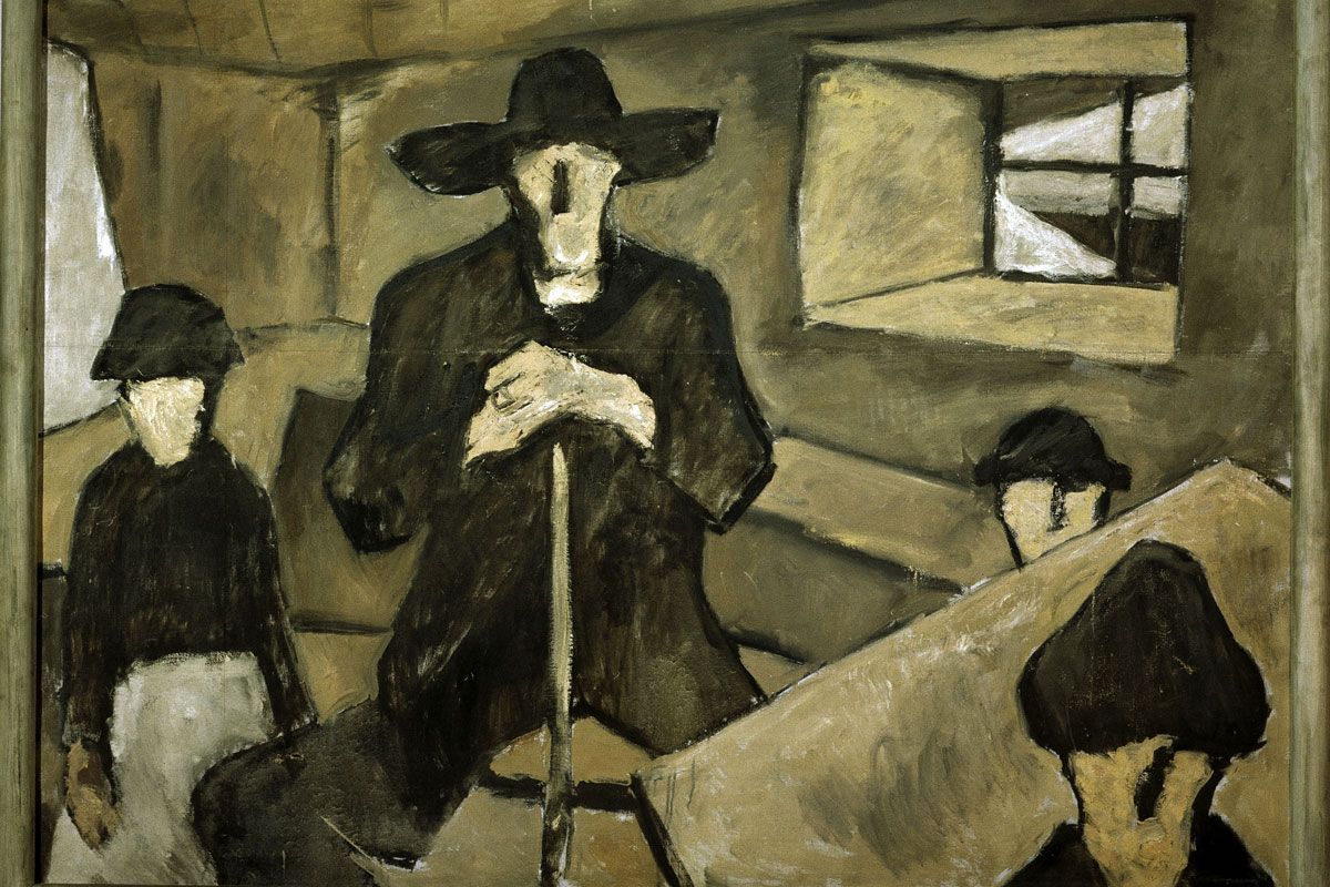
Set up to remember the 75h anniversary of the death of great Austrian painter Albin-Egger-Lienz (1868-1926) this themed trail stops at points which are of significance to the artist. Albin Egger was entrusted with completing the artwork for the war memorial chapel (St. Andrä church). This location is also the final resting place of the famous painter.

Getting here

  • Arrival by public transport

    Alle Busse führen zum Bahnhof Lienz.

  • Parking

    Neben der Tirolerstraße befindet sich der Parkplatz am Bahnhof.
    Parkplatz ÖBB Ladestraße (Bahnhof)

Weather

Today

light rain showers
17°C/9°C
65%3.8l5 km/h

Sun

mainly clear
17°C/8°C
40%1l5 km/h

Mon

mainly clear
18°C/6°C
10%0.5l5 km/h
Go to weather forecast

More tours in the surrounding area

  • Lasörling altitude trail

    Difficulty:medium
    Length:55.4 kmDuration:25:00 hElevation uphill:3,718 m
  • Venediger altitude trail

    Difficulty:difficult
    Length:55.5 kmDuration:27:00 hElevation uphill:3,975 m
  • Theme path "Virgen crossroads"

    Difficulty:easy
    Length:3.2 kmDuration:1:00 hElevation uphill:104 m
  • Figerhorn

    Difficulty:difficult
    Length:6.6 kmDuration:6:00 hElevation uphill:811 m
  • Muhs panorama trail

    Difficulty:medium
    Length:15.2 kmDuration:6:00 hElevation uphill:1,090 m
  • Herz-Ass Villgratental

    Difficulty:medium
    Length:75.6 kmDuration:34:00 hElevation uphill:5,703 m
  • Glödis via ferrata route

    Opening hours:open
    Difficulty:B
    Duration:1:00 hDuration:4:00 hElevation difference:230 m
  • Children's mile Golzentipp

    Difficulty:easy
    Length:3.7 kmDuration:2:00 hElevation uphill:140 m
  • Böses Weibele

    Difficulty:easy
    Length:10.0 kmDuration:4:00 hElevation uphill:545 m
  • Iseltrail

    Difficulty:medium
    Length:75.3 kmDuration:24:30 hElevation uphill:2,347 m
  • Badener Hütte

    Difficulty:difficult
    Length:23.2 kmDuration:12:00 hElevation uphill:1,754 m
  • Lucknerhaus - Stüdlhütte

    Difficulty:medium
    Length:9.3 kmDuration:4:30 hElevation uphill:862 m
  • Hiking tour to St. Pöltner Hütte and 3 lakes

    Difficulty:difficult
    Length:14.8 kmDuration:7:40 hElevation uphill:1,119 m
  • Trail Virgentaler Sonnseitenweg

    Difficulty:medium
    Length:41.9 kmDuration:1 dayElevation uphill:2,641 m
  • Hike to Kalser Tauernhaus

    Difficulty:medium
    Length:12.2 kmDuration:4:00 hElevation uphill:244 m
  • Hiking tour to Neue Sajathütte 2.600m

    Difficulty:medium
    Length:10.3 kmDuration:6:50 hElevation uphill:1,086 m
Newsletter

The mountain is calling? So does our newsletter!

In our monthly newsletter we reveal the best holiday tips for Tyrol.