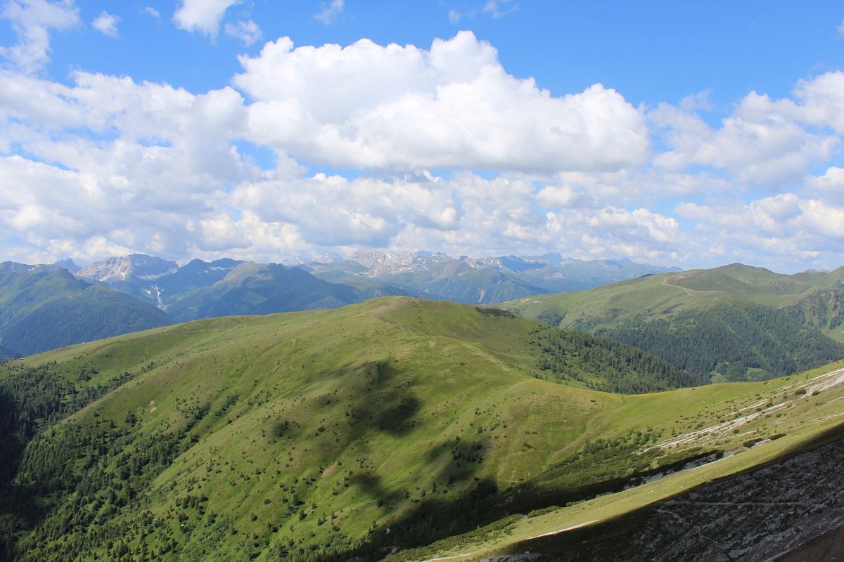
Open interactive mapOpen this POI on the interactive mapElevation profiledownloadThe Gailtal altitude trail Stage 2.gpx
Stage1Höfe_Trail_2022-215@Peter Maier (2).jpg © Peter Maier Höfe Trail stage 1: Sillian - KartitschOpening hours:closedDifficulty:easyLength:11.7 kmDuration:3:00 hElevation uphill:551 mSee trailSee trail: Höfe Trail stage 1: Sillian - Kartitsch
Weg Peischlachtörl_So_LinderMichael.jpg © Michael Linder Böses WeiblDifficulty:difficultLength:14.1 kmDuration:8:00 hElevation uphill:1,193 mSee trailSee trail: Böses Weibl
Schwarzsee am Schmugglersteig © Schwarzsee Lake SchwarzseeDifficulty:mediumLength:7.8 kmDuration:3:30 hElevation uphill:790 mSee trailSee trail: Lake Schwarzsee
rotenkogel-sonnenaufgang-c-konrad-klaunzer.JPG © Konrad Klaunzer RotenkogelDifficulty:difficultLength:3.9 kmDuration:3:00 hElevation uphill:383 mSee trailSee trail: Rotenkogel
Blick auf Rote und Weiße Spitze © TVB Osttirol Rote Spitze 2,956 mDifficulty:mediumLength:10.2 kmDuration:5:30 hElevation uphill:1,260 mSee trailSee trail: Rote Spitze 2,956 m
Karlsbader Hütte am Laserzsee © TVB Osttirol / Leischner Hike to Karlsbader Hütte 2.260m (via Rudi-Eller-Weg)Difficulty:mediumLength:10.8 kmDuration:4:00 hElevation uphill:780 mSee trailSee trail: Hike to Karlsbader Hütte 2.260m (via Rudi-Eller-Weg)
Gipfelkreuz am Dorfberg © I. Bodner DorfbergDifficulty:mediumLength:17.6 kmDuration:5:30 hElevation uphill:770 mSee trailSee trail: Dorfberg
Obstansersee Hütte – PfannspitzeDifficulty:mediumLength:14.4 kmDuration:6:30 hElevation uphill:1,250 mSee trailSee trail: Obstansersee Hütte – Pfannspitze
Gölbnerblick hut via the new waterfall path CelarDifficulty:mediumLength:4.2 kmDuration:1:30 hElevation uphill:290 mSee trailSee trail: Gölbnerblick hut via the new waterfall path Celar
Oberstalleralm im Herbst © Elias Bachmann OberstalleralmDifficulty:easyLength:2.8 kmDuration:0:50 hElevation uphill:170 mSee trailSee trail: Oberstalleralm
Volkzeiner Hütte in Außervillgraten © germanadventurer Volkzeiner HütteDifficulty:easyLength:13.4 kmDuration:3:30 hElevation uphill:370 mSee trailSee trail: Volkzeiner Hütte
Suspension_Bridge_Glocknerkrone_Stage_6-373_c-Peter-Maier.jpg © Peter Maier Trail Talrundweg Kals am GroßglocknerDifficulty:easyLength:19.5 kmDuration:7:00 hElevation uphill:623 mSee trailSee trail: Trail Talrundweg Kals am Großglockner
seespitz-gipfel-c-magdalena-innerhofer.jpeg © Magdalena Innerhofer Oberseitsee - Seespitze 3.021 mDifficulty:difficultLength:14.4 kmDuration:8:30 hElevation uphill:1,310 mSee trailSee trail: Oberseitsee - Seespitze 3.021 m
umbalfaelle-sommer-plattform-2026-c-bernhard-assmair.jpeg © Bernhard Aßmair Umbal waterfalls nature force trailDifficulty:easyLength:6.0 kmDuration:2:30 hElevation uphill:257 mSee trailSee trail: Umbal waterfalls nature force trail
Hängebrücke am Wangenitzsee © C. Isep Schober trekDifficulty:mediumLength:32.9 kmDuration:30:00 hElevation uphill:3,262 mSee trailSee trail: Schober trek
Sunrise Golzentipp, Obertilliach_TVB Osttirol_Trauner Carolina_Obertilliach © TVB Osttirol | Carolina Trauner Golzentipp 2.317 mDifficulty:easyLength:5.6 kmDuration:2:00 hElevation uphill:267 mSee trailSee trail: Golzentipp 2.317 m
Gipfel des Toblacher Pfannhorns © Ingrid Bodner Toblacher PfannhornDifficulty:mediumLength:9.8 kmDuration:4:30 hElevation uphill:1,020 mSee trailSee trail: Toblacher Pfannhorn
Gipfelkreuz der Großen Kinigat © TVB Osttirol/Herdieckerhoff Thomas (www.germanadventurer.com) Große KinigatDifficulty:difficultLength:8.5 kmElevation uphill:1,250 mSee trailSee trail: Große Kinigat
Glacier educational trail Innergschlöss_TVB Osttirol_Lugger Martin_Matrei in Osttirol (3) © TVB Osttirol | Martin Lugger Glacier trail Innergschlöss/SchlatenkeesDifficulty:mediumLength:9.4 kmDuration:4:50 hElevation uphill:680 mSee trailSee trail: Glacier trail Innergschlöss/Schlatenkees
Jagdhausalmen_TVB Osttirol_Lugger Martin_Sankt Jakob im Defereggental (5).jpg © NPHT / Martin Lugger Hike to Jagdhausalm 2.009mDifficulty:easyLength:16.6 kmDuration:5:00 hElevation uphill:400 mSee trailSee trail: Hike to Jagdhausalm 2.009m
Walderalm © Hall Wattens Von Gandenwald/Kranzach zur WalderalmDifficulty:mediumLength:9.9 kmDuration:4:30 hElevation uphill:611 mSee trailSee trail: Von Gandenwald/Kranzach zur Walderalm
Walderalm © Tourismusverband Region Hall-Wattens Ganalm-WalderalmDifficulty:difficultLength:15.4 kmDuration:4:00 hElevation uphill:662 mSee trailSee trail: Ganalm-Walderalm
Karwendelblick © Anne W. To the crocus bloom on the WalderalmDifficulty:mediumLength:9.4 kmDuration:4:30 hElevation uphill:619 mSee trailSee trail: To the crocus bloom on the Walderalm
Zedlacher Paradies Kinder © Assil Hannah Themed path Zedlacher ParadiesDifficulty:easyLength:4.4 kmDuration:1:20 hElevation uphill:119 mSee trailSee trail: Themed path Zedlacher Paradies
Anna Schutzhaus on the EderplanDifficulty:easyLength:20.5 kmDuration:9:00 hElevation uphill:1,338 mSee trailSee trail: Anna Schutzhaus on the Ederplan
Give feedback for a chance to win a special holiday experience!Click here for the surveyClick here for the survey